The second batch of photographs taken recently on the Rogue River
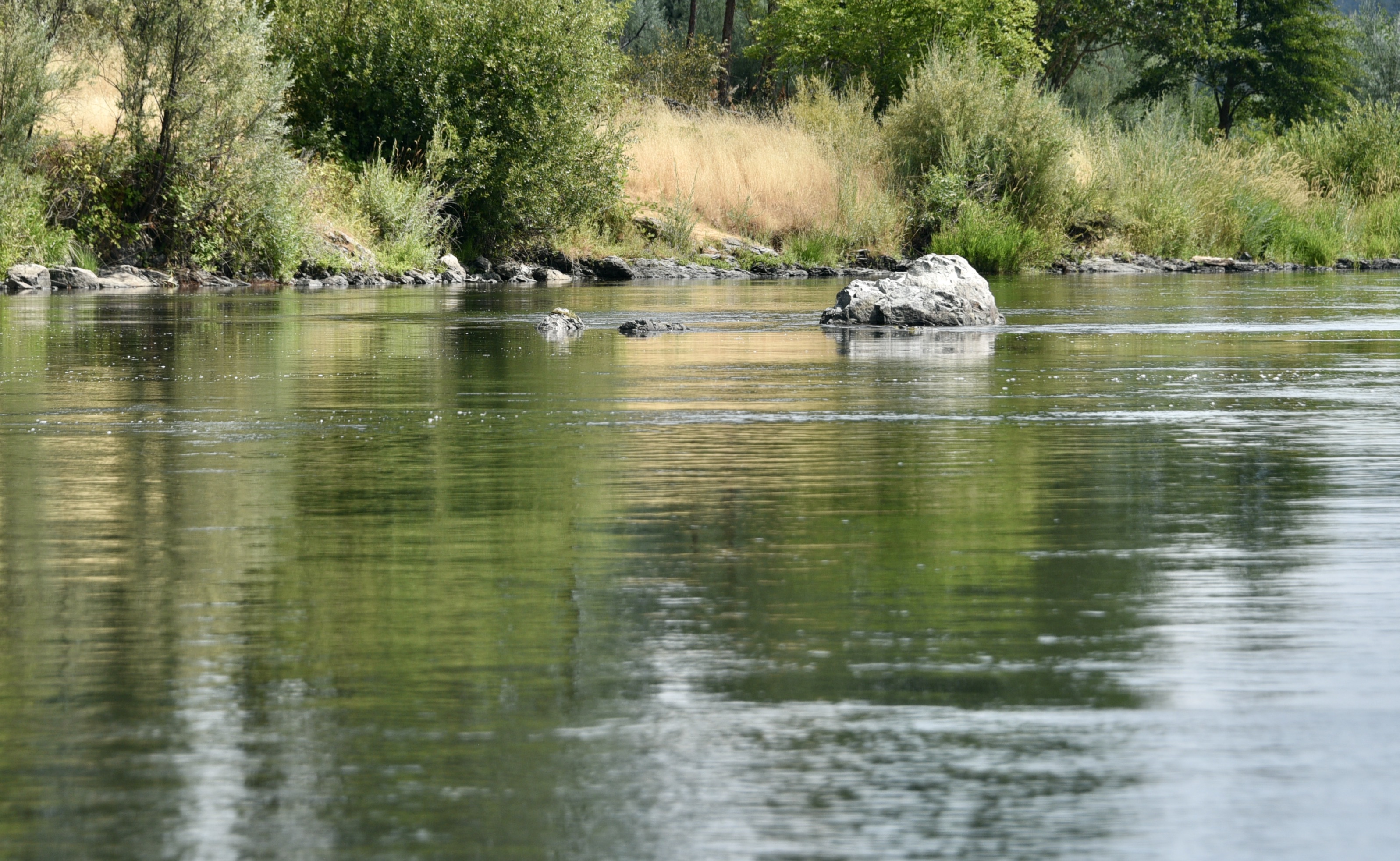
oooo

oooo
oooo
oooo

oooo
oooo
That is the last photograph from what was a gorgeous trip.
My thanks to Rusty and his dog, Mercy.
Dogs are animals of integrity. We have much to learn from them.
Tag: Rogue River
The second batch of photographs taken recently on the Rogue River
oooo
oooo
oooo
oooo
oooo
oooo
That is the last photograph from what was a gorgeous trip.
My thanks to Rusty and his dog, Mercy.
A continuation of yesterday’s post
But first we want to remember Prince Phillip. Dear Prince Phillip. Jeannie and I watched the whole of the funeral and it was very moving.

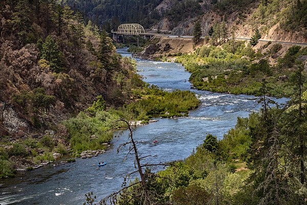
So in terms of the photographs already shown yesterday, we had done the Hog Creek landing and the next view point and we are now up to the bridge itself.
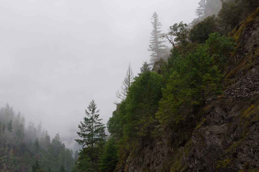
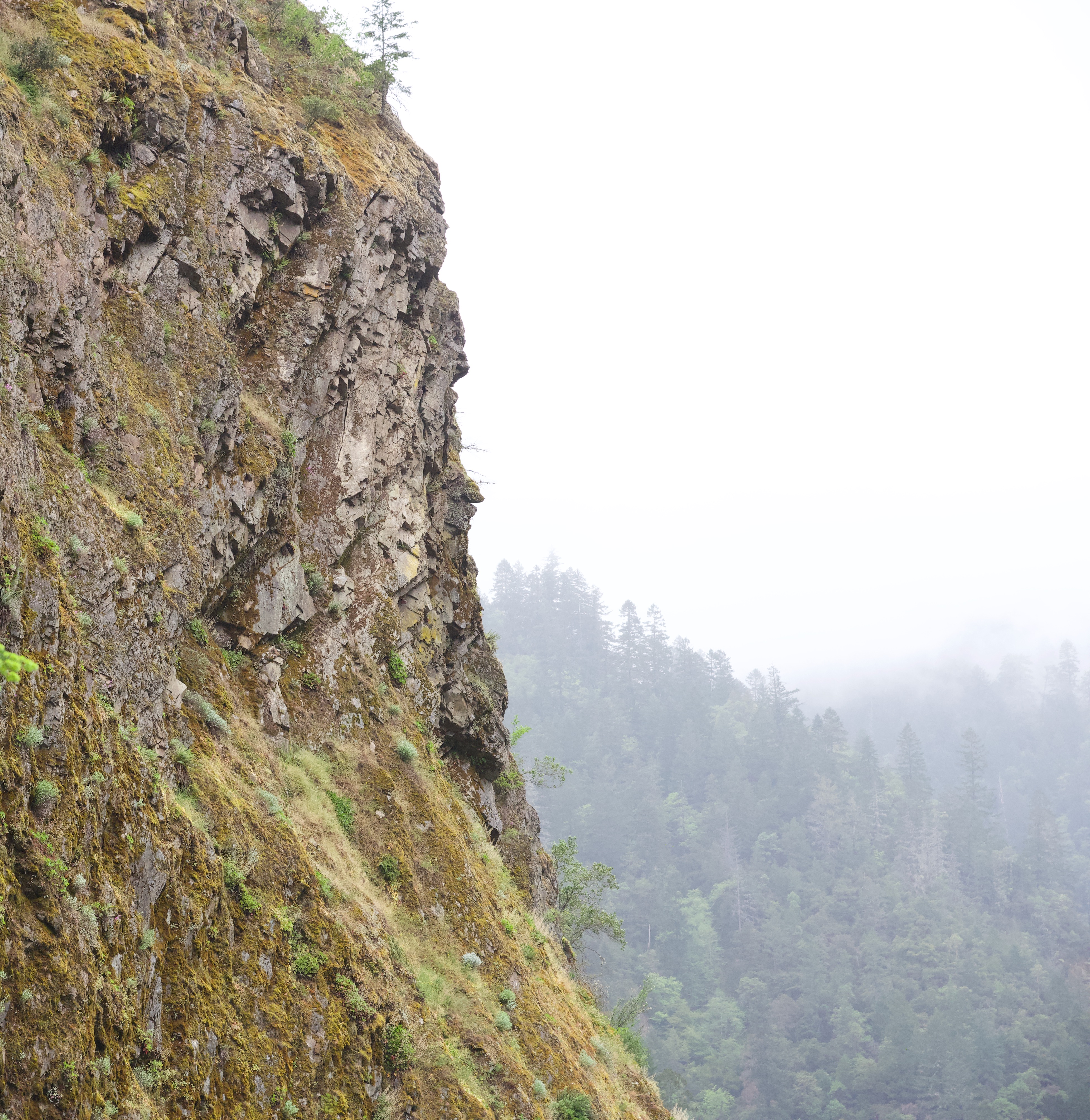
Except that I forgot to show you another photograph of the Canyon.

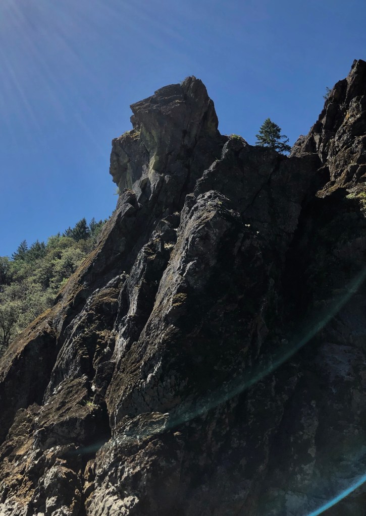
The very dramatic scene with its incredibly steep flanks was just amazing!
Now to the viewpoint just before the bridge.

We had the very good fortune to take a shot of a fisherman just upstream of us.

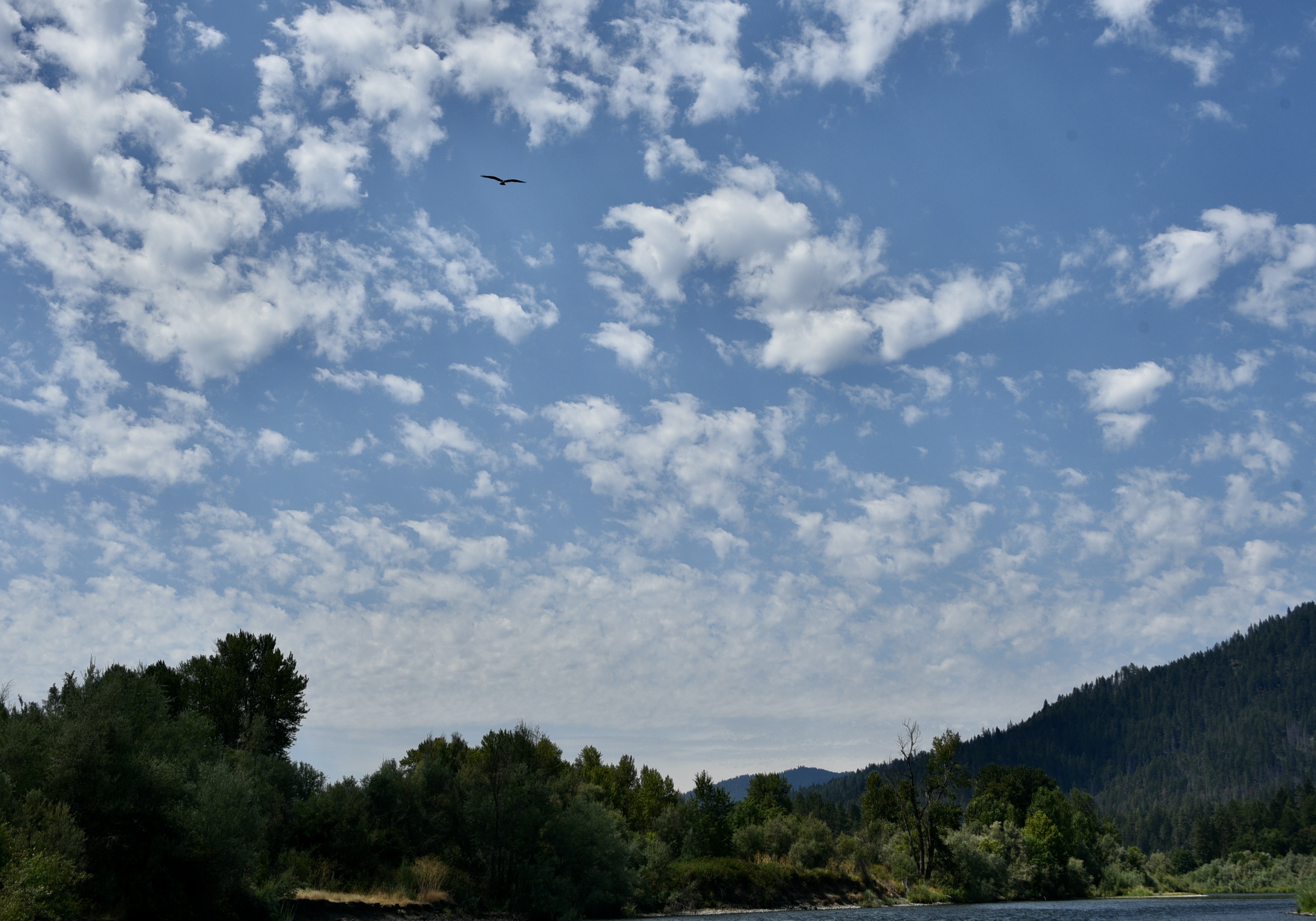
All around us were spectacular sights.

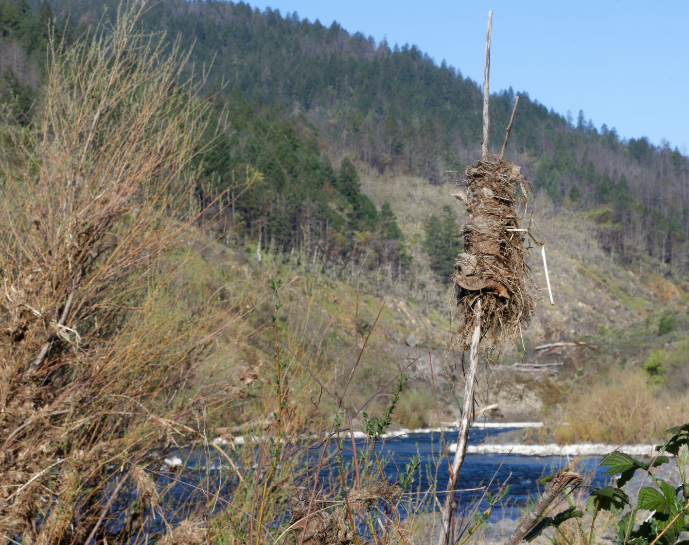
Take this shot of a bird approaching a tree standing stark on the top of a small ridge. That was just to the right of the road facing the bridge.

It really is a very scenic place.
That is the end of my set of photographs. My eyes were truly opened.
The art of seeing!
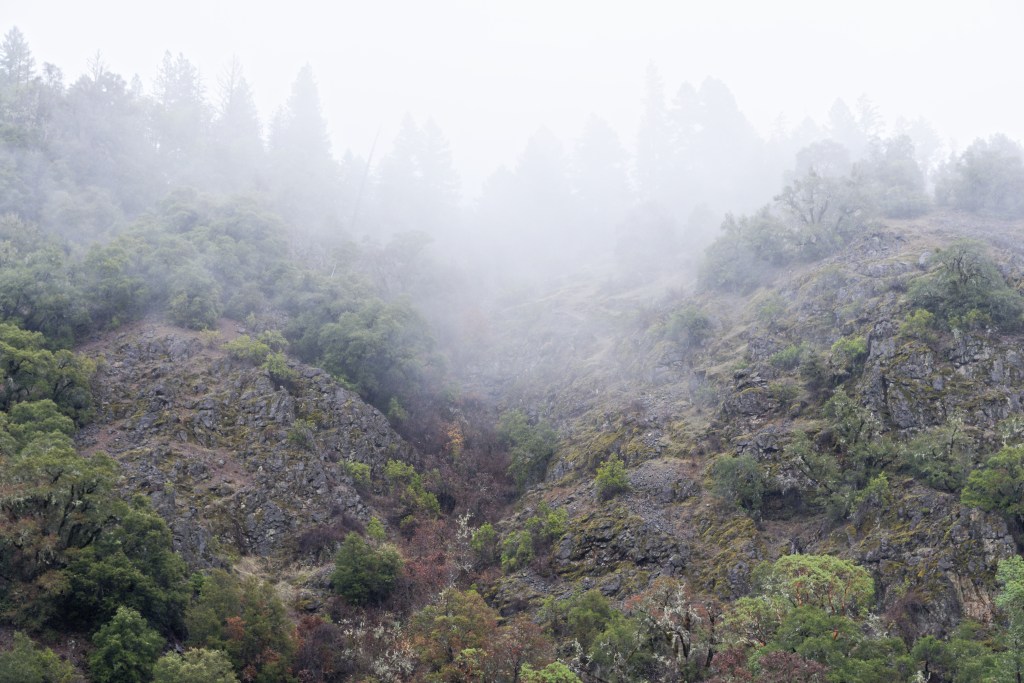
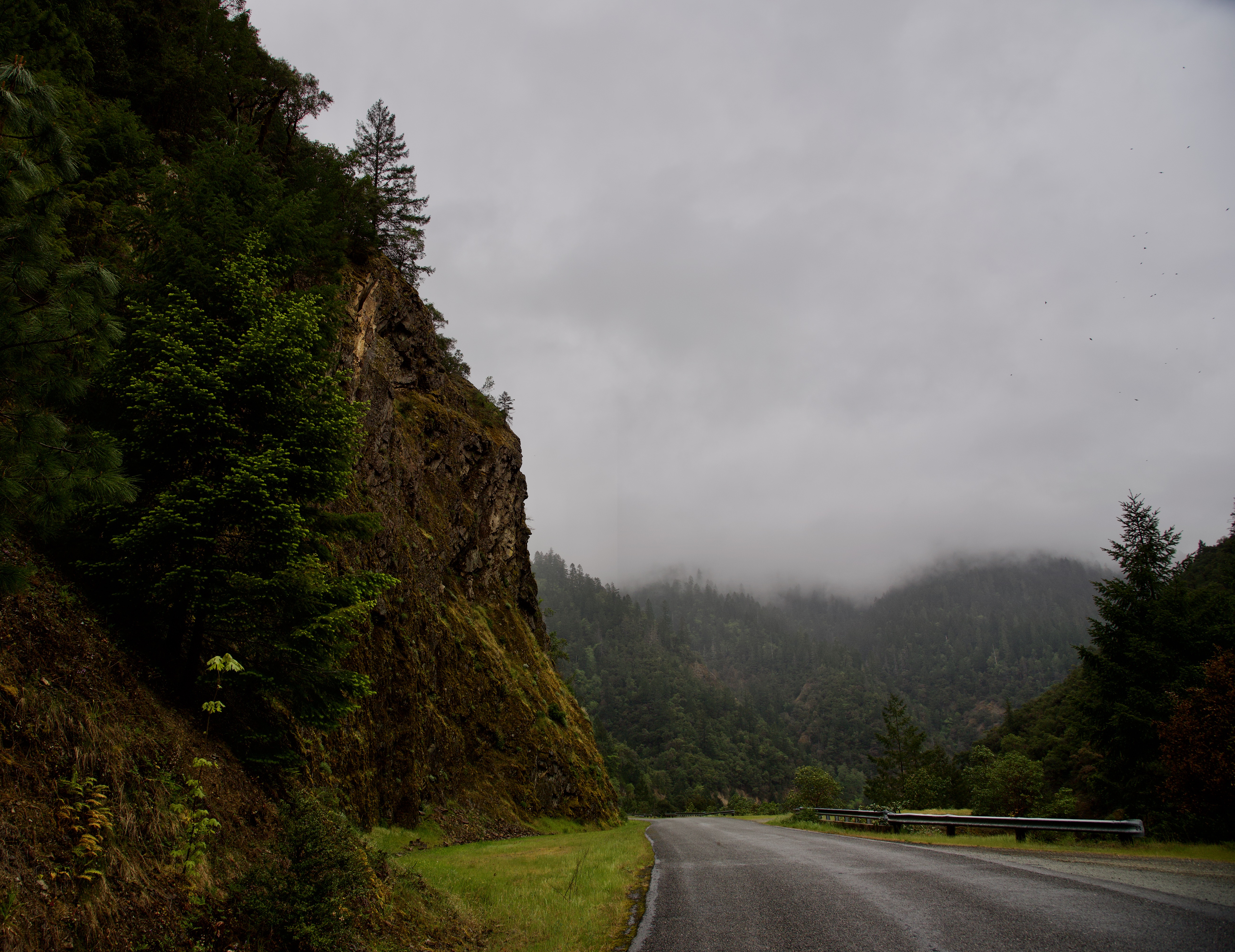
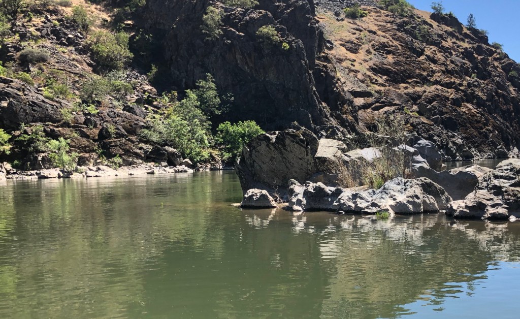
A few days ago there was a conversation on the photography forum Ugly Hedgehog about the camera opening one’s eyes. It struck a note in me and Jeannie and I went out in the early morning, taking the camera, to shoot photographs of the Hellgate Canyon.
It is not the first time we have been there but it is the first time I have gone with my eyes wide open!
But first some history of the Rogue River. And thanks to WikiPedia for the following.
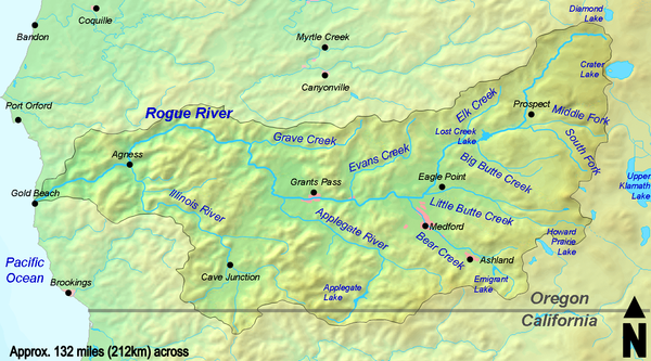
The Rogue River in southwestern Oregon in the United States flows about 215 miles (346 km) in a generally westward direction from the Cascade Range to the Pacific Ocean. Known for its salmon runs, whitewater rafting, and rugged scenery, it was one of the original eight rivers named in the Wild and Scenic Rivers Act of 1968. Beginning near Crater Lake, which occupies the caldera left by the explosive volcanic eruption and collapse of Mount Mazama, the river flows through the geologically young High Cascades and the older Western Cascades, another volcanic province. Further west, the river passes through multiple exotic terranes of the more ancient Klamath Mountains. In the Kalmiopsis Wilderness section of the Rogue basin are some of the world’s best examples of rocks that form the Earth’s mantle.
Hellgate Canyon is just 8 miles from where we live on Hugo Road. But just before Hellgate is the Hog Creek parking area. We stopped there and then went down to the landing stage on the edge of the Rogue River. I took some photographs.


Then we motored the short distance further on to the view point above the canyon. Took more photographs.


Then onto the viewing spot just before the bridge.
I am going to pause this now and continue it on Sunday.
Despite the gloom and real stress for many people it’s not wall-to-wall pessimism.
The reason I was prompted to write about this was a couple of connections made in the last few days and the power they have to keep this elderly chap still bouncing along.
Recently on the forum Ugly Hedgehog there was a gentleman who posted some photographs of some dogs that he had seen at the dog park. It was in a post called Today at the dog park.
They were lovely and I thought what a good idea it would be if I was able to republish them for next week’s Picture Parade. So I asked!
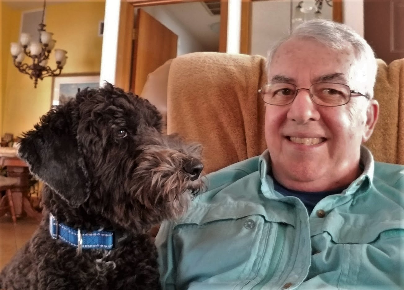
Well I was not disappointed and indeed said gentleman emailed me with a short bio and a photograph of him and his dog by way of an introduction. This is what he wrote:
I was born on Long Island and spent the first 60 years of my life there except for my Naval service for four years during the Vietnam war. I was a Naval Aviator, and after my active duty was over I returned to Long Island and got into a career in law enforcement that lasted 31 years. I made thousands of arrests during my career and many of those who were incarcerated threatened to “get me” some day, so I would prefer that you don’t use my real name.
When I retired at age 60 I moved to Tampa, FL because my daughter lived there and I have two granddaughters and now my son lives here too. It’s great for photographing flora and fauna all year round. My love for dogs has worn off on my kids as my daughter has two of them and my son three! Photography has been a hobby of mine for over 60 years. Here is a casual photo of me and my buddy Ollie (a three year old golden doodle).
You will have to wait until Sunday to view his photographs!
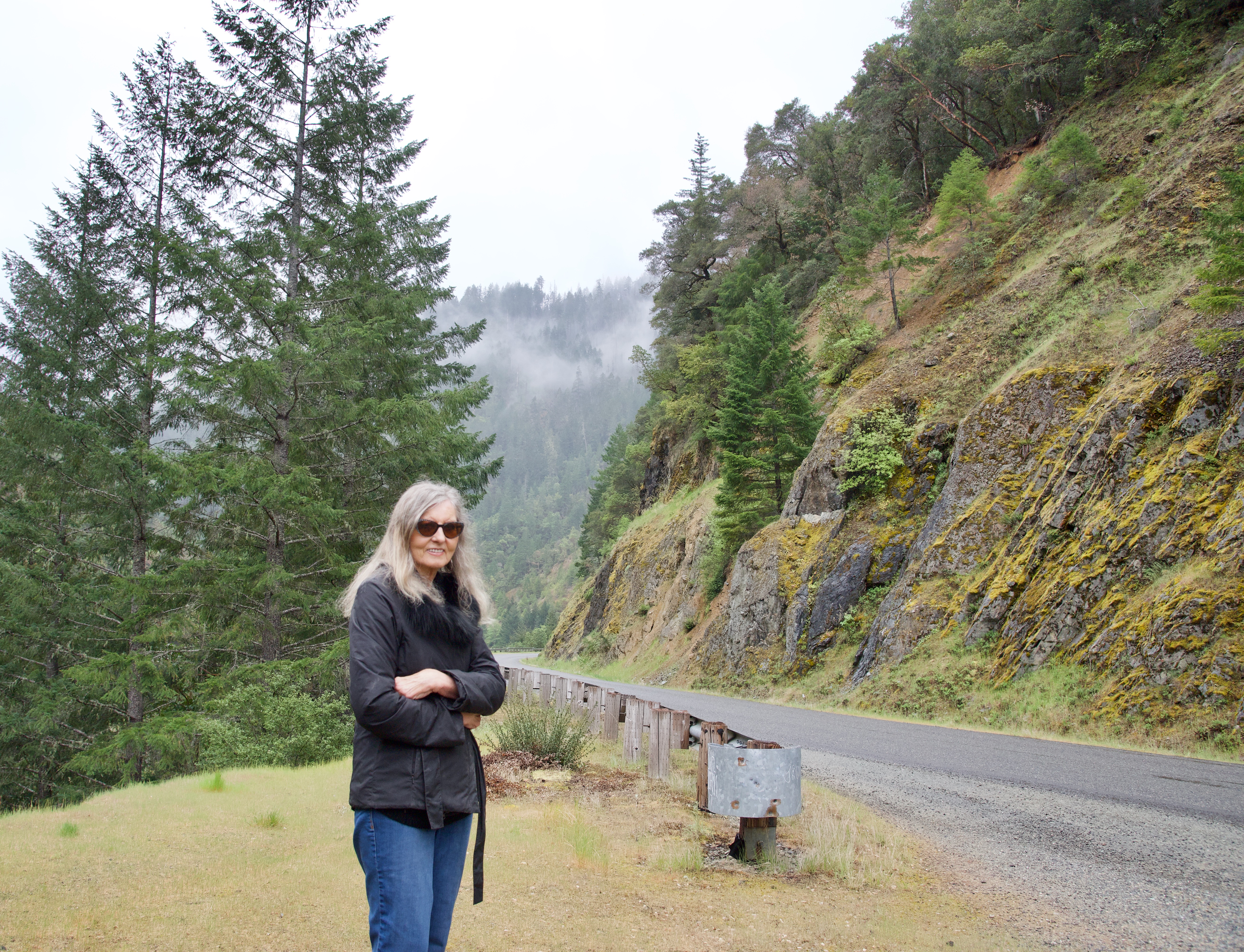
At the end of November Jean and I wanted to join the local camera club. It was clear that I had a camera, a Nikon D750, that was way more advanced than I thought and, frankly, I didn’t know my way around it.
So we joined the Caveman Camera Club in Grants Pass, Oregon. Although at the moment the pandemic puts a halt on physical meetings, twice a month ‘zoom’ meetings are held. Also mentors were available. I took advantage of the opportunity to work under a mentor and last week I went the short distance of nine miles to meet with Gene. Gene had so much knowledge and had regularly taught photography for a number of years. I came away very inspired and very motivated to become better in my photographic and composure skills. Gene’s area of interest is landscapes.
What was clear was that for my whole life, and I have been taking photographs for a very long time, I had been taking pictures and not composing photographs.
It’s going to be a long journey but one that fills me with delight
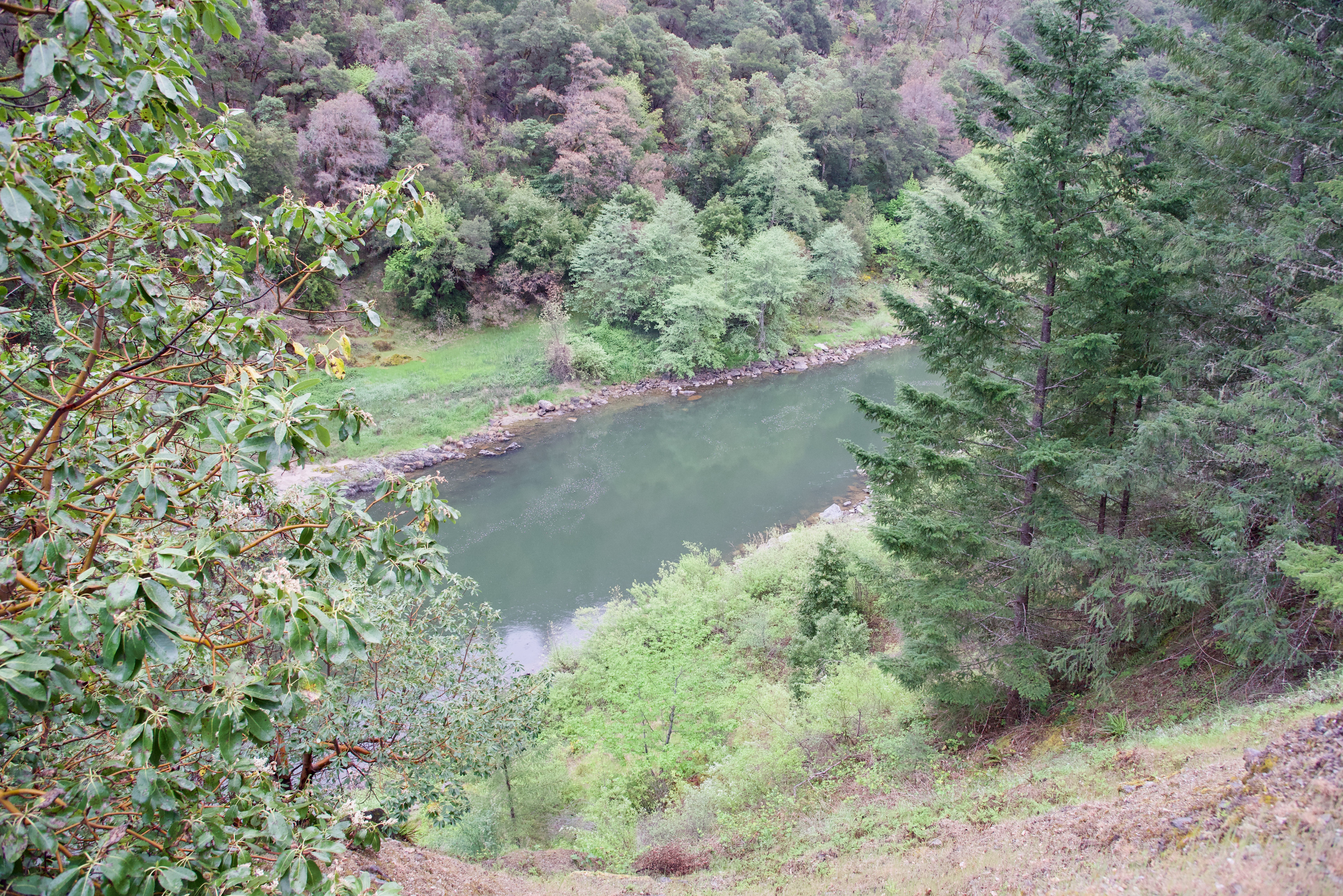
Here are some of my very first attempts, taken yesterday along the Rogue River in the rain and mist.
oooo
oooo
oooo
Well it’s a start!
But I just wanted to reiterate that staying local both literally and virtually is very rewarding.
I simply forgot it was Earth Day yesterday!
I wanted to let the post on Tuesday run for a couple of days because it really made the point about dogs, in particular, being animals who love to love!
But I then forgot, until I woke up on the 22nd, that yesterday was Earth Day.
So what to publish?
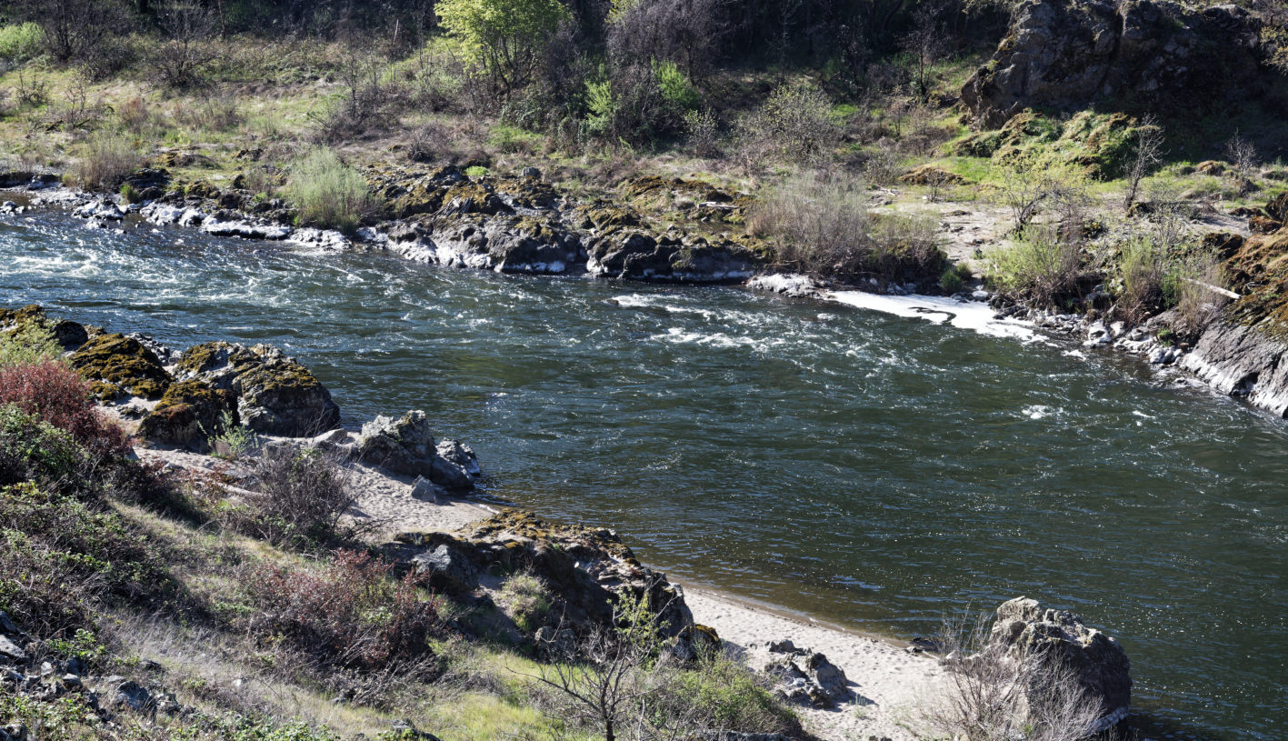
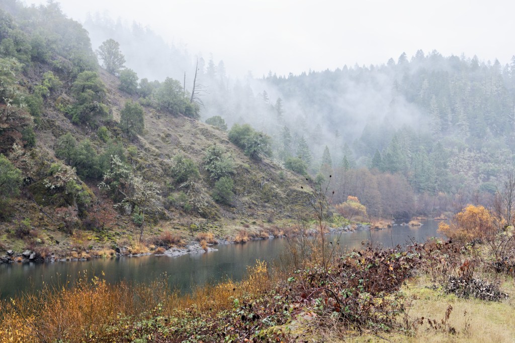
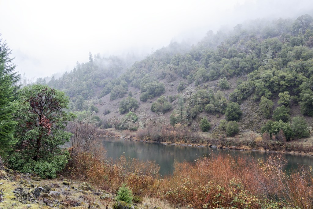
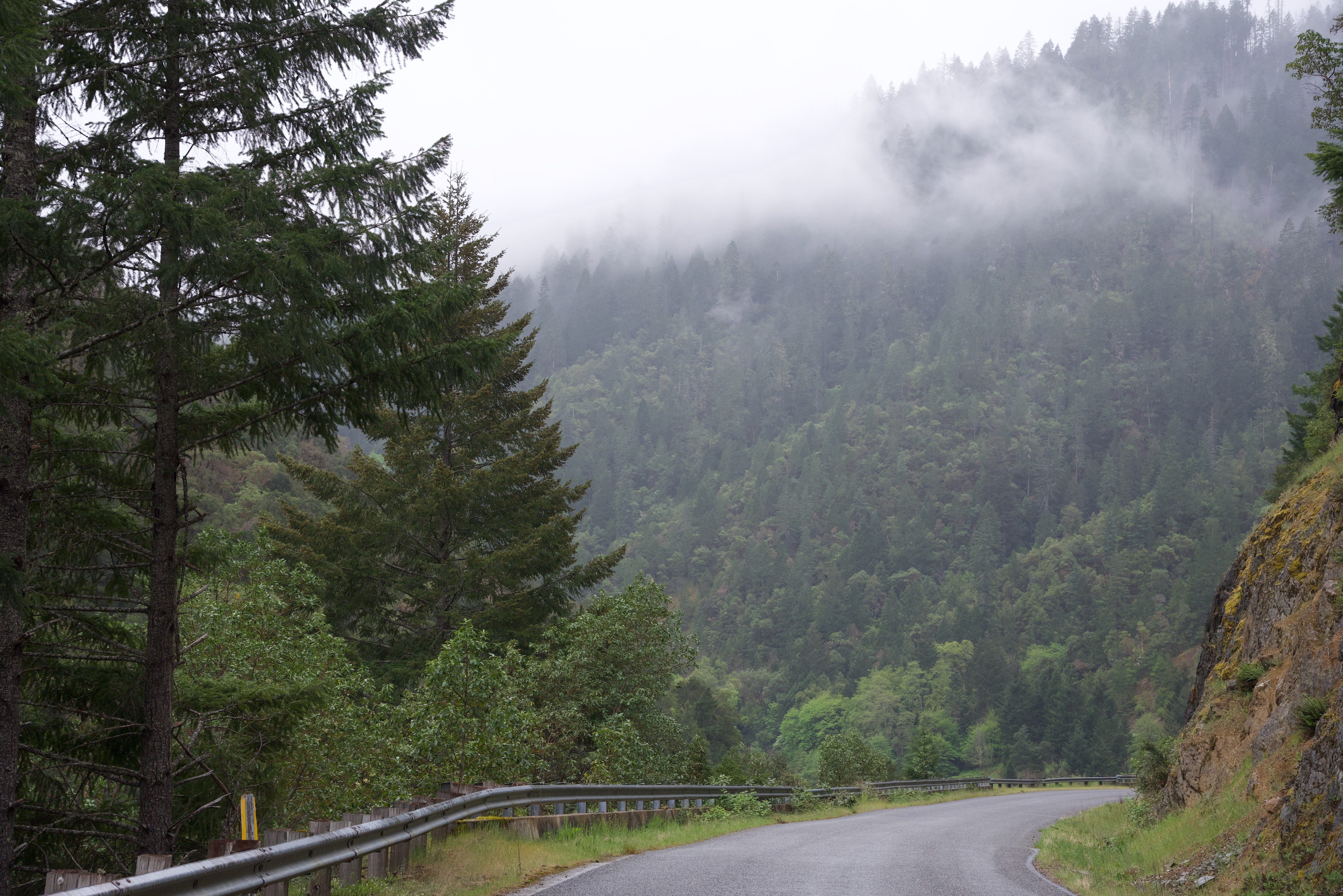
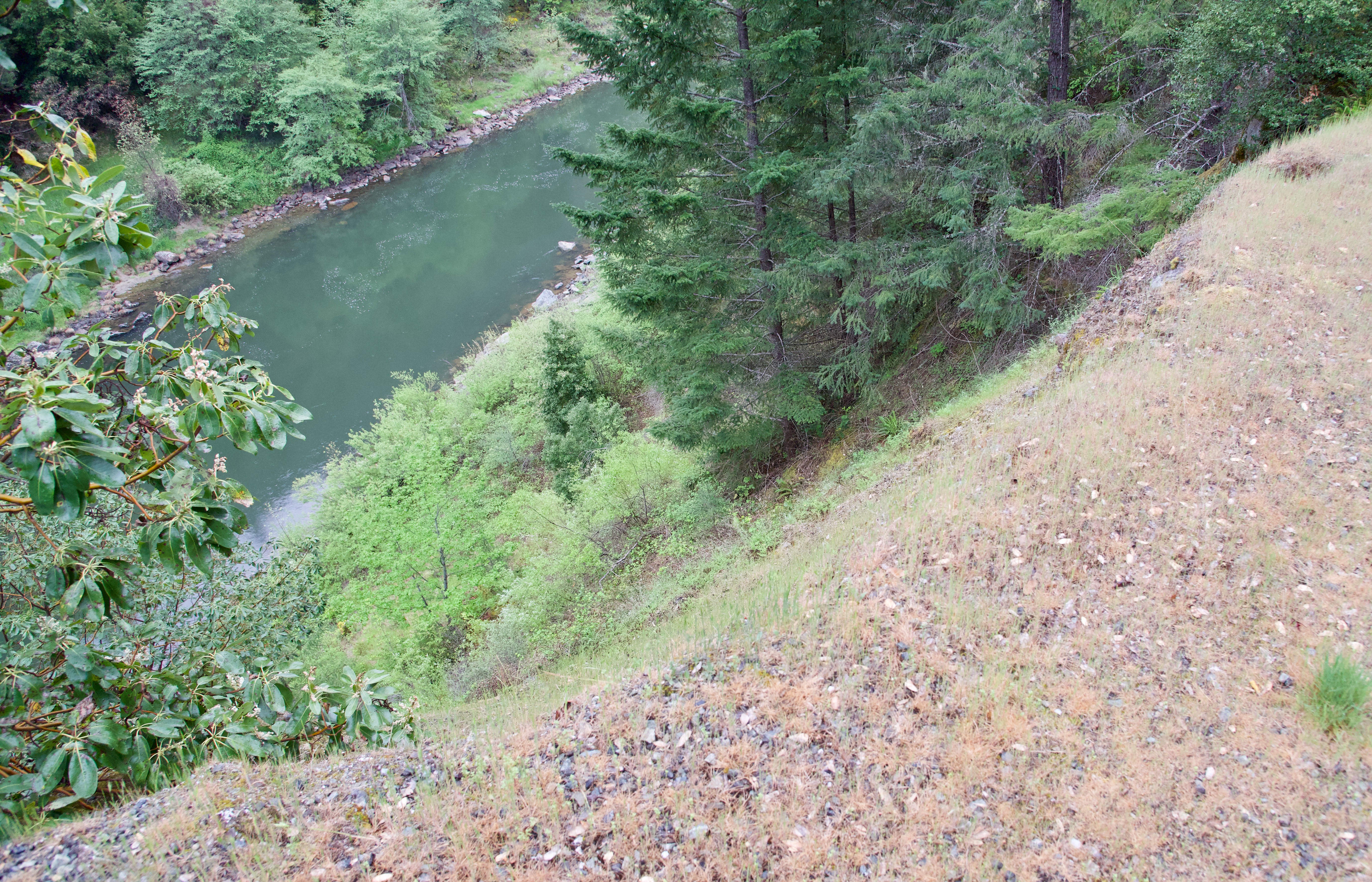
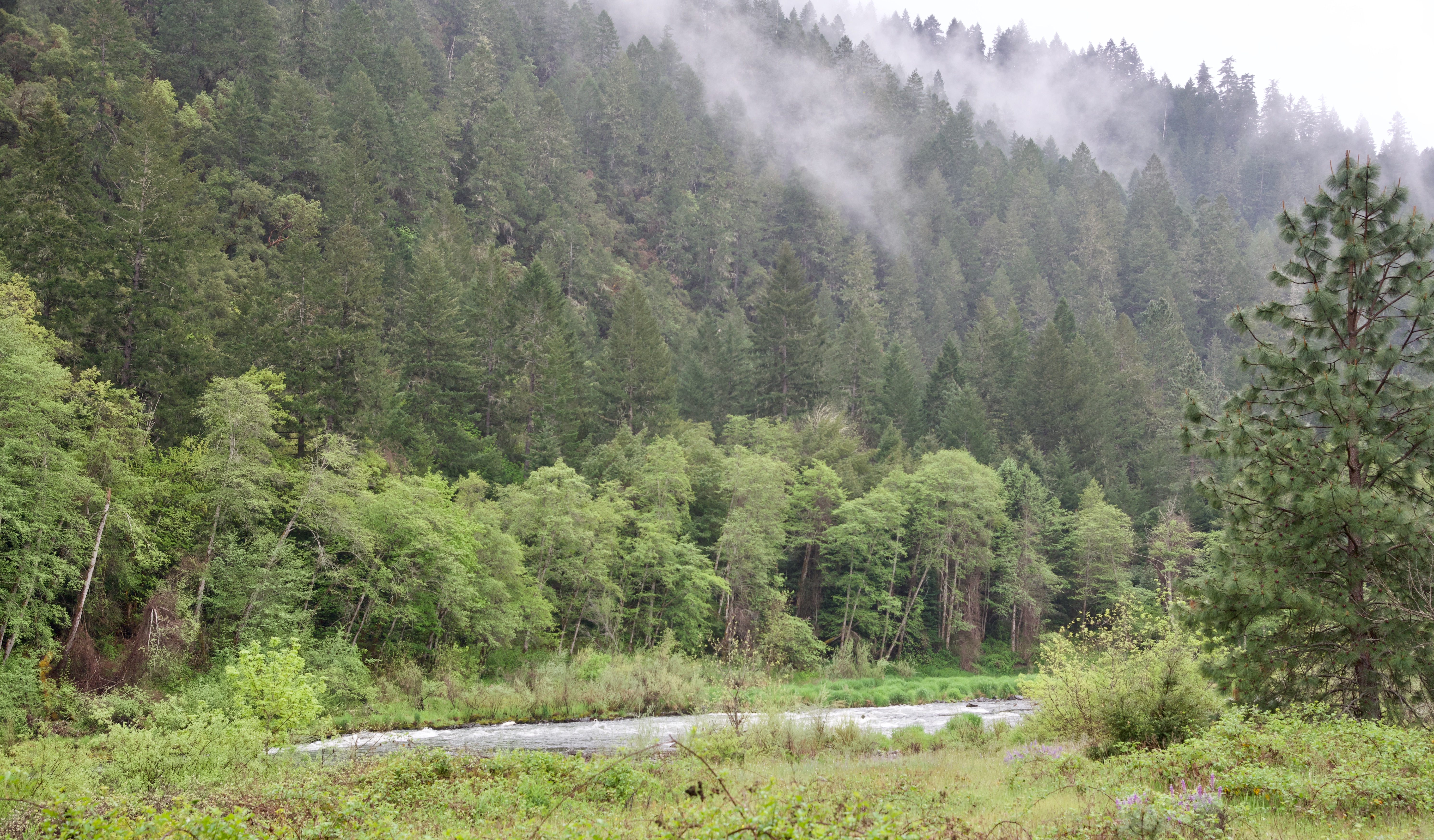
Yesterday in Merlin was a damp day with a steady rain coming down in the morning. About 10am I volunteered the idea that we should drive the shortish distance to Galice; just 10 miles from where we live. Galice is a very small settlement on the Western bank of the Rogue River. Then we drove on for a few more miles. It was incredible scenery. The misty, damp forest and the river running below in the gorge.
I had my camera with me and the following are some of the photographs that were taken.
Just for a change! All within 15 miles of home!
oooo
oooo
oooo
oooo
oooo
oooo
For those interested in learning more, I am publishing the WikiPedia account of the Rogue River.
The Rogue River (Tolowa: yan-shuu-chit’ taa-ghii~-li~’,[7] Takelma: tak-elam[8]) in southwestern Oregon in the United States flows about 215 miles (346 km) in a generally westward direction from the Cascade Range to the Pacific Ocean. Known for its salmon runs, whitewater rafting, and rugged scenery, it was one of the original eight rivers named in the Wild and Scenic Rivers Act of 1968. Beginning near Crater Lake, which occupies the caldera left by the explosive volcanic eruption of Mount Mazama, the river flows through the geologically young High Cascades and the older Western Cascades, another volcanic province. Further west, the river passes through multiple exotic terranes of the more ancient Klamath Mountains. In the Kalmiopsis Wilderness section of the Rogue basin are some of the world’s best examples of rocks that form the Earth’s mantle. Near the mouth of the river, the only dinosaur fragments ever discovered in Oregon were found in the Otter Point Formation, along the coast of Curry County.
People have lived along the Rogue River and its tributaries for at least 8,500 years. European explorers made first contact with Native Americans (Indians) toward the end of the 18th century and began beaver trapping and other activities in the region. Clashes, sometimes deadly, occurred between the natives and the trappers and later between the natives and European-American miners and settlers. These struggles culminated with the Rogue River Wars of 1855–56 and removal of most of the natives to reservations outside the basin. After the war, settlers expanded into remote areas of the watershed and established small farms along the river between Grave Creek and the mouth of the Illinois River. They were relatively isolated from the outside world until 1895, when the Post Office Department added mail-boat service along the lower Rogue. As of 2010, the Rogue has one of the two remaining rural mail-boat routes in the United States.
Dam building and removal along the Rogue has generated controversy for more than a century; an early fish-blocking dam (Ament) was dynamited by vigilantes, mostly disgruntled salmon fishermen. By 2009, all but one of the main-stem dams downstream of a huge flood-control structure 157 miles (253 km) from the river mouth had been removed. Aside from dams, threats to salmon include high water temperatures. Although sometimes too warm for salmonids, the main stem Rogue is relatively clean, ranking between 85 and 97 (on a scale of 0 to 100) on the Oregon Water Quality Index (OWQI).
Although the Rogue Valley near Medford is partly urban, the average population density of the Rogue watershed is only about 32 people per square mile (12 per km2). Several historic bridges cross the river near the more populated areas. Many public parks, hiking trails, and campgrounds are near the river, which flows largely through forests, including national forests. Biodiversity in many parts of the basin is high; the Klamath-Siskiyou temperate coniferous forests, which extend into the southwestern Rogue basin, are among the four most diverse of this kind in the world.
Just to reflect on the fact that people have lived along the Rogue River and its tributaries for 8,500 years!
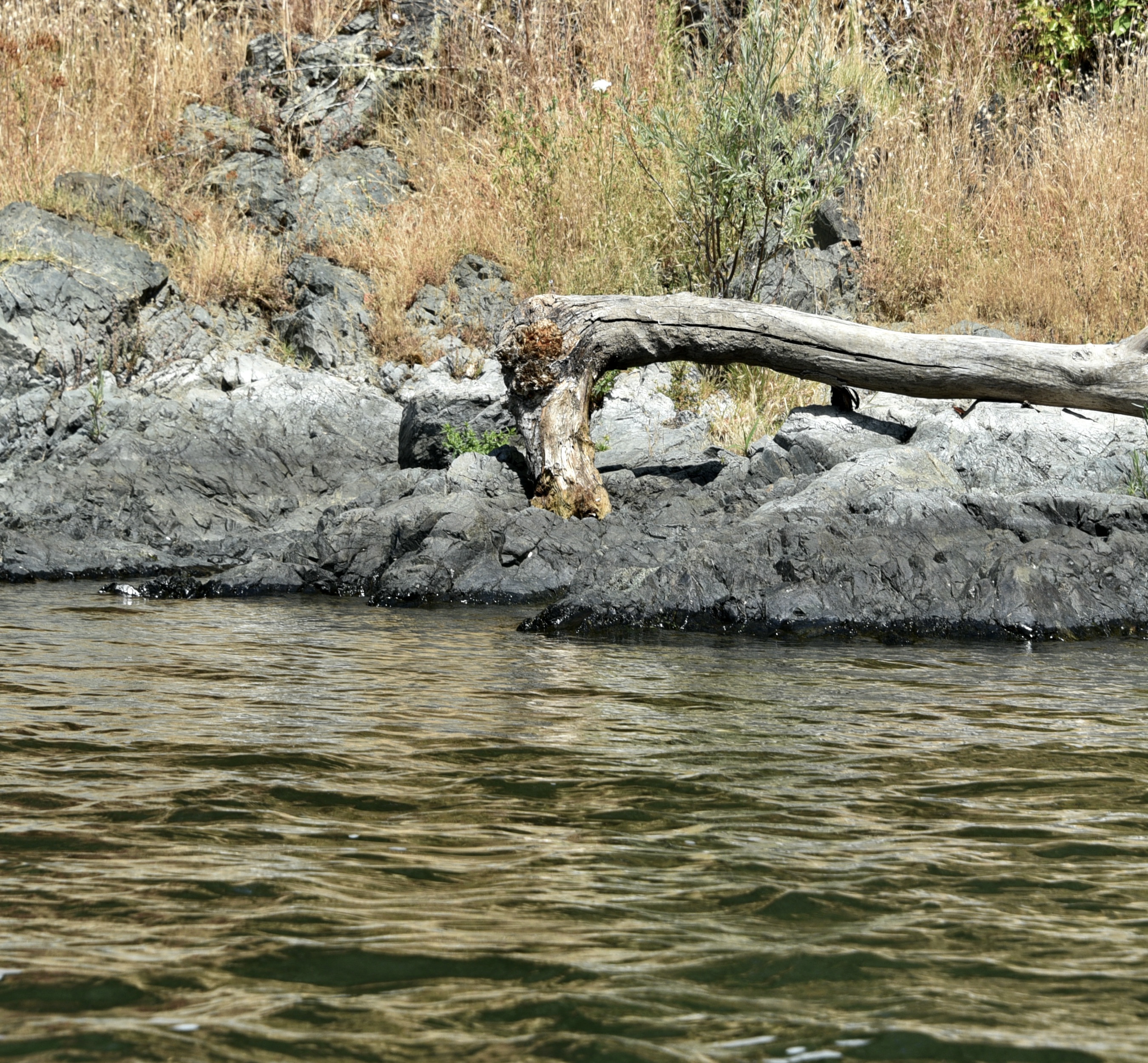
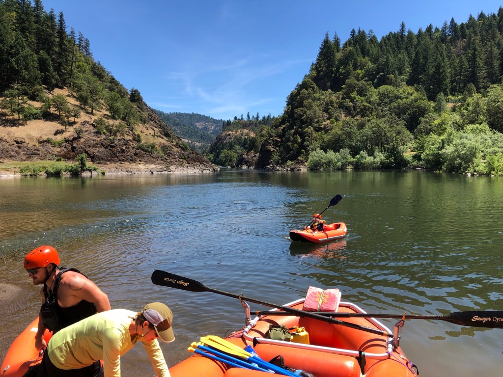
The last day of our experience of rafting downstream the Rogue River.
We are into the section of the Rogue River where it narrows and ‘white water’ appears. (In case you wondering why there are no photographs of real white-water it’s because I had to hang on with both hands and the iPhone stayed in my pocket!)
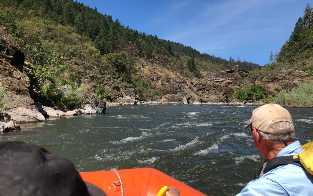
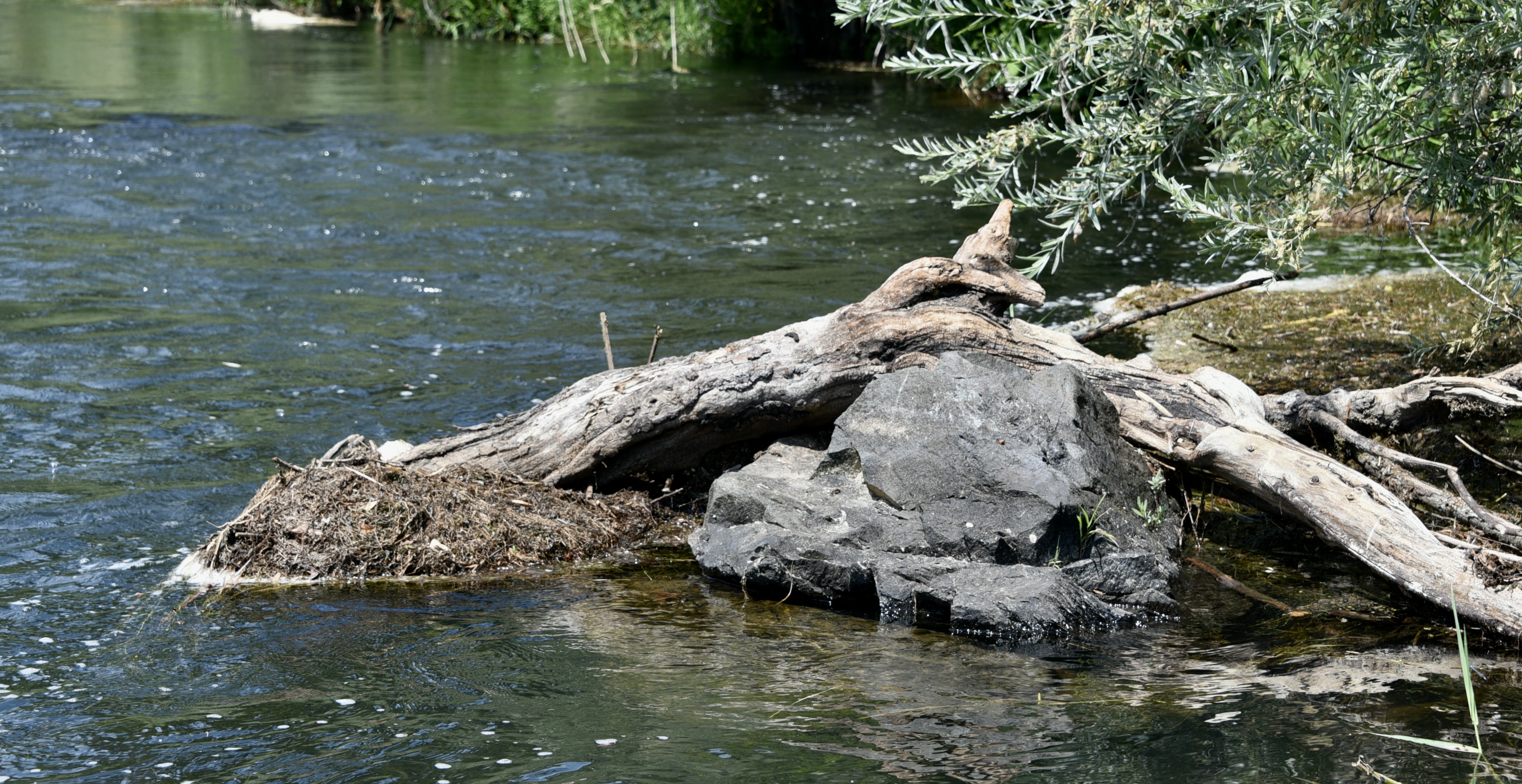
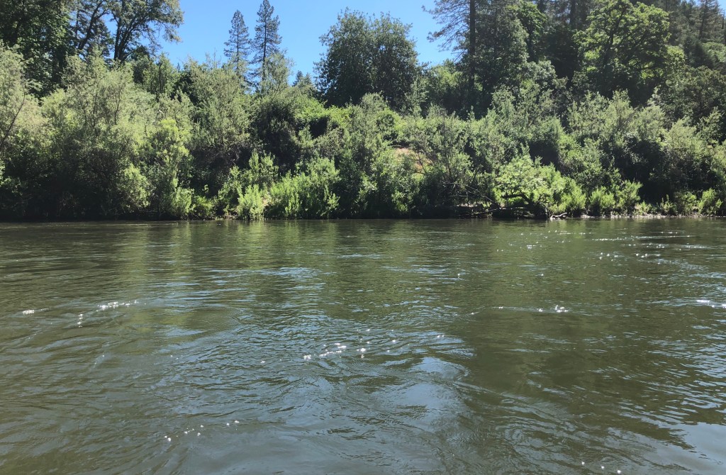
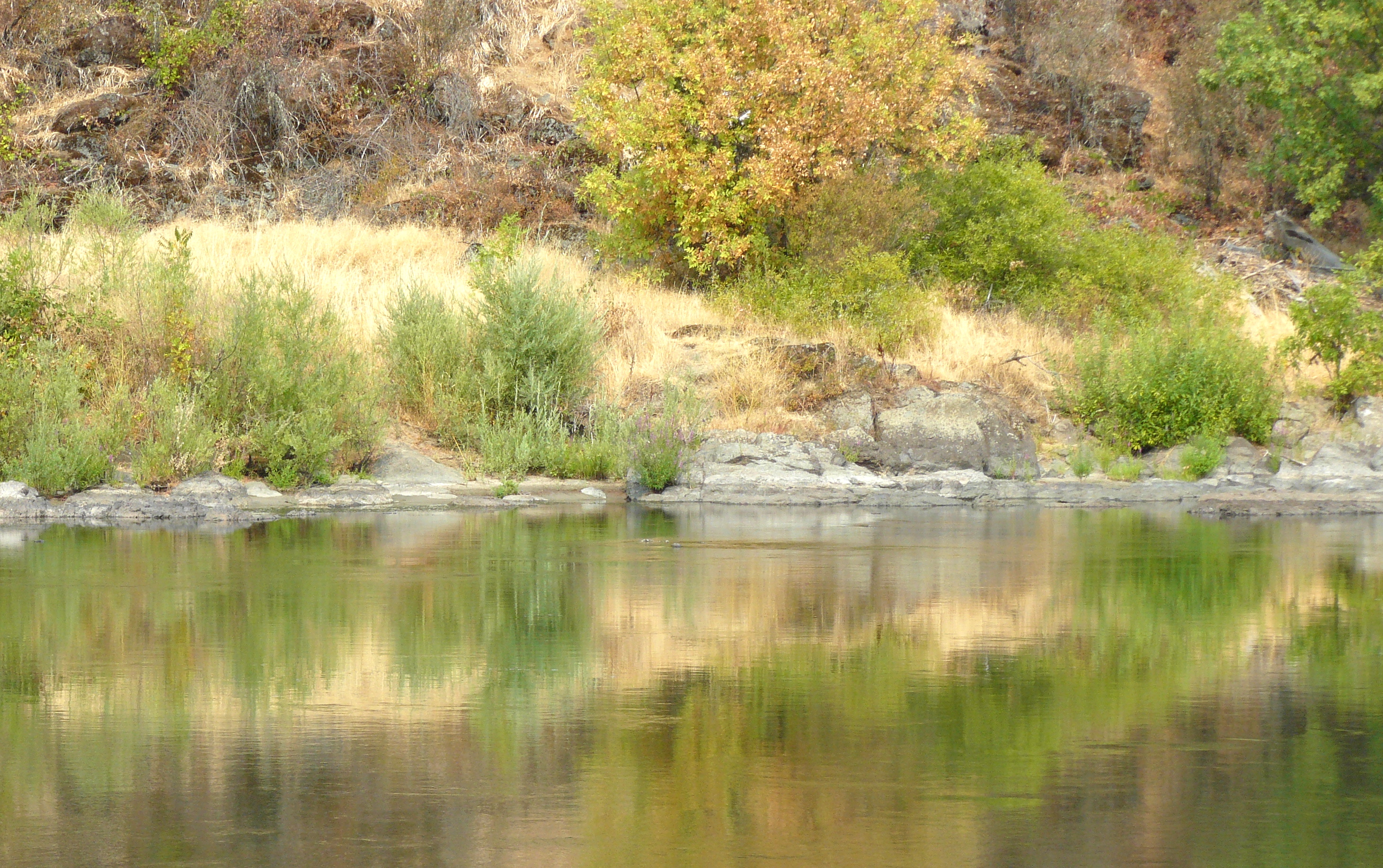
And there are times when we are being carried down by the flow very close to the rocks.
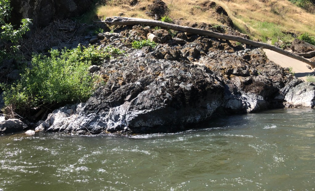
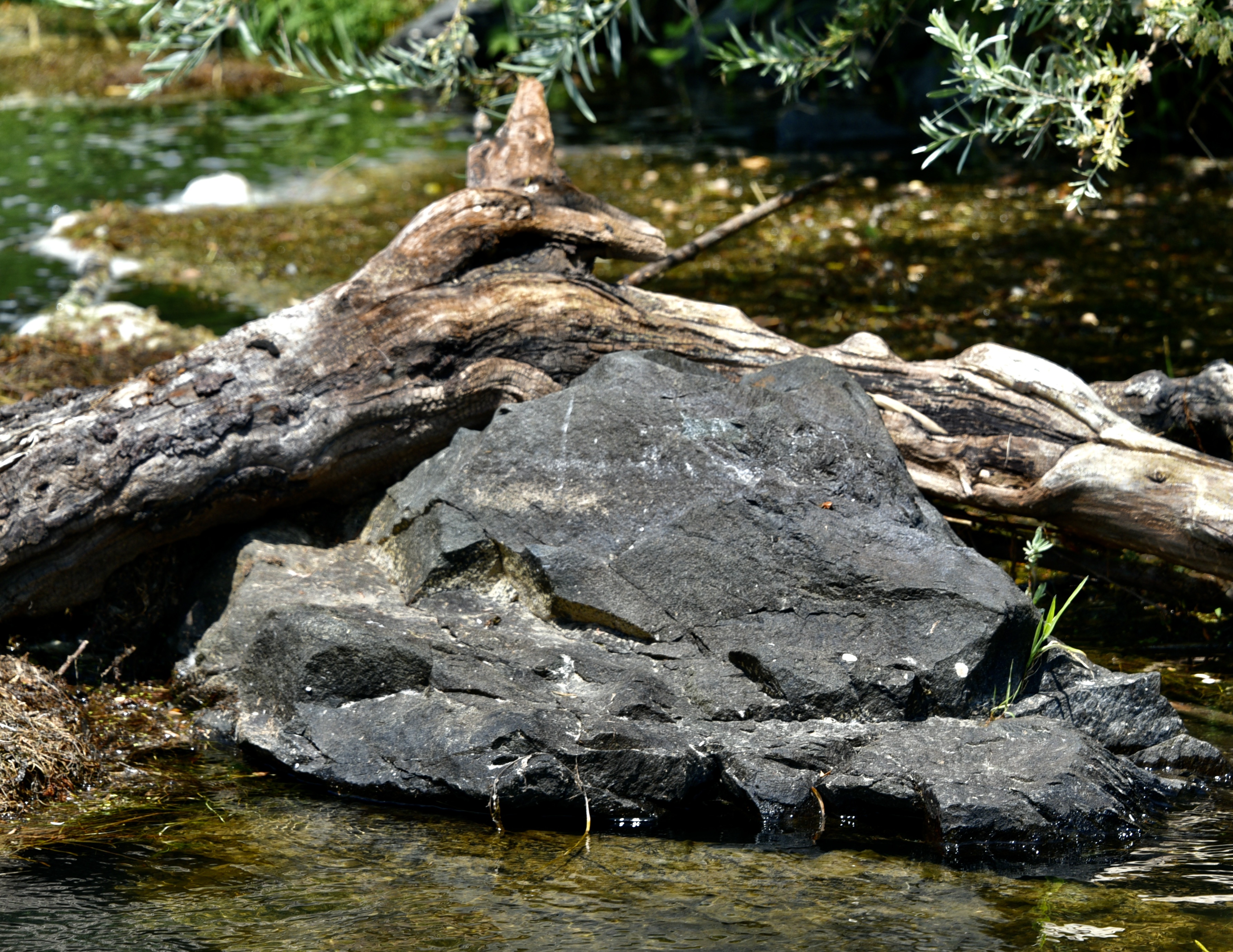
Some of the scenery is dramatic; ergo this rock towering over the edge of the river.
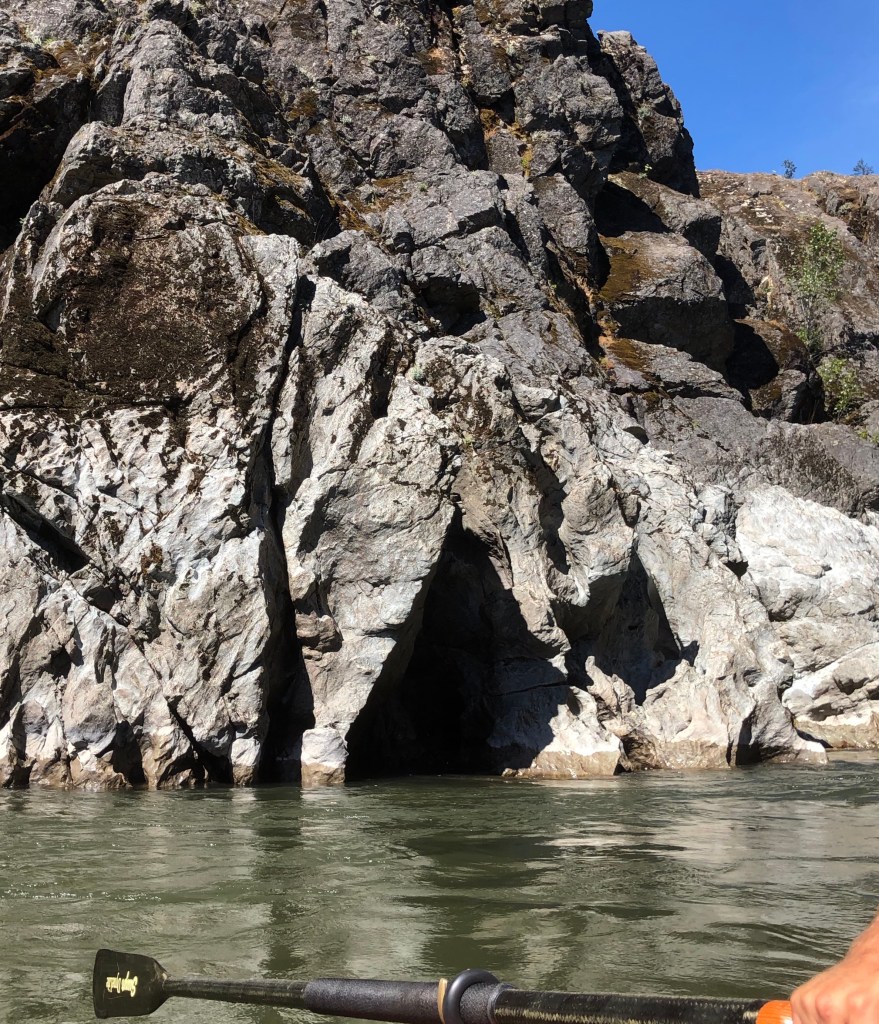
Another detail of the shoreline.
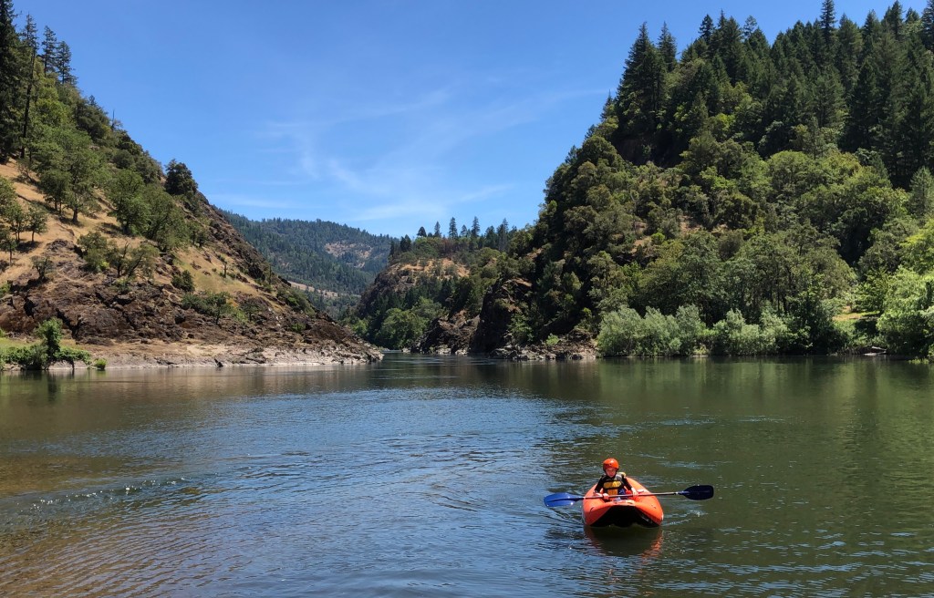
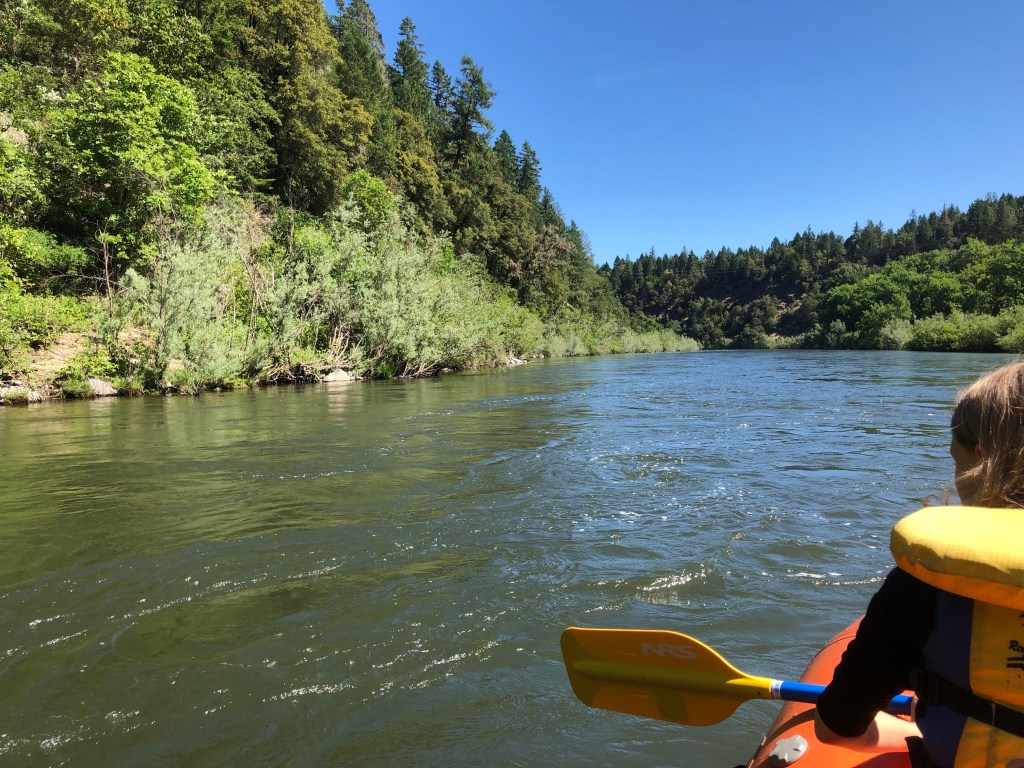
Then it was time for another to enter the kayak. We nudged the dinghy into a quiet edge of the river.
It was a 12-year-old girl who wanted to have a go in the kayak. She was excellent!
Once again, we moved out from the ‘resting’ area to join the main river.
And before we know it we had arrived at our destination.
We are at Morrisons Rogue River Lodge where there is a stop for lunch while Jean and I are to return by coach back to Grants Pass. We have only drifted 9 miles!
But it has been a wonderful 9 miles!
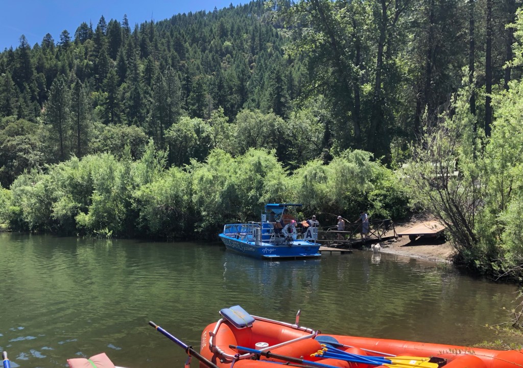
And for the close a picture of Morrisons Rogue River Lodge halt from the Morrisons website.
P.S. There is an interesting article on the total Rogue River in Wikipedia that is worth reading. It starts:
The Rogue River (Tolowa: yan-shuu-chit’ taa-ghii~-li~’,[7] Takelma: tak-elam[8]) in southwestern Oregon in the United States flows about 215 miles (346 km) in a generally westward direction from the Cascade Range to the Pacific Ocean. Known for its salmon runs, whitewater rafting, and rugged scenery, it was one of the original eight rivers named in the Wild and Scenic Rivers Act of 1968. Beginning near Crater Lake, which occupies the caldera left by the explosive volcanic eruption of Mount Mazama, the river flows through the geologically young High Cascades and the older Western Cascades, another volcanic province. Further west, the river passes through multiple exotic terranes of the more ancient Klamath Mountains. In the Kalmiopsis Wilderness section of the Rogue basin are some of the world’s best examples of rocks that form the Earth’s mantle. Near the mouth of the river, the only dinosaur fragments ever discovered in Oregon were found in the Otter Point Formation, along the coast of Curry County.
That’s all folks!
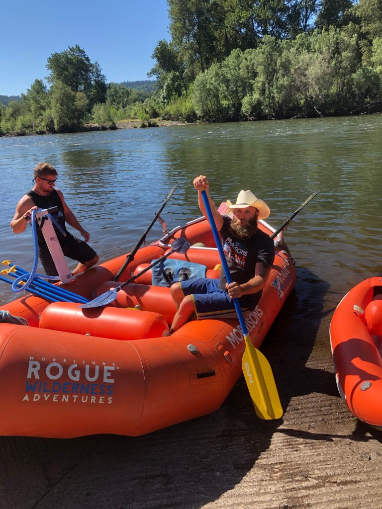
Continuing our journey downstream the Rogue River.
Now we are rafting!
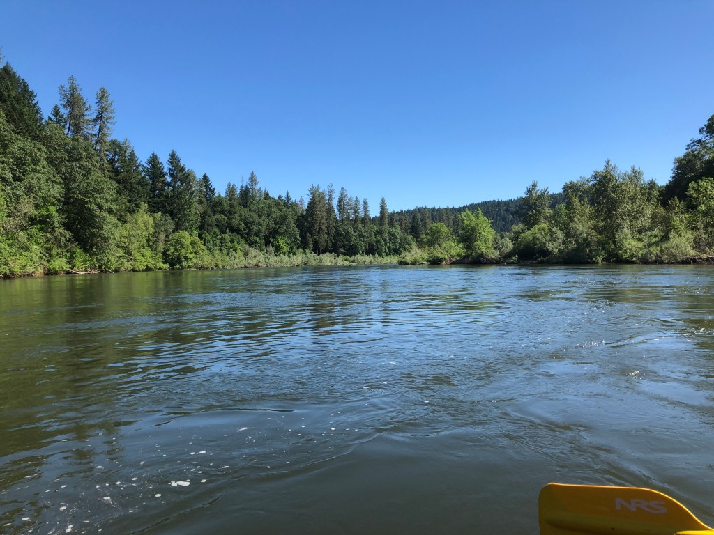
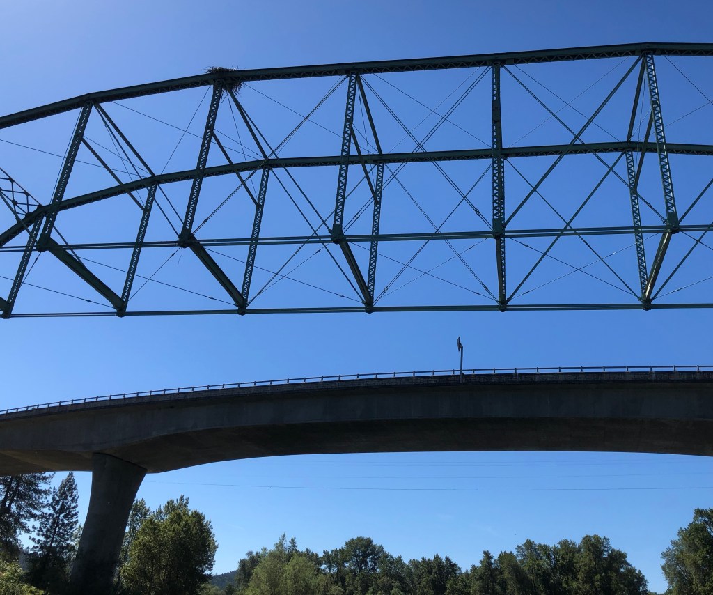
Fairly quickly we pass under Robertson Bridge.
In fact there are two bridges; the old metal one and the modern concrete one.
But way on top of the metal bridge is an osprey’s nest.
We continue.
The river, flowing at 2,800 cubic feet per second we are told, flows into the gorge.
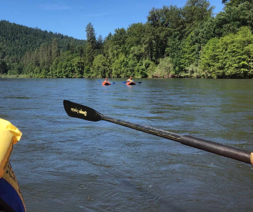
Behind us are the two kayaks. The one on the left is permanently manned by Christian, one of the guides, and the other one is available for anyone who wants to have a go.
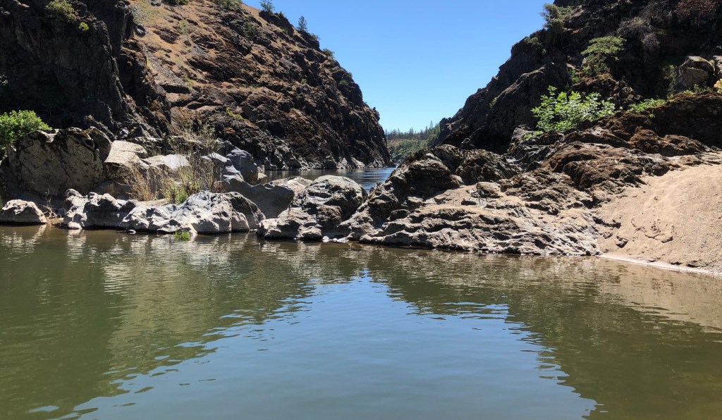
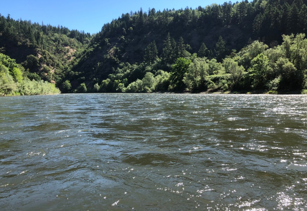
Deeper into the gorge we go.
It is wild country.
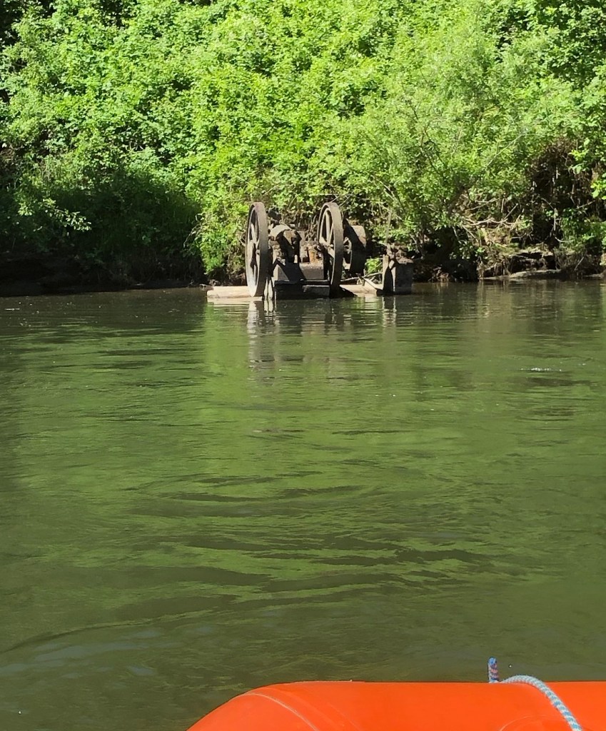
We pass an old pump that some years ago was displaced by a flooding Rogue!
And as the gorge narrows the flow of the river becomes more agitated and the start of the white-water section beckons.
The final post tomorrow!
The experience of rafting downstream the Rogue River.
It is Tuesday, 4th June. It is 08:45.
We are early because we are excited and because the location that we have to go to is just four miles from home.
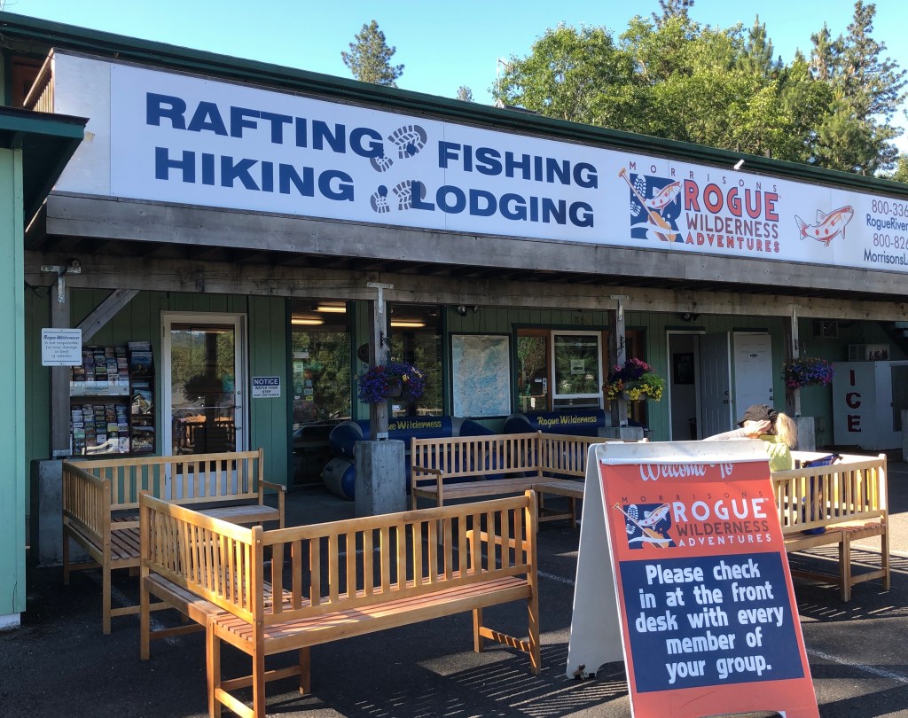
Neither of us have done anything like this before. But we decided to book just a half-day trip because a) the weather was warm but not roasting, and b) it was a local event and we would be back home by lunchtime to let the dogs out.
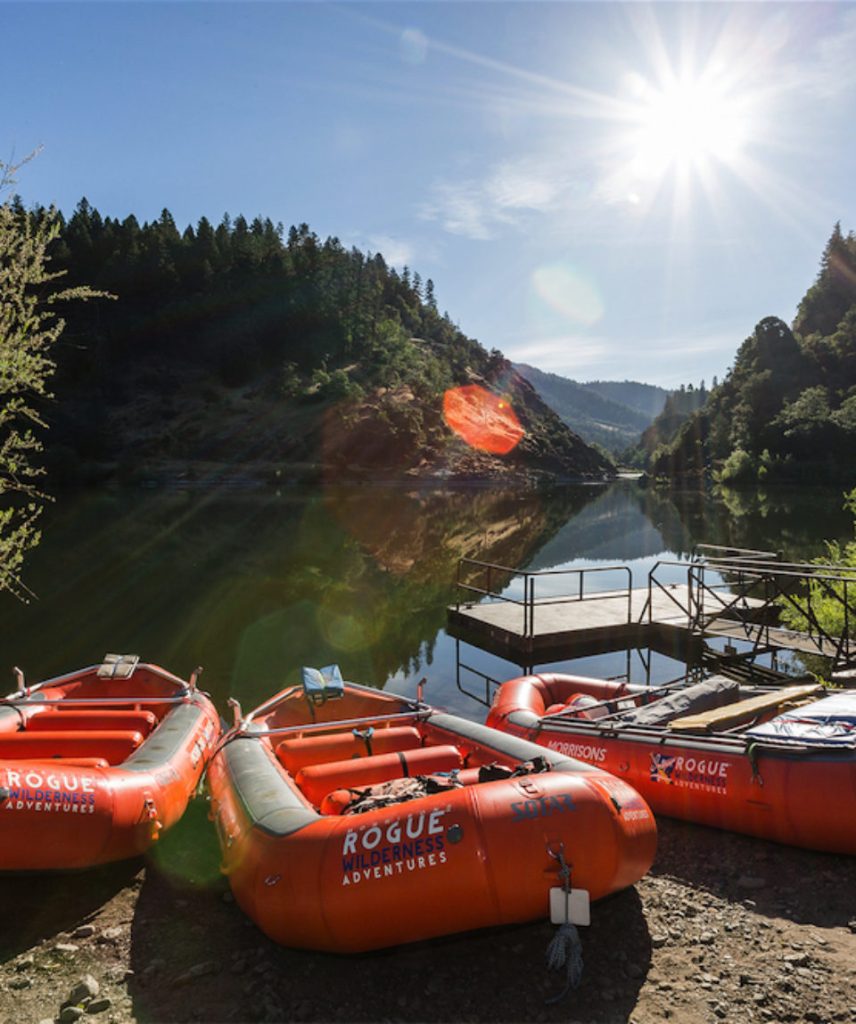
Inevitably we are early so I can’t resist wandering around the back to where the guides were loading up the truck.
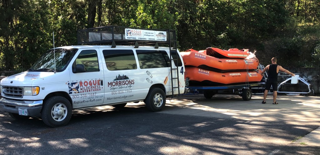
Then it is time to check in.
Almost immediately we are fitted with the appropriately sized personal buoyancy protector.
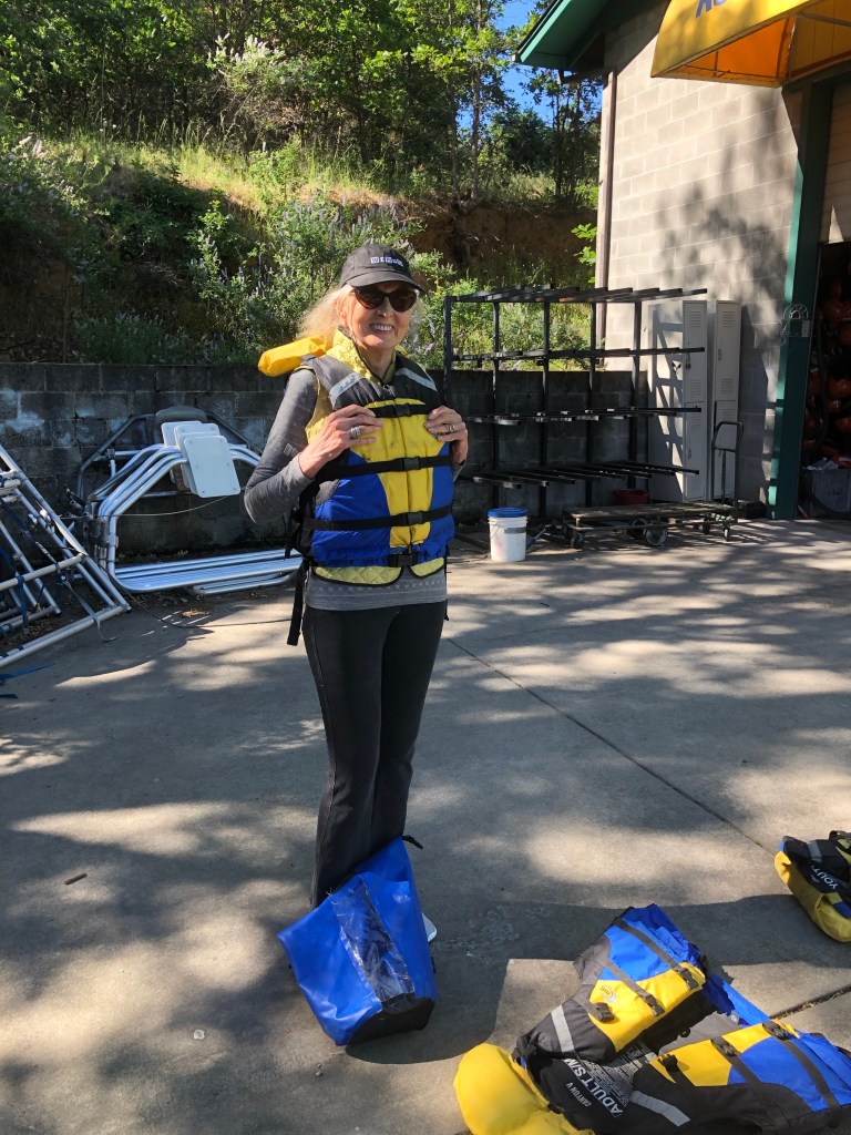
At first we thought we were the only people going on the 9:30 trip but then a family booked in but they were going for an all-day rafting trip. But all of us on the same first raft.
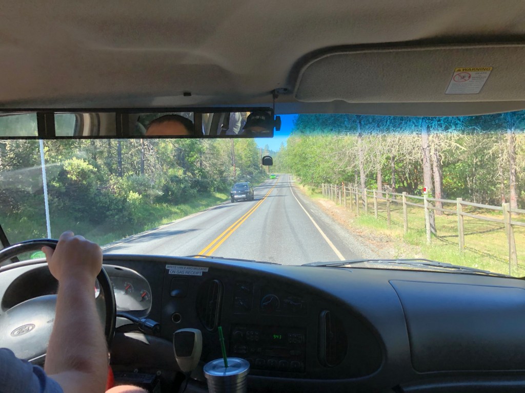
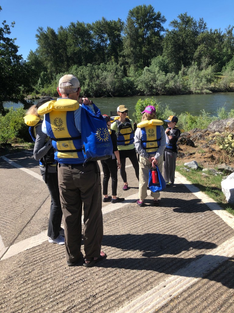
The coach towing the dinghies and kayaks, and carrying all of us, left Merlin and in about 15 minutes time came down to Robertson Bridge boat jetty where we all stepped out and assembled at the head of the ramp while the crew unshipped the dinghies and kayaks and got them ready for boarding.
oooo
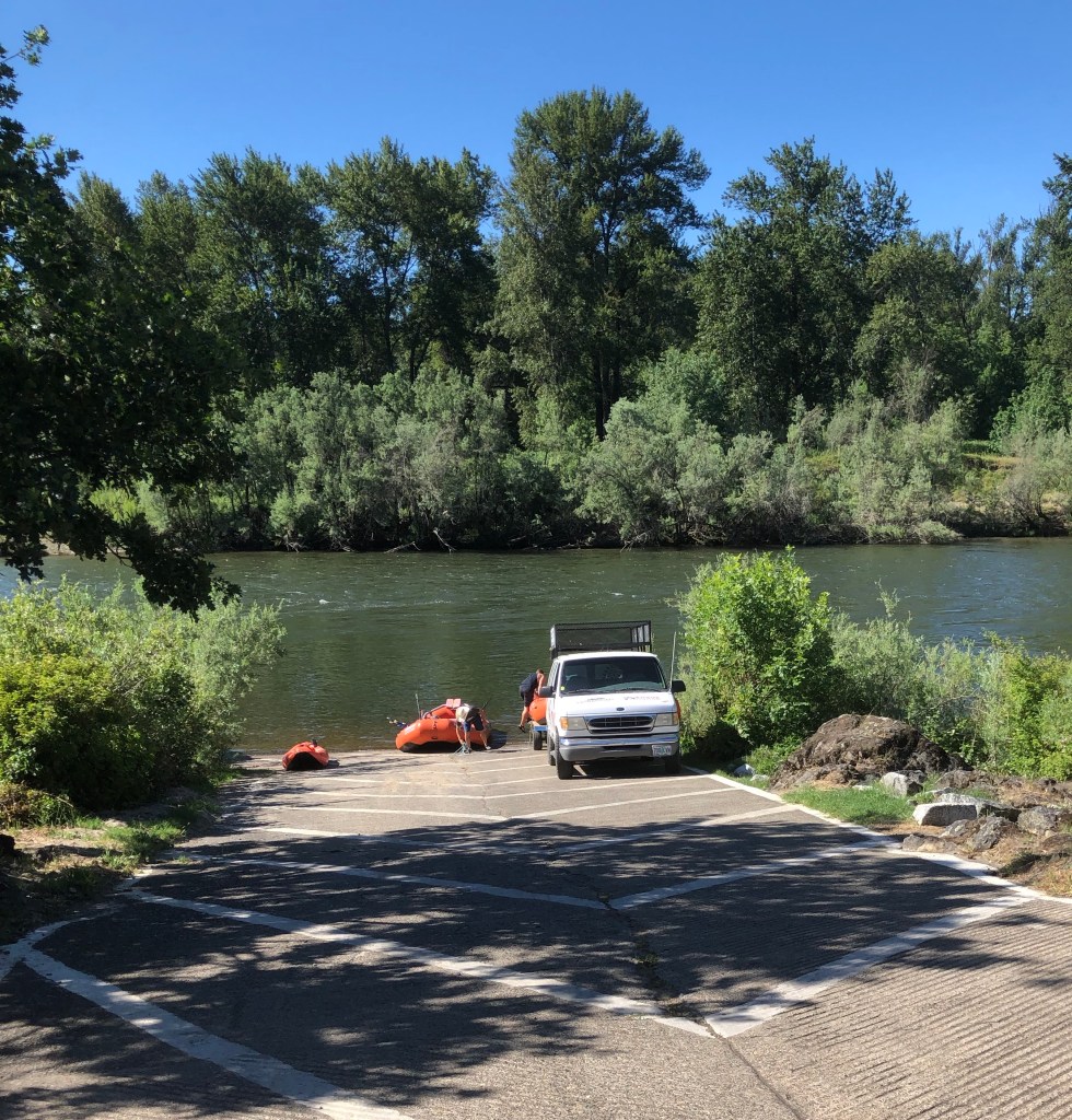
We were all going in a single dinghy and the other one was, I guess, a spare. It was put to one side. But the two kayaks were coming.
Then it was time to board.
And we were off!

More of our adventure tomorrow!
Some people just keep going.
In last week’s picture parade, I featured my mother swimming up at Secesh Reservoir near Wolf Creek. There were many lovely comments and it made my mother’s day to read all your kind words. I also mentioned that my mother was determined to take a swim in our nearby Rogue River and that it would be featured in today’s picture parade.
So here are those pictures.
Matson Park is not far from Grants Pass here in Oregon and has the great advantage of offering a beach, albeit a stony beach, that makes entry into the water easier.
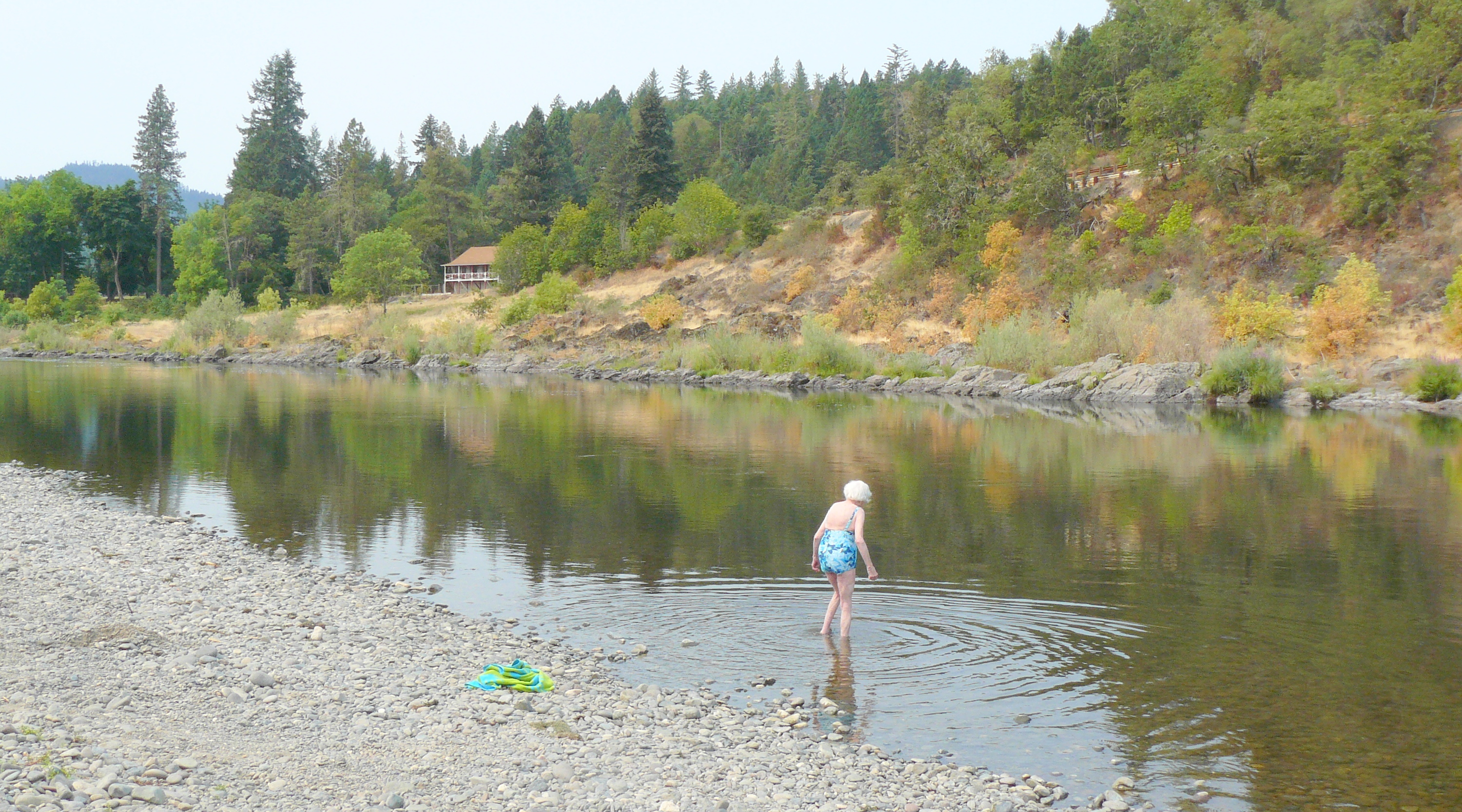
Jean had to lend my mother her shoes as the river bed was pretty stony.
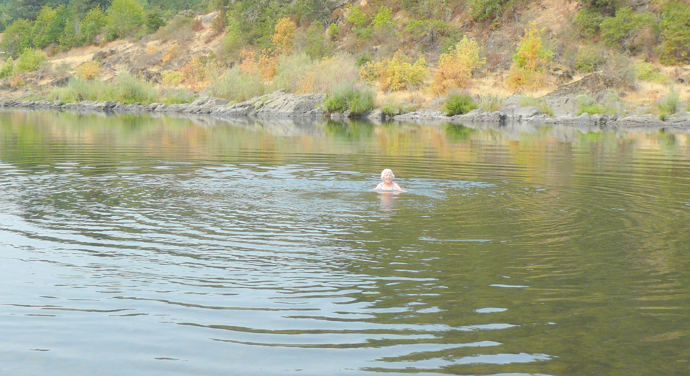
Luckily the lack of recent rains meant that the river was flowing much more gently than would be usual.
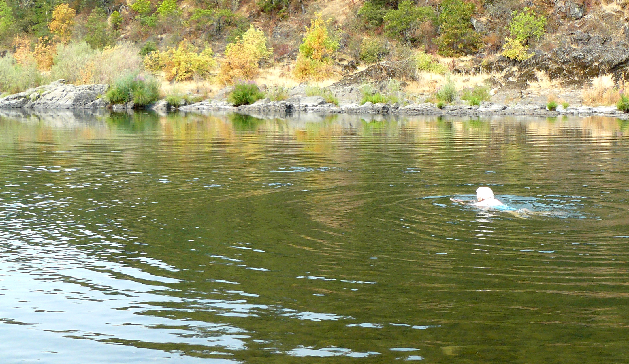
Yet even with the low volume of water flowing by, the current was a good three to four miles-per-hour and Mum was only able to stay local to us by vigorously swimming upstream.
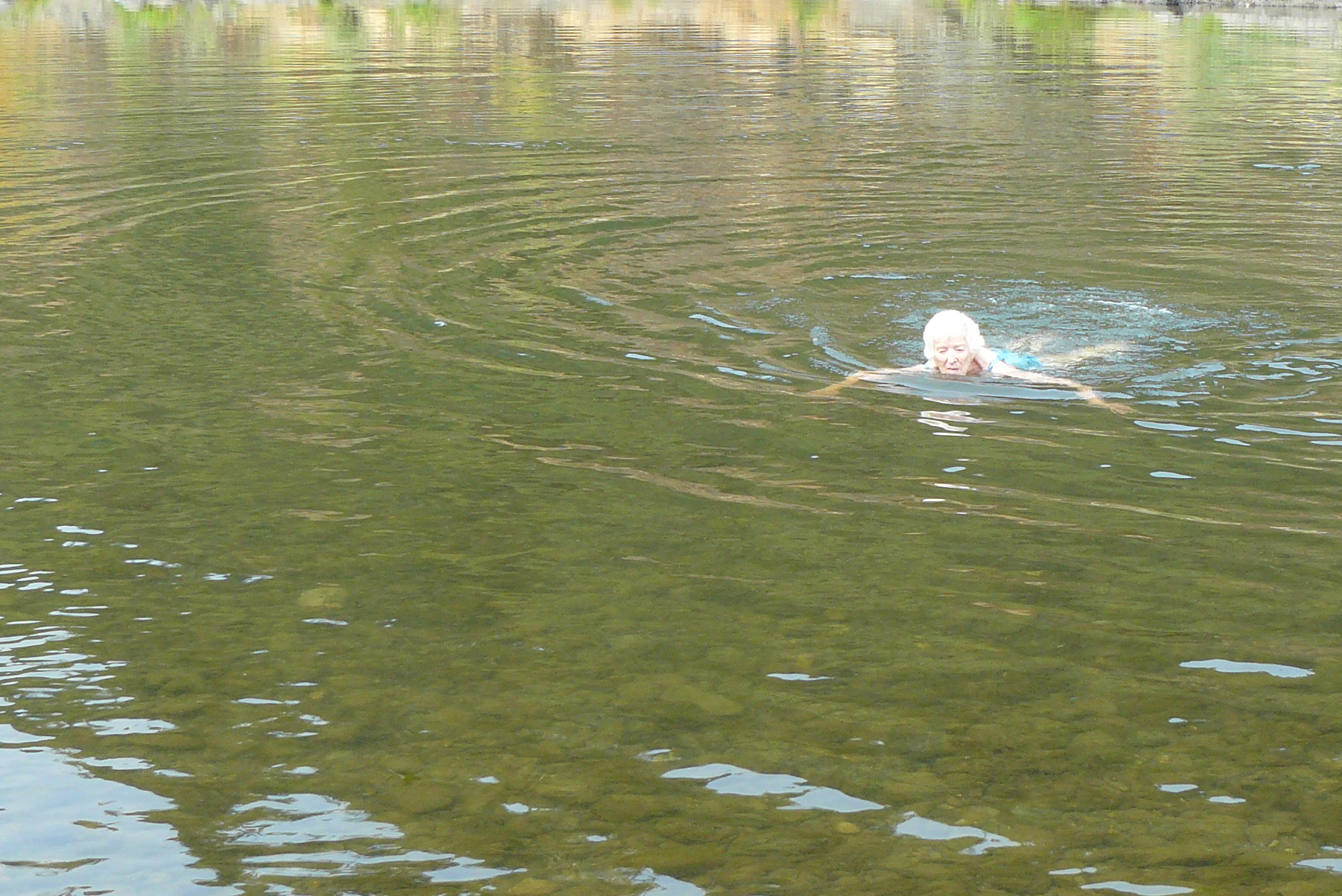
Very soon it made sense to return to the beach. What a remarkable lady she is!
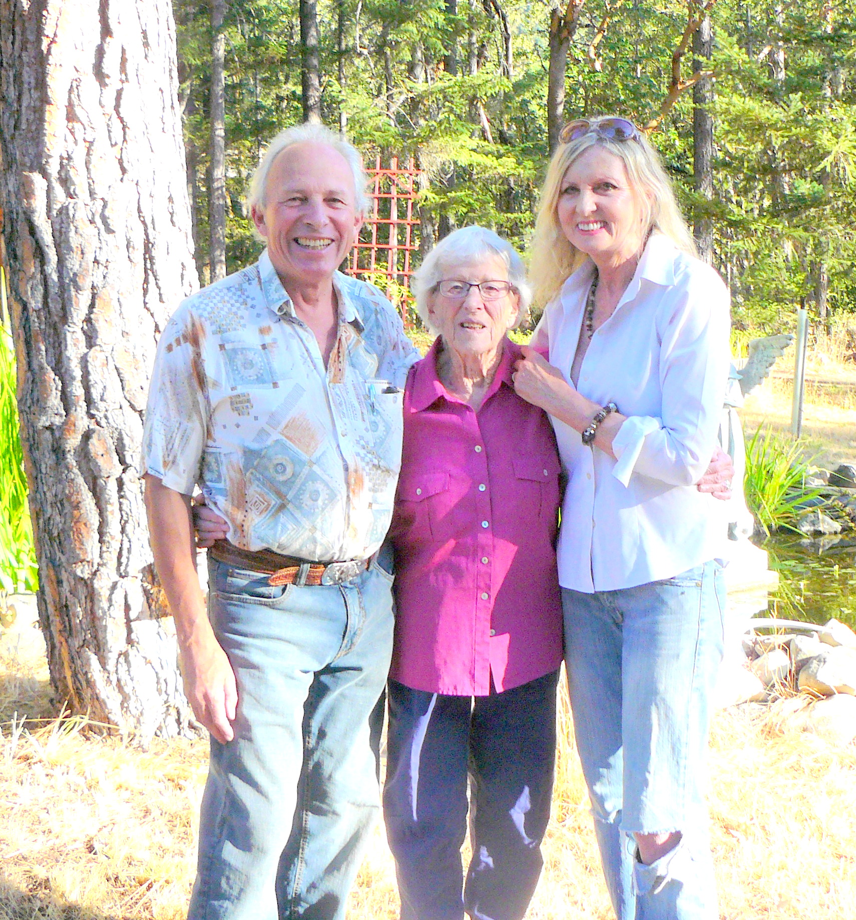
Soon the day came round for Mum to return to London. This picture was taken just before we left for Medford Airport.
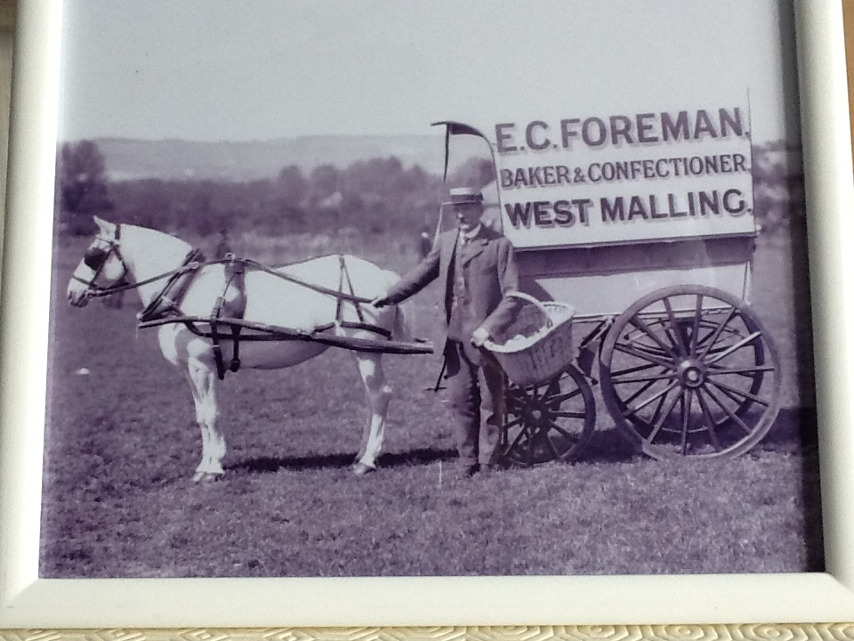
Finally, to close today’s post, here’s a photograph of Mum’s Great Uncle. Believed to have been taken around 1930, Uncle Foreman was the baker in the small village of West Malling in Kent, South-East England.
A dip into this remarkable State.
Just fancied a change from two days of Democratic Deficit. So today’s post is a brief overview of the US State that Jean and I live in, together with our animals, the State of Oregon.
Now it’s easy to look up a Wikipedia reference to Oregon but what really caught my eye was as a result of a recent visit to the local Grants Pass office of the Bureau of Land Management. We had gone there to purchase a $5 permit that allows us to go on to BLM land and harvest our own Christmas Tree!
In the Grants Pass office were a number of brochures of scenic attractions in Oregon and we picked up one describing the Rogue-Umpqua National Scenic Byway. Just a quick browse reminded us of Oregon’s stunning and dramatic scenery. Just wanted to share some images.
Mount Thielsen
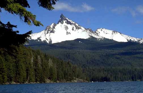
The Mount Thielsen trail is described here.
Crater Lake
At a depth of 1,932 feet Crater Lake is the deepest lake in the United States. It was formed more than 7,500 years ago when the Mount Mazama volcano erupted and then collapsed back in on itself.
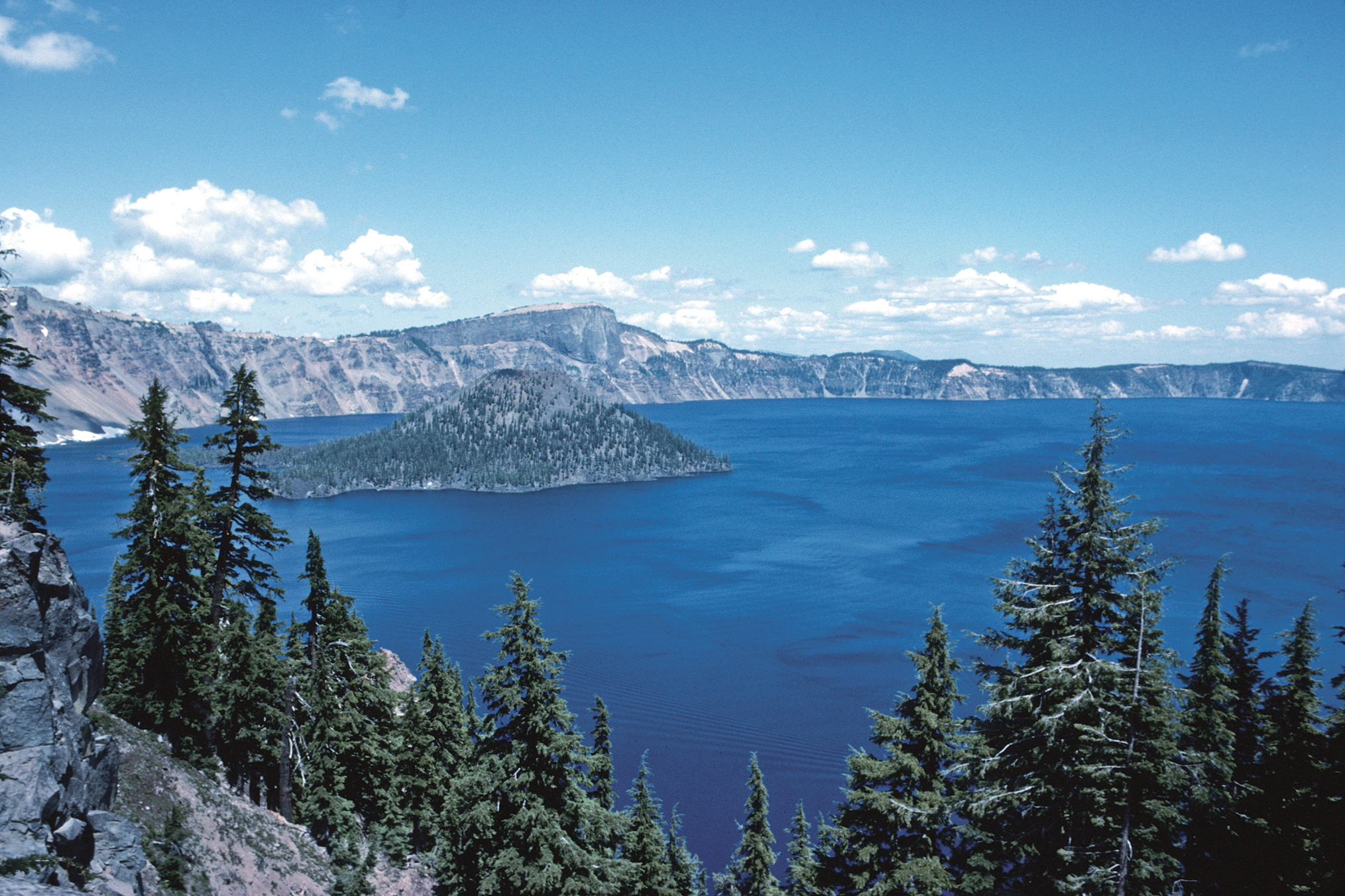
As Wikipedia describes the lake,
The lake partly fills a nearly 2,148-foot (655 m)-deep caldera[1] that was formed around 7,700 (± 150) years ago[2] by the collapse of the volcano Mount Mazama. Human interaction is traceable back to the indigenous Native Americans witnessing the eruption of Mount Mazama. There are no rivers flowing into or out of the lake; the evaporation is compensated for by rain and snowfall at a rate such that the total amount of water is replaced every 250 years. At 1,943 feet (592 m), the lake is the deepest in the United States, and the seventh[3] or ninth deepest in the world, depending on whether average or maximum depth is measured.[4]
Watson Falls
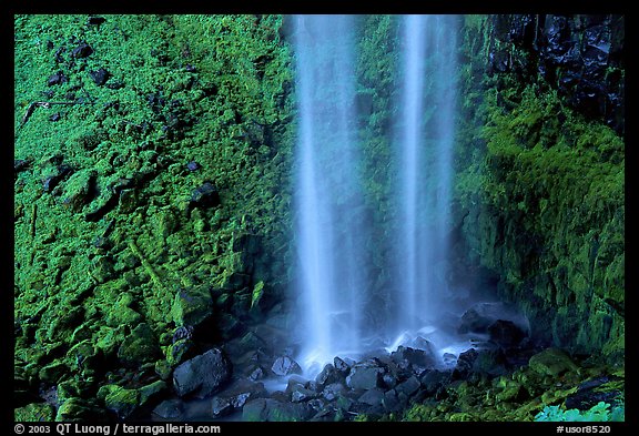
The website EveryTrail describes Watson Falls:
Watson Falls is the third highest waterfall in Oregon at 272 feet. It is the most beautiful waterfall along the North Umpqua River Valley. You will cross a wooden bridge below the falls that will put you right into the lower rapids with an amazing view of the falls as they roar over the basalt lava cliffs ahead.
Someone who goes under the handle of HikingTheWest posted this video on YouTube about 6 weeks ago.
Oregon Caves
These caves are an Oregon National Monument with full details on the US National Park Service’s website. That website explains:
Nestled deep inside the Siskiyou Mountains, the caves formed as rainwater from the ancient forest above dissolved the surrounding marble and created one of the world’s few marble caves. The highly complex geology found on the Monument contributes to the unusual and rare plants and animals found nowhere else but here.
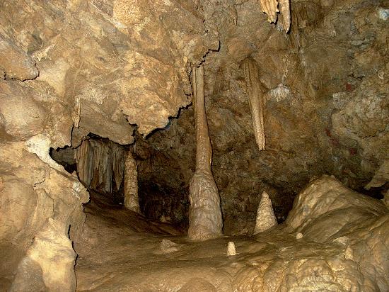
There are many good videos of the Oregon Caves on YouTube so do have a browse if you want to. This one caught my eye, especially as it was filmed in January, 2013..
Rogue River
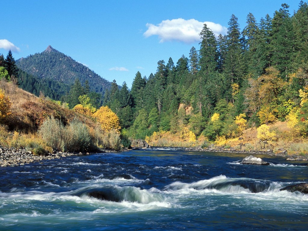
Final sight for today, the Rogue River runs close by Grants Pass, our nearest town to where we live. Again there is a Wikipedia entry from which one learns that, “Although the Rogue Valley near Medford is partly urban, the average population density of the Rogue watershed is only about five people per square mile (12 per km2).”
Just reflecting on that last paragraph, a simple calculation reveals that the State of Oregon has a population of around 3.9 million people with an land area of 98,300 square miles. Thus the population density of Oregon is 39.6 persons per square mile. To put that into perspective, our neighbouring Californians to the South enjoy a population density of 238 persons per square mile!
Jean and I are very lucky to be living in such a beautiful part of Southern Oregon.
