I was going through some files yesterday and found many photographs taken by me.
oooo
These were taken in 2018 which was when my son, Alex, and his partner, Lisa, came over to see us.
Here is the opening part of Wikipedia writing about Crater Lake:
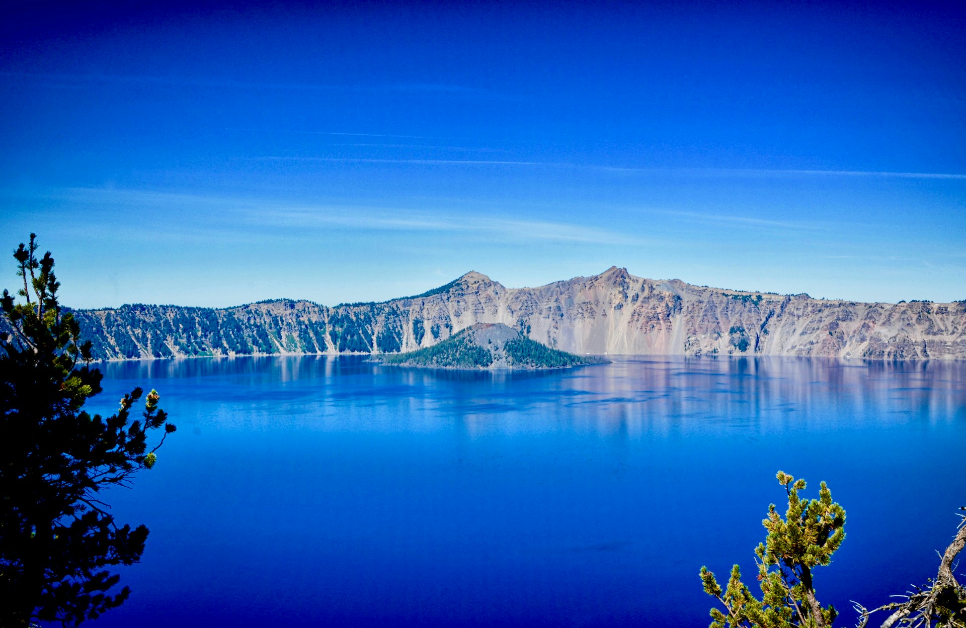
Crater Lake (Klamath: Giiwas)[2] is a volcanic crater lake in south-central Oregon in the WesternUnited States. It is the main feature of Crater Lake National Park and is a tourist attraction for its deep blue color and water clarity. The lake partly fills a 2,148-foot-deep (655 m) caldera[3] that was formed around 7,700 (± 150) years ago[4] by the collapse of the volcano Mount Mazama. No rivers flow into or out of the lake; the evaporation is compensated for by rain and snowfall at a rate such that the total amount of water is replaced every 150 years.[5] With a depth of 1,949 feet (594 m),[6] the lake is the deepest in the United States. In the world, it ranks eleventh for maximum depth, as well as fifth for mean depth.
It was formed when this former volcano, “which collapsed on itself during an eruption just 7,700 years ago and slowly filled with melted snow, now stands as Oregon’s only national park.”
At over 2,000 feet deep it is the deepest lake in the United States of America.
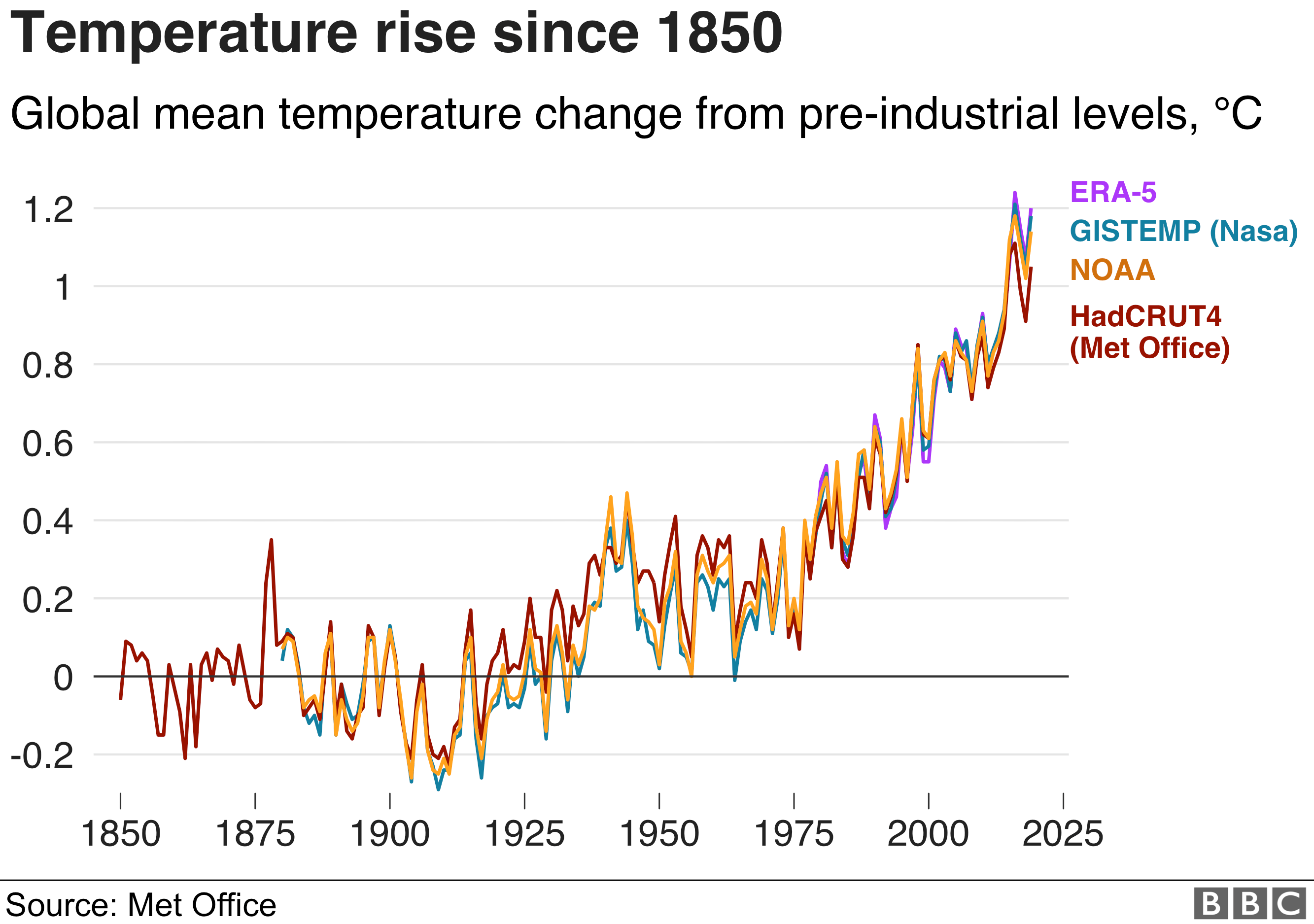
What is happening to Earth’s climate needs attention NOW!
Two charts recently from the BBC News.
The 10 years to the end of 2019 have been confirmed as the warmest decade on record by three global agencies.
According to Nasa, Noaa and the UK Met Office, last year was the second warmest in a record dating back to 1850. The past five years were the hottest in the 170-year series, with the average of each one more than 1C warmer than pre-industrial.
The Met Office says that 2020 is likely to continue this warming trend.2016 remains the warmest year on record, when temperatures were boosted by the El Niño weather phenomenon.
This is the reality.
It affects every part of the world and it affects everyone. BUT! We, as in you and me, and everyone else, still haven’t got it.
The recent COP26 was progress and, especially, the next convention being held in a year’s time is important. But it is a long way from where we need to be. A very long way.
Patrice Ayme is someone that I follow and there have been times when I have gladly republished his posts. With his permission I should add.
Recently he published a post called Cataclysmic Seven Degree Centigrade Rise and I wanted to share it with you. Here is is:
ooOOoo
CATACLYSMIC SEVEN DEGREES CENTIGRADE RISE
Abstract: Expected rise of temperature in mountains correspond to a seven degree C rise. This informs global heating: in the long run, it will also be 7C. Large systems (Antarctica, Greenland) have greater thermal inertia, so their temperatures rise slower… But they will rise as much. In other words the so-called “forcing” by man-made greenhouse gases (which corresponds to 600 ppm of CO2) is universal, but the smaller the system, the faster the temperature rise…
****
Geographical systems with little thermal inertia (mountain glaciers) show an accelerated rate of heating of these parts which is only compatible with a seven (7) degrees rise in Celsius by 2100… A rise the IPCC of the UN considers impossible… But INERTIA says that it IS happening. The first thing this implies is that most forests will burn… worldwide. Then the ice shelves in Antarctica will follow.
TEMPS RISING ULTRA FAST IN MOUNTAINS
Anybody familiar with mountains worldwide know that temperatures are rising extremely fast: large glaciers I used to know have completely disappeared.. As in Chacaltaya, Bolivia. Or Portage, Alaska. The closest glacier to an Alpine village I went to as a child has been replaced by a larch forest (melezes)… One reason for this is that mountains are smaller in frozen mass than immense ensembles like Greenland and Antarctica. Moreover, the mountains’ permafrost is not as cold.
From 1984 to 2017, the upper reaches of the fires in the Sierra Nevada of California rose more than 1,400 feet. Now the temperature in the lower atmosphere decreases by 7C every 1,000 meters. There are many potential factors to explain why fires go higher (although some contradict each other). To avoid paralysis by analysis, I will assume the rise in fires is all due to temperature rise. So what we have here is a 2.5C rise in 33 years.
….FROM SMALLER THERMAL INERTIA:
Mountain thermal capacity is accordingly reduced relative to those of Greenland and Antarctica. The proportionality factors are gigantic. Say the permafrost of a mountain range is of the order of 10^4 square kilometers, at a depth of one kilometer (typical of the Sierra Nevada of California or the Alps at a temp of -3C. By comparison, Antarctica is 14x 10^6 sq km at a depth of 4 kilometers of permafrost at a temp of -30C. Thinking in greater depth reveals the proportions to be even greater: individual mountains are of the order of square kilometers. This means that (using massively simplified lower bounds), Antarctica has a mass of cold which is at least 4 orders of magnitude higher than a mountain range: to bring Antarctica to seriously melt, as mountain ranges are right now, would require at least 10,000, ten thousand times, as much heat (or maybe even a million, or more, when considering individual mountains).
As it is, mountains are exposed to a heat bath which makes their permafrost unsustainable. From their small thermal inertia, mountains warm up quickly. Greenland and Antarctica, overall, are exposed to the same bath, the same “forcing”, but because they are gigantic and gigantically cold, they resist more: they warm up, but much slower (moreover as warmer air carries more snow, it snows more while Antarctica warms up).
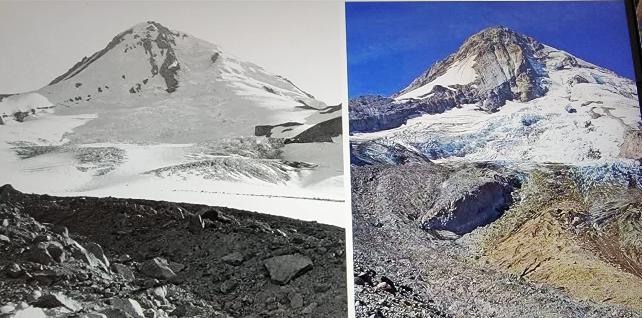
I have looked, in details at glaciologists records, from the US to Europe… Everywhere glaciologists say the same thing: expect a rise of the permafrost line of 1,000 meters… That corresponds to a SEVEN DEGREE CENTIGRADE RISE. Basically, while glaciers were found down to 2,500 meters in the Alps (some can still be seen in caves)… Expect that, in a few decades, none will occur below 3,500 meters… Thus speak the specialists, the glaciologists…
Mount Hood, Oregon, in August 1901 on the left, and August 2015, on the right. The Eliot glacier, front and center, which used to sprawl for miles, is in the process of disappearing completely.
What is happening then, when most climate scientists speak of holding the 1.5 C line (obviously completely impossible, even if humanity stopped emitting CO2 immediately)???… Or when they admit that we are on a 2.7C future in 2100? Well, those scientists have been captured by the establishment… They say what ensure their prosperous careers… At a global rise of 2.7 C, we get a migration of the permafrost line of around 500 kilometers towards the poles… Catastrophic, yes, but still, Antarctica will not obviously start to melt, big time.
If it came to light that a seven degree centigrade rise is a real possibility, authorities would turn around and really do some things, which may destabilize the worldwide plutocratic establishment: carbon tariffs are an obvious example. Carbon tariffs could be imposed next week… and they would have a big impact of the CO2 production. So why are carbon tariffs not imposed? Carbon tariffs would destabilize the deindustrialization gravy train: by employing who are basically slaves in poor countries, plutocrats make themselves ever wealthier, while making sure there would be no insurrection at home… A trick already used in imperial Rome, by the Senatorial aristocracy/plutocracy. That would be highly effective… By the way, without saying so, of course, and maybe even unwittingly, this is basically what Trump had started to do…
The devil has these ways which the commons do not possess…
That would stop the crafty, dissembling nonsense that countries such as France are at 4.6 tons per capita of CO2 emissions per year… That’s only true when all the CO2 emitted to produce the goods the French need is NOT counted.. including deforestation in Brazil to grow soybean. With them counted, one gets to 11 tons or so, more than double… The wonderful graph of CO2 emissions collapsing in Europe is the same graph as collapsing industrial production…
The devil has these ways the commons have not even detected…
Carbon tariffs would be a way to solve two wrongs in one shot: the wrong of deindustrialization, of corrupt pseudo-leaders not putting the most advanced countries, their own countries, first… And the wrong of producing too much CO2.
Little fixes will go a long way, as long as they incorporate hefty financing fundamentally researching new energy (it does not really matter which type, as long as it is fundamental…)
Patrice Ayme
ooOOoo
Now this isn’t some academic treatise that doesn’t affect the likes of you and me. This is, as I have said, the harsh reality of NOW!
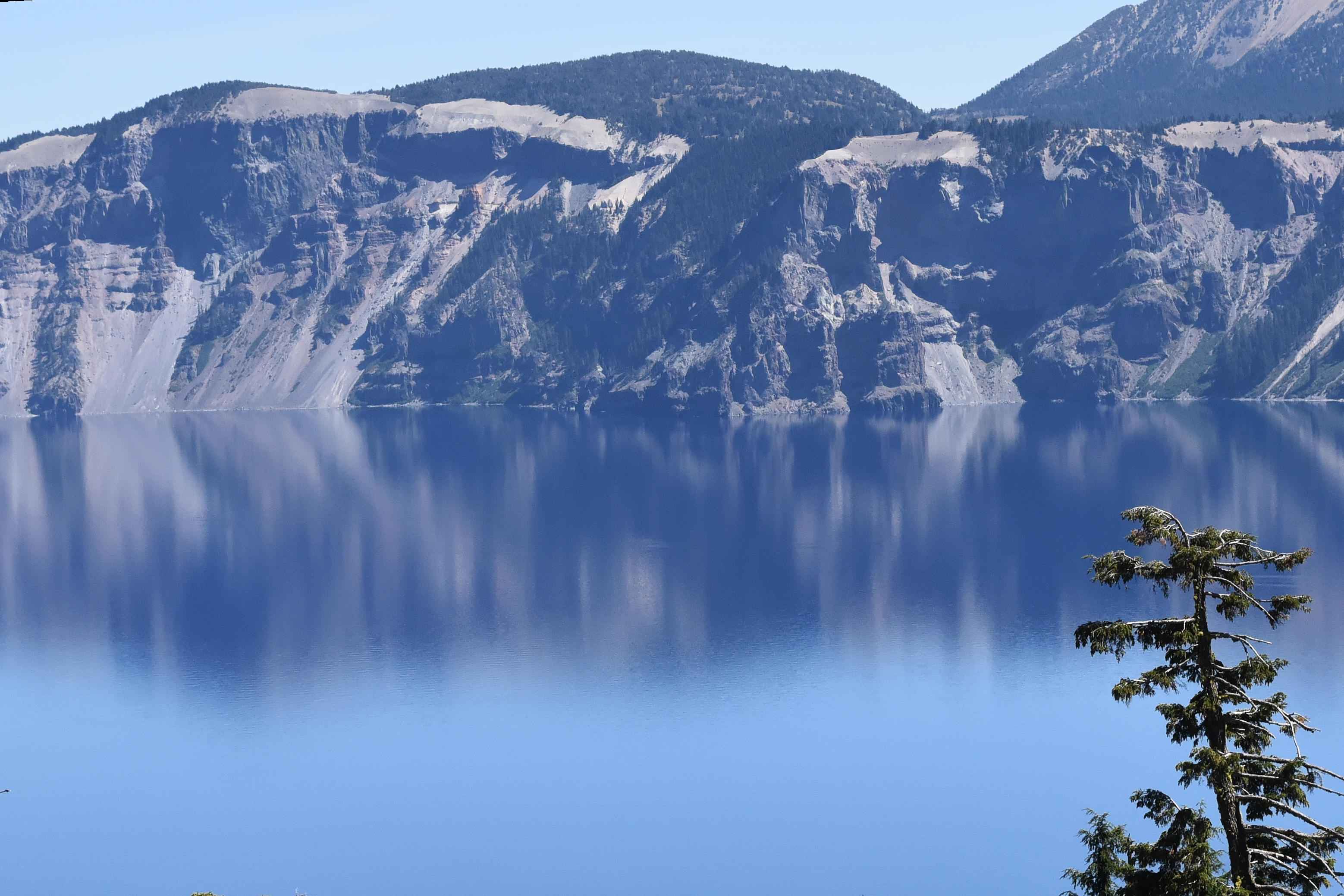
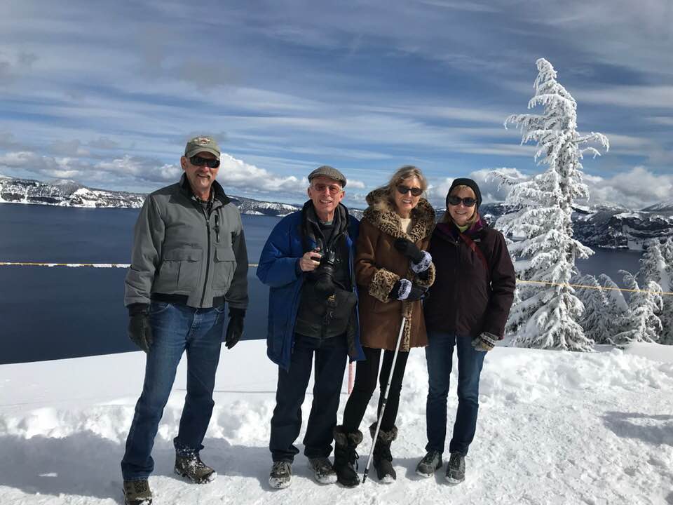
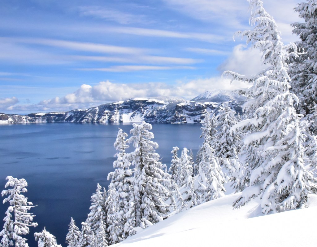
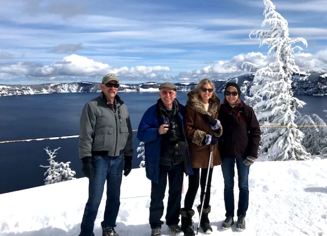
Here’s a photo of me and Jeannie together with Andy and Trish taken in March, 2018. On the edge of Crater Lake.
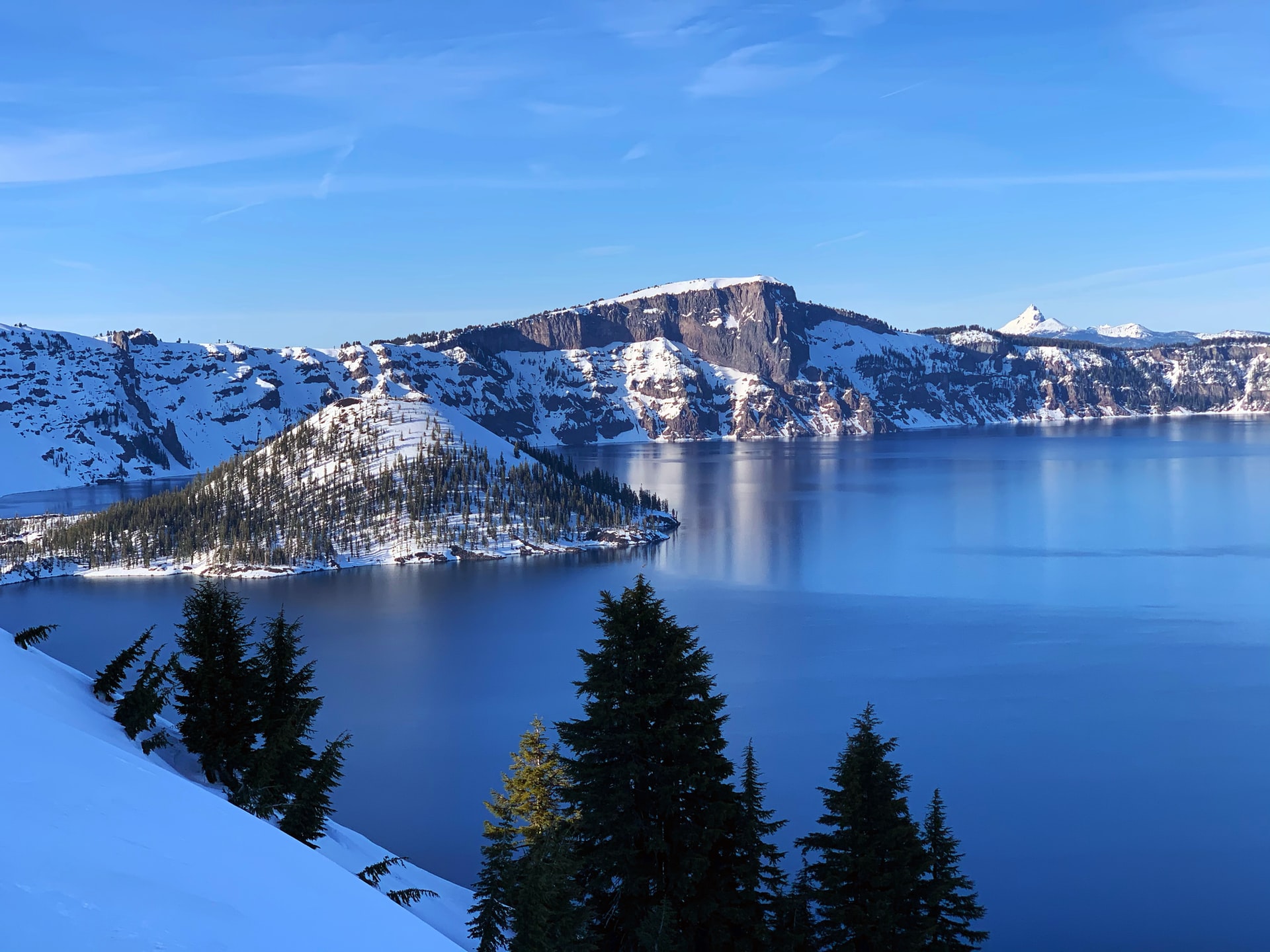
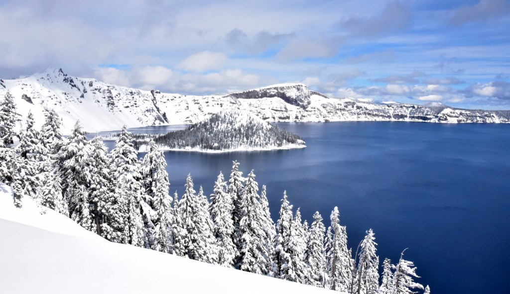
Then this is a stock photograph of Crater Lake taken in March, 2020.
Taken by Valerie Little
Not a great deal of difference but the trees in the photo above aren’t encased in snow as is the tree in the 2018 photo.
Now there is important news to bring you from COP 26. On Sunday Boris Johnson said:
Scientists say this would limit the worst impacts of climate change.
During a Downing Street news conference, Mr Johnson said:
“We can lobby, we can cajole, we can encourage, but we cannot force sovereign nations to do what they do not wish to do”
“For all our disagreements, the world is undeniably heading in the right direction”
The “tipping point has been reached in people’s attitudes” – with leaders “galvanised and propelled by their electorates”
But “the fatal mistake now would be to think that we in any way cracked this thing”
Mr Johnson said that despite the achievements of the summit, his reaction was “tinged with disappointment”.
He said there had been a high level of ambition – especially from countries where climate change was already “a matter of life and death”.
And “while many of us were willing to go there, that wasn’t true of everybody”, he admitted.But he added the UK could not compel nations to act. “It’s ultimately their decision to make and they must stand by it.”
That point about attitudes is interesting. Who would have thought, say, five years ago, that attitudes had changed so dramatically by late-2021.
One hopes that we will come to our collective senses but I can’t see the CO2 index being returned to its normal range without machines taking the excessive CO2 out of the atmosphere. Because, as was quoted on The Conversation nearly a year ago:
On Wednesday this week, the concentration of carbon dioxide in the atmosphere was measured at at 415 parts per million (ppm). The level is the highest in human history, and is growing each year.
Finally, my daughter, Maija, and my son-in-law, Marius, had a child some ten years ago. He is my grandson and I left England before he was born. He is Morten and he is a bright young spark.
Morten
Morten and all the hundreds of thousands of young persons like him are going to have to deal with the world as they find it!
Part Two of a pictorial account of our recent trip to Klamath Falls and Crater Lake.
Covering Sunday, 18th March, when we travelled from Klamath Falls up to Crater Lake and then Monday, 19th March, when we returned back from Klamath Falls to Merlin, OR.
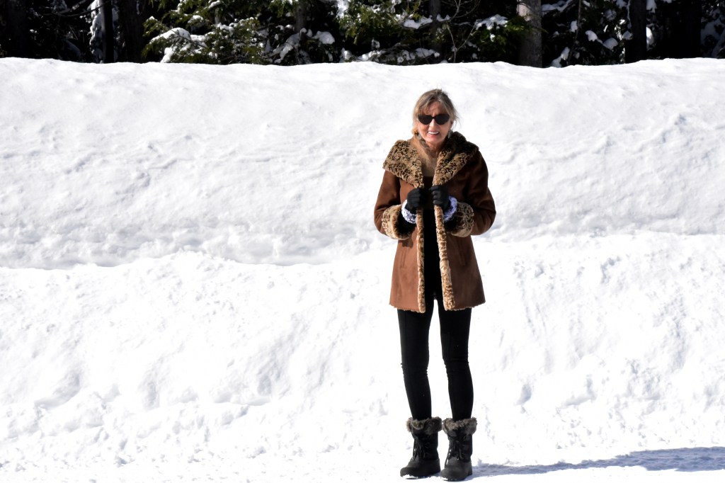
Over the weekend Jean and I went up to Klamath Falls to spend two nights in the company of good friends, Trish and Andy, who live in Tucson, Az.
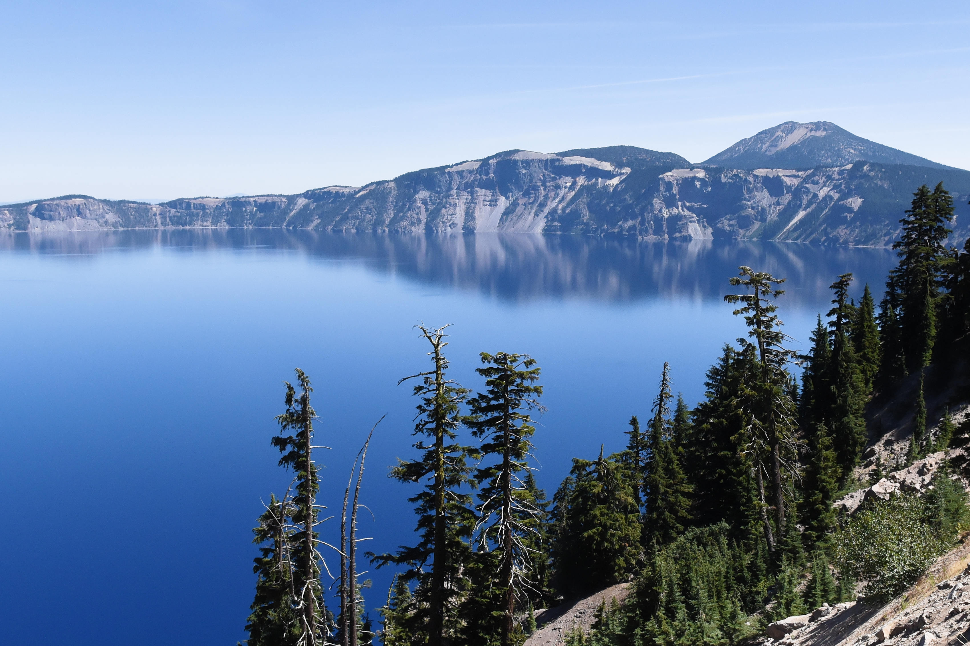
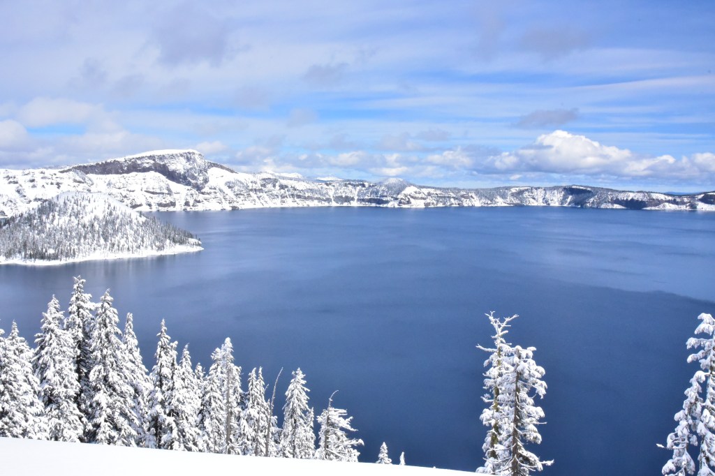
Last Sunday we all jumped into our car, a GMC Canyon with 4WD, and drove the 60-odd miles from Klamath Falls to the Rim Village Visitor Center.
Talk about impressive!
Here are three photographs that I took that are presented untouched, as in no post processing, that I wanted to share with you.
More details coming along, plus more photos for the next Picture Parade.
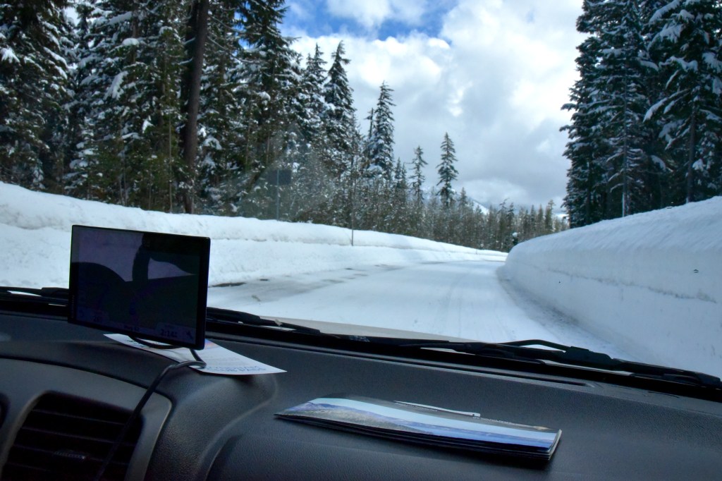
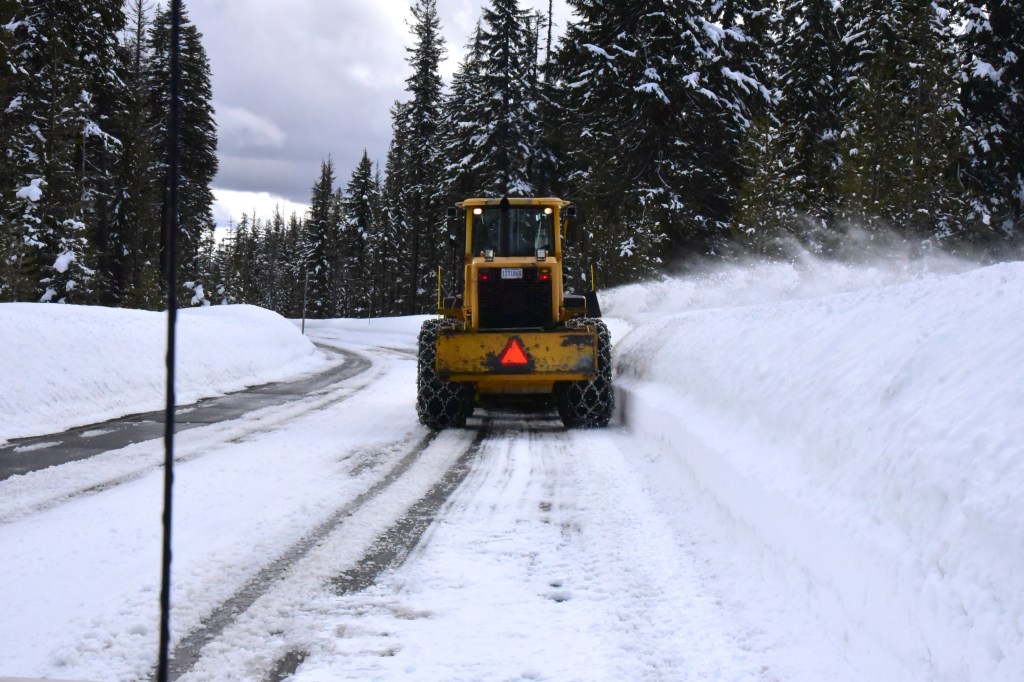
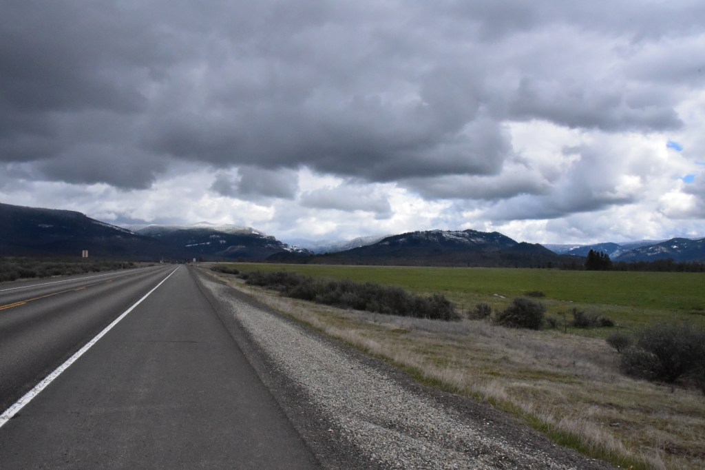
The first was taken during Saturday afternoon when Jean and I were on our way to Klamath Falls.
On the road to the high country!
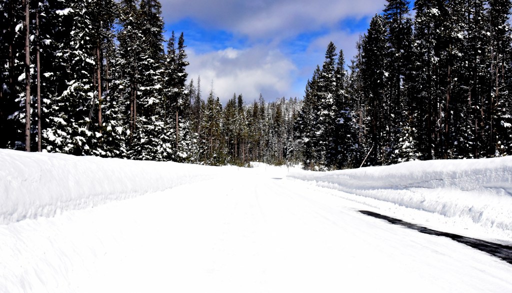
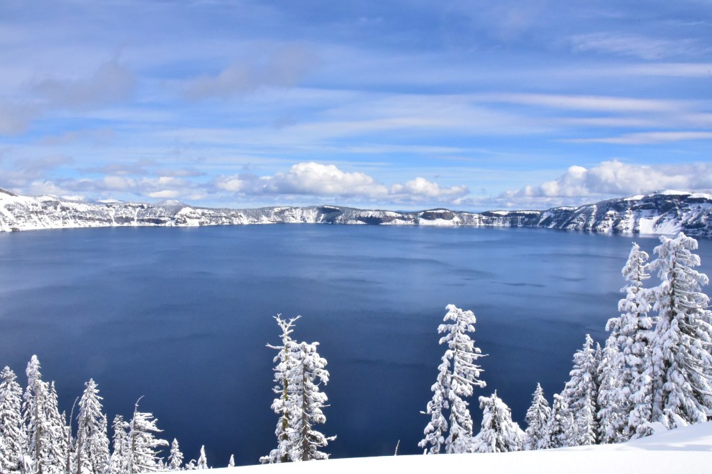
The next photograph was taken when we stopped in one of the many ‘turnouts’ along the highway going up to Crater Lake. In fairness, the high snow bank was more a result of the snow blowers than falling snow … but still!
Rumour has it that it had snowed in these parts!
This last photograph, for today anyway, is the sight of Crater Lake!
Just fancied a change from two days of Democratic Deficit. So today’s post is a brief overview of the US State that Jean and I live in, together with our animals, the State of Oregon.
Now it’s easy to look up a Wikipedia reference to Oregon but what really caught my eye was as a result of a recent visit to the local Grants Pass office of the Bureau of Land Management. We had gone there to purchase a $5 permit that allows us to go on to BLM land and harvest our own Christmas Tree!
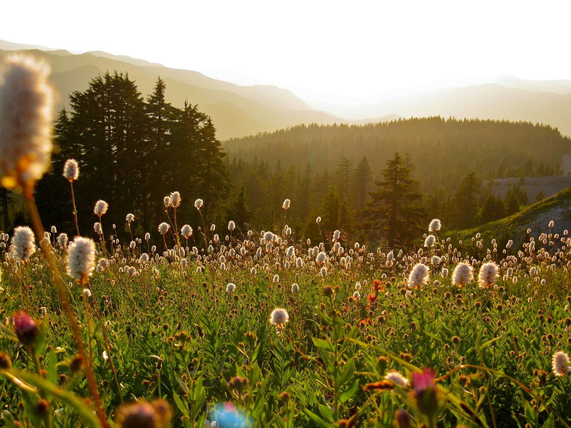
In the Grants Pass office were a number of brochures of scenic attractions in Oregon and we picked up one describing the Rogue-Umpqua National Scenic Byway. Just a quick browse reminded us of Oregon’s stunning and dramatic scenery. Just wanted to share some images.
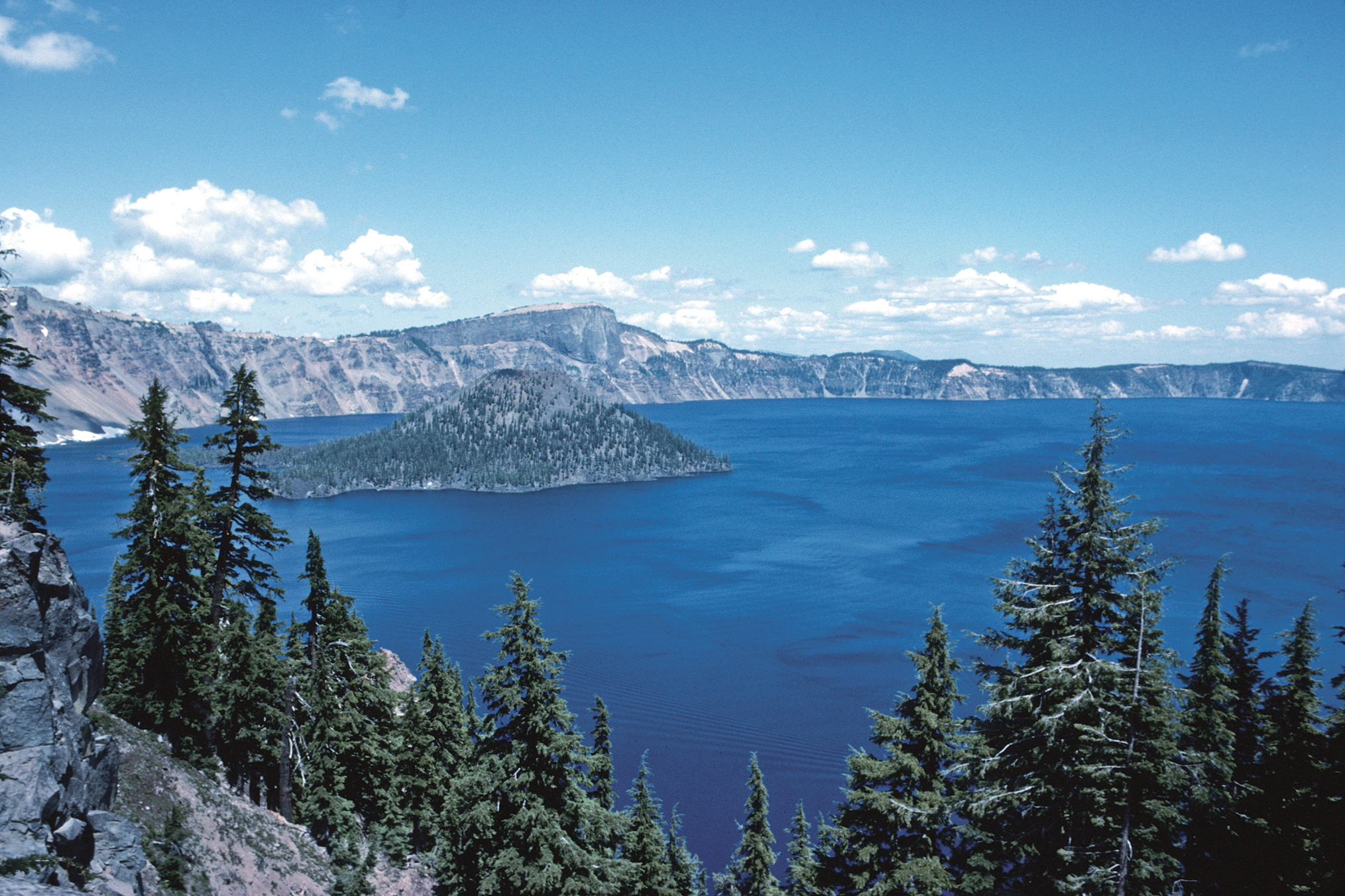
At a depth of 1,932 feet Crater Lake is the deepest lake in the United States. It was formed more than 7,500 years ago when the Mount Mazama volcano erupted and then collapsed back in on itself.
The lake partly fills a nearly 2,148-foot (655 m)-deep caldera[1] that was formed around 7,700 (± 150) years ago[2] by the collapse of the volcano Mount Mazama. Human interaction is traceable back to the indigenousNative Americans witnessing the eruption of Mount Mazama. There are no rivers flowing into or out of the lake; the evaporation is compensated for by rain and snowfall at a rate such that the total amount of water is replaced every 250 years. At 1,943 feet (592 m), the lake is the deepest in the United States, and the seventh[3] or ninth deepest in the world, depending on whether average or maximum depth is measured.[4]
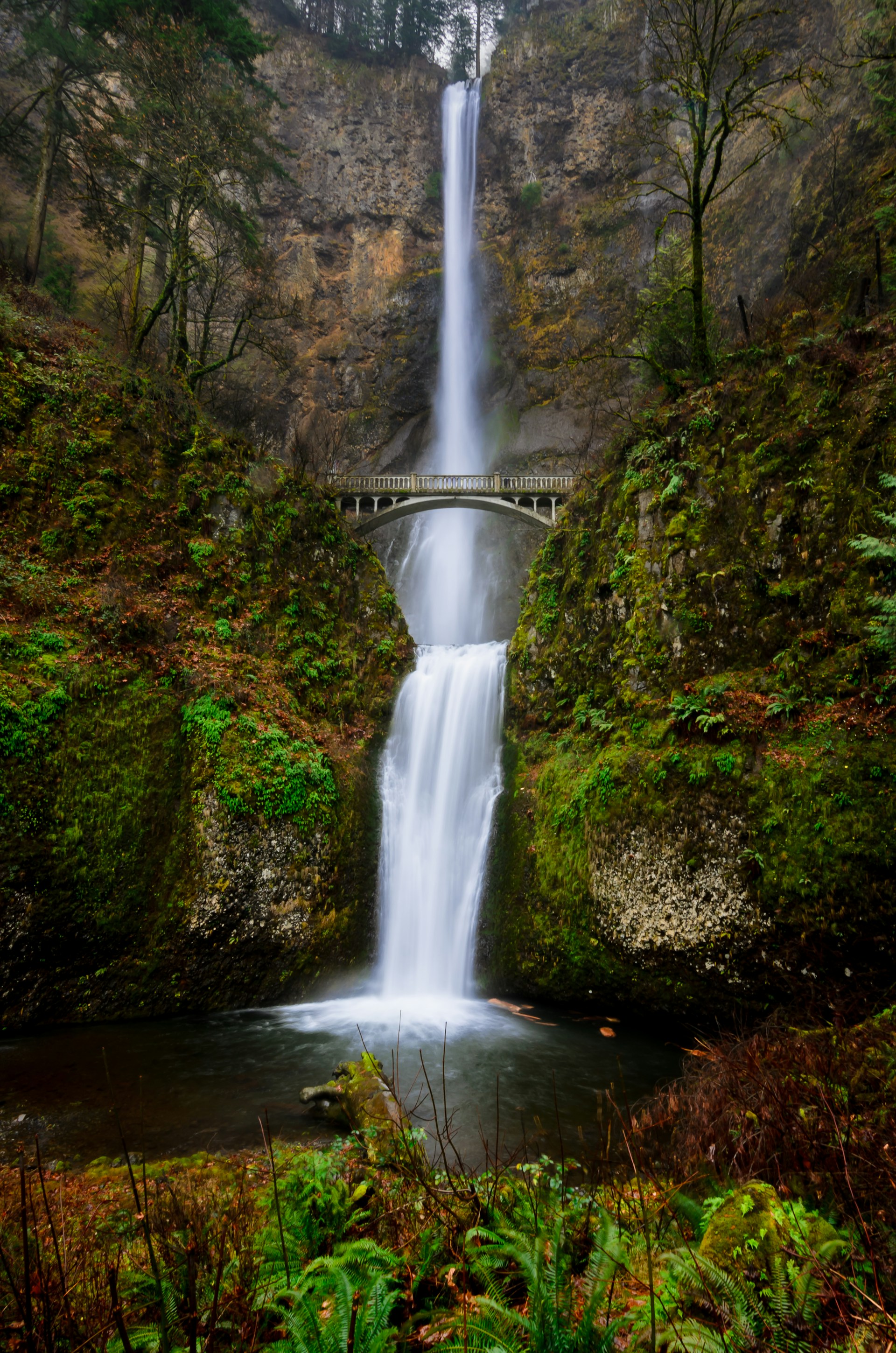
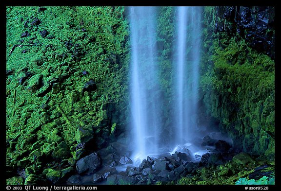
Watson Falls is the third highest waterfall in Oregon at 272 feet. It is the most beautiful waterfall along the North Umpqua River Valley. You will cross a wooden bridge below the falls that will put you right into the lower rapids with an amazing view of the falls as they roar over the basalt lava cliffs ahead.
Someone who goes under the handle of HikingTheWest posted this video on YouTube about 6 weeks ago.
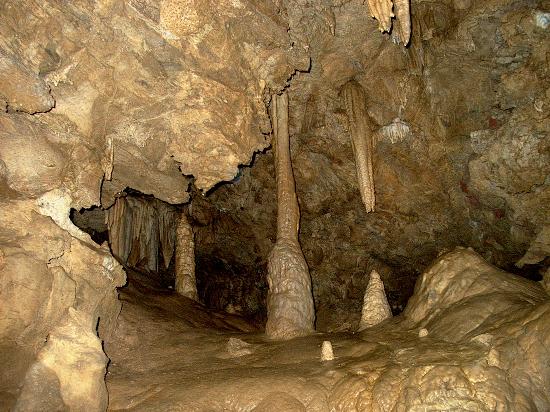
Oregon Caves
These caves are an Oregon National Monument with full details on the US National Park Service’s website. That website explains:
Nestled deep inside the Siskiyou Mountains, the caves formed as rainwater from the ancient forest above dissolved the surrounding marble and created one of the world’s few marble caves. The highly complex geology found on the Monument contributes to the unusual and rare plants and animals found nowhere else but here.
A view of the inside of the caves.
There are many good videos of the Oregon Caves on YouTube so do have a browse if you want to. This one caught my eye, especially as it was filmed in January, 2013..
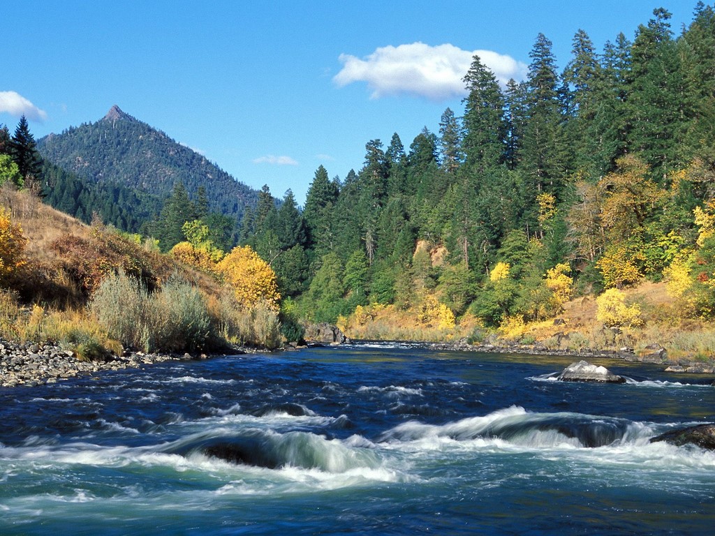
Rogue River
The Rogue River
Final sight for today, the Rogue River runs close by Grants Pass, our nearest town to where we live. Again there is a Wikipedia entry from which one learns that, “Although the Rogue Valley near Medford is partly urban, the average population density of the Rogue watershed is only about five people per square mile (12 per km2).”
Just reflecting on that last paragraph, a simple calculation reveals that the State of Oregon has a population of around 3.9 million people with an land area of 98,300 square miles. Thus the population density of Oregon is 39.6 persons per square mile. To put that into perspective, our neighbouring Californians to the South enjoy a population density of 238 persons per square mile!
Jean and I are very lucky to be living in such a beautiful part of Southern Oregon.