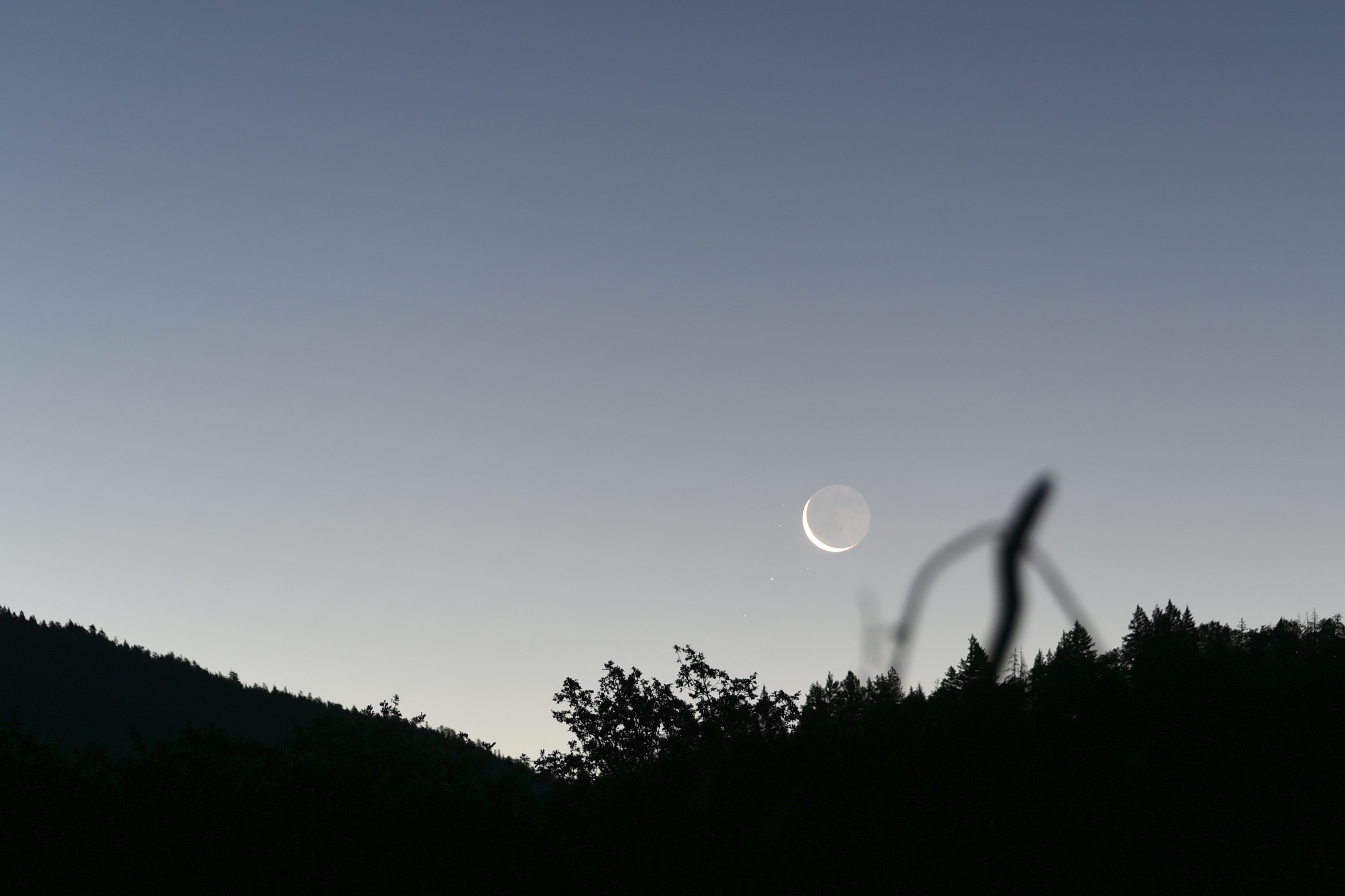
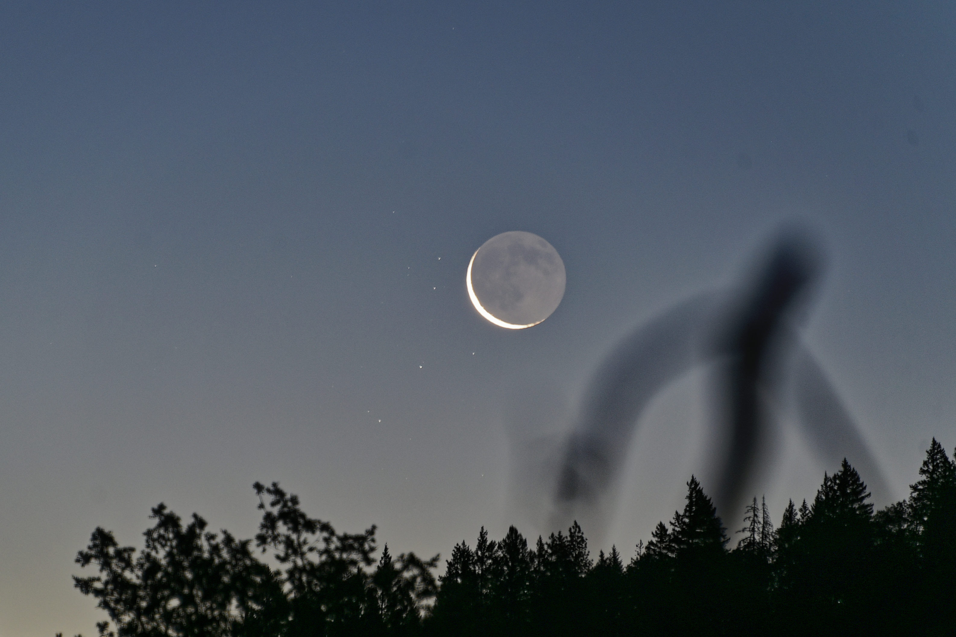
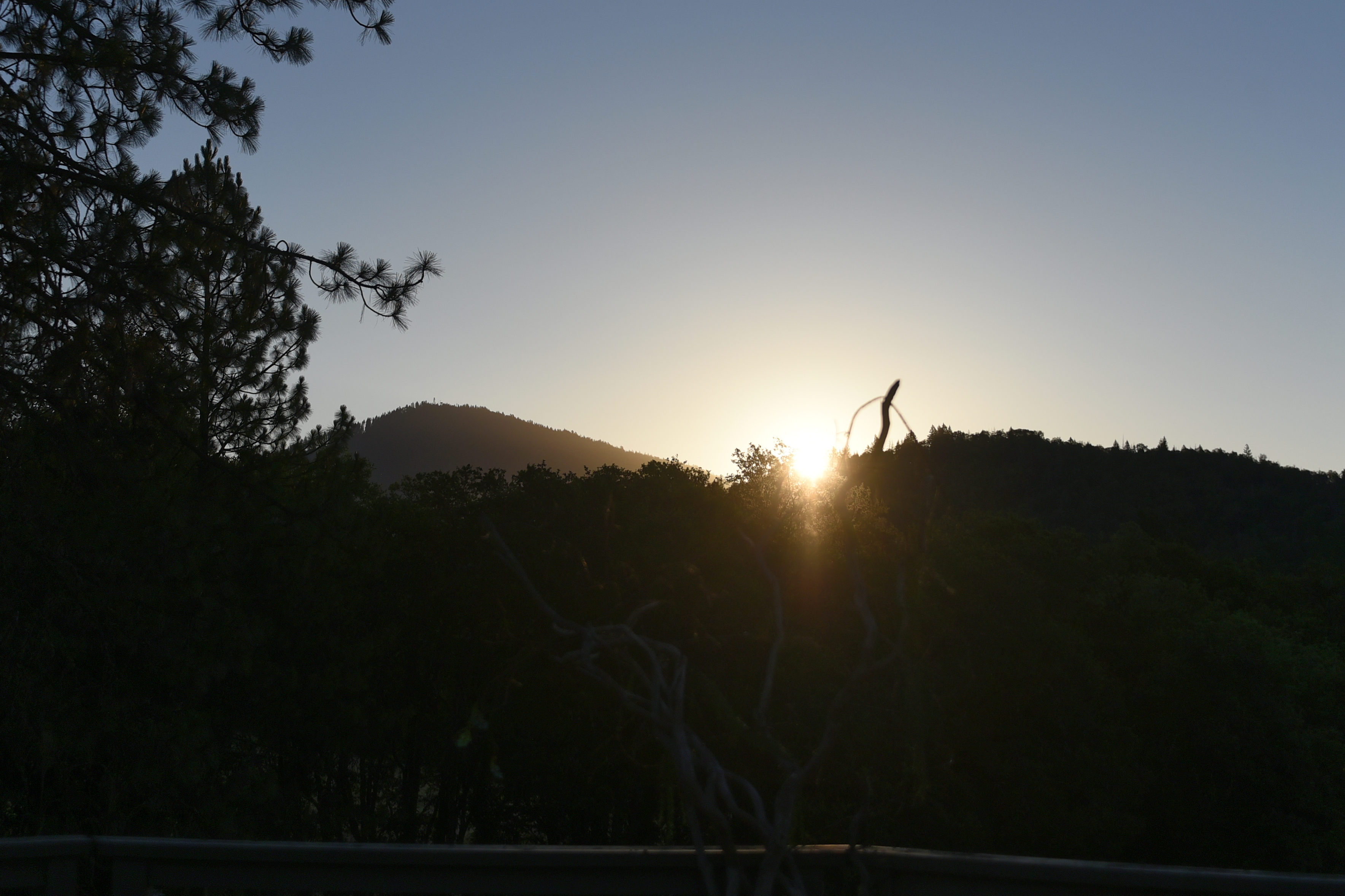
I hope that I can republish this photograph. I shall provide all the details.
ooOOoo
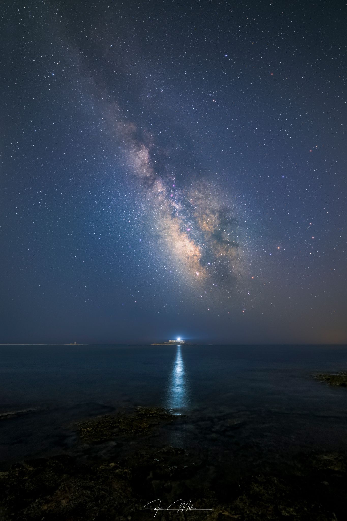
Milky Way over Isola delle Correnti
On 07/17/2026 11:00 pm by Enrico Modica | Website | Portopalo di Capopassero, Sicily, Italy
The photograph was captured at approximately 11:00 PM (23:00 CEST) on July 17, 2026, near Isola delle Correnti, the southernmost point of Sicily, Italy, where the Ionian Sea meets the Mediterranean Sea.
The image depicts the Galactic Centre of the Milky Way rising above the island, with the lighthouse beam reflecting across the sea and naturally guiding the viewer’s eye toward the star-filled sky. The bright central bulge of our Galaxy lies in the direction of the constellation Sagittarius, approximately 27,000 light-years from Earth. Also visible are several prominent summer constellations, including Scorpius (with the bright red star Antares), Ophiuchus and Aquila (with Altair).
Camera: Nikon D750 (full-frame DSLR) Lens: Samyang 14 mm f/2.8 Mount: Sky-Watcher Star Adventurer 2i Pro (star tracker)
Sky Camera: Nikon D750 Lens: Samyang 14 mm Star tracker used 30 stacked exposures ISO 800 Aperture: f/3.2 Exposure time: 45 seconds per frame
Foreground 4 untracked exposures ISO 400 Aperture: f/4 Exposure time: 30 seconds per frame Processing
The sky images were calibrated, aligned, and stacked using DeepSkyStacker to improve the signal-to-noise ratio. The RAW files were then developed in Adobe Lightroom Classic, while the final image was completed in Adobe Photoshop, where the tracked sky and the static foreground were blended and refined to achieve a natural representation of the scene while preserving the finest details of the Galactic Centre.
ooOOoo
It is a stunning image.
It takes me back many years to when I was living on Songbird of Kent, a sloop, in Cyprus, and using the summers to cruise. I will never forget the night skies at sea, far from lights from the land.
A post by George Monbiot on the 9th July explains.
I looked up quotations about government, and this one caught my eye: “Government, even in its best state, is but a necessary evil; in its worst state, an intolerable one.” — Thomas Paine.
Here is that post by George, republished with his permission.
ooOOoo
In Deep
Posted on 9th July 2026
The numbers are simply mind-blowing: up to £264 billion for a climate “solution” that will increase emissions. Has the government lost its mind?
By George Monbiot, published in the Guardian 8th July 2026
The new prime minister will be looking for money? Well, here’s £21.7bn lying on the ground. The government could cancel its deranged, disastrous carbon capture and storage (CCS) programme at no cost to public welfare: in fact, it would greatly reduce the harm we will suffer.
Yes, £264bn. More than a quarter of a trillion. This cost will be divided between the public and private sectors. Given the record of CCS programmes so far, we can expect the public to carry most of it.
An investigation by the House of Commons Public Accounts Committee found that roughly 25% of the public costs of CCS will be borne directly by the government, while the remainder will come from extra levies on our energy bills. The government should explain to the electorate that it intends to slap up to £198bn on our bills. Then see how that lands.
Even this might not be the end of it. Buried in an arcane side document is a government commitment to pay a “premium” for the hydrogen produced by the CCS programme for 15 years. This commitment is uncosted, but could run to tens of billions more.
But surely CCS is essential for cutting carbon emissions? That’s how the government has pitched it. On the contrary, this programme will massively increase them. The Climate Change Committee claims that the role of CCS is “limited to sectors where there are few, or no, alternatives”. But this is simply untrue. Its own data shows that only between 5% and 6% of the CCS deployment in the UK will be used to address the emissions of industrial sectors such as chemicals and cement, whose impact is hard to abate (though even here there are partial alternatives).
The great majority of CCS will be attached to new fossil fuel-burning power stations, wood-burning power stations and hydrogen production from fossil gas. In fact, almost all the projects in the government’s first tranche are for fossil fuel-based schemes. But there are abundant alternatives to these highly destructive plans. Given the speed at which battery technology is evolving, enabling a balanced and reliable electricity supply without any use of fossil fuels, the committee’s claim is bunkum.
Its insistence that we need hydrogen made from fossil gas is also baseless. Its own figures show that producing hydrogen from gas with CCS will cost twice as much by 2050 as producing it from the electrolysis of water, using renewable electricity.
The new CCS plants will mean massively more gas use than the UK would otherwise have required. Ultimately, that means more imports of liquefied natural gas (LNG). We now know that, thanks to methane leakage along the production and transport chain, LNG has higher emissions than coal. Two-thirds of its greenhouse impact occurs before the gas arrives in this country. So that’s all right then – it doesn’t count towards our national figures.
If the real aim were to cut emissions, we would push fossil fuel use in the electricity sector down to zero, and scale up renewables and battery storage instead. The net effect? Much lower climate impacts and much lower bills. Instead, the programme will greatly ramp up both. Why?
Well, the whole thing has been built the wrong way round. It appears likely to be the result of massive lobbying by fossil fuel companies. In 2023 alone, as the key decision on deployment loomed, the oil companies Equinor, BP and ExxonMobil attended 24 meetings with Conservative ministers to discuss CCS. Why? Because they know it’s the only way they will be permitted to keep burning gas. Governments have sought to find a way of meeting their demands while adhering to the climate budgets, so lo, a £264bn white elephant is born. As the Climate Change Committee admits, “gas with CCS accounts for around half of the remaining demand for fossil fuels in 2050” in the UK. In other words, this is their lifeline.
And now we know something else: that the scientific credibility of CCS as a climate solution was shaped by the oil company BP. Investigative work by ProPublica and Drilled discovered that BP both financed and helped steer one of the most famous of all climate papers. The “Wedges” paper, published in 2004, became a foundation of government policy around the world. It purported to show how climate stabilisation was compatible with continued fossil use. And one of the major policies its plan relied on was carbon capture and storage.
BP’s chief executive suggested the “wedges” concept. Another BP executive was so heavily involved that the scientists suggested he should be named as co-author. He declined: the industry tries not to leave fingerprints. The paper greatly oversold CCS, presenting it as “already deployed at an industrial scale”. In reality, it had barely been tested. Yet it underpinned three of the 15 climate actions the paper proposed.
But success is not the point. The point is to provide a gigantic, publicly-funded reason for the fossil fuel industry to stay in business. Guess who the lead operator of the government’s first CCS cluster is. Hello, BP.
So we come round full circle. From cradle to grave, this programme appeases the world’s most antisocial and destructive sector. The wasted money, the lost years, the lost lives: for how much longer will this farce continue? And how many more warnings will the government ignore?
I am towards the end of my days, and we live a pretty frugal (as in use of fossil fuels) life.
However, that does not mean that I am not very concerned about George’s essay. I have a son, a daughter, and a grandson. They are a tangible group who will be affected by this proposed legislation. As will millions of other people.
I really hope, and this is truly meant, that the UK Government does not push ahead with this Act.
Now, it is the technology being applied to our electricity supply.
Although we have an array of solar panels here at home, we still have electricity cables coming to the house. In the Winter, when the solar panels are nowhere enough for our electic consumption, we depend on Pacific Power to provide the electic power for our home.
That is why the following article, published by The Conversation, was highly relevant.
ooOOoo
Electric companies don’t need to black out customers to prevent wildfires – here are 3 relatively fast, affordable solutions
A severe winter snow drought has left snowpack levels far below normal across the American West in 2026. Without a slow-melting blanket of snow to keep the soil and forests moist, alpine vegetation is drying into a tinderbox earlier than normal and ramping up the fire risk.
The historic dryness means electric utilities are facing a dilemma: how to deliver power through dry, windy regions without accidentally starting a catastrophic fire.
To cope, many utilities are turning to a controversial method pioneered in California: the public safety power shut-off – better known as a preemptive blackout. Imagine your power provider deliberately cutting electricity to your entire neighborhood for hours to days, not because a storm hit or a wire broke, but because the weather forecast is hot, dry and windy. This preventive darkness is fast becoming the new normal for millions of residents in the West.
Most of the snowpack in the Western U.S. was far below the 30-year average in June 2026, suggesting a dry summer ahead. Snow-water equivalent is a measure of the amount of water in snowpack. National Water and Climate Center
As an energy systems researcher living in the West, I study how our electric grid interacts with these escalating climate risks. I believe utilities have better options that boost fire safety quickly while avoiding the drastic move of shutting off the power or investing in expensive alternatives, such as underground power lines or microgrids.
Billion-dollar spark: Why the West is going dark
To understand why a utility would willingly turn off its own product, you have to look at how the Western grid was built.
Most rural power lines consist of bare, uninsulated aluminum wires strung across thousands of miles of wooden poles, often through rugged forests. If those wires accidentally touch one another or trees or the ground, they can short-circuit, sending off sparks that can start fires.
Burying power lines can keep the wind from blowing tree branches into them, but it can be prohibitively expensive, particularly where transmission lines pass through rugged mountains. AP Photo/Rich Pedroncelli
California utilities have been using preemptive outages for several years to avoid causing more fires on hot, dry, windy days. Today, that strategy has spread beyond the state. According to the Western Electricity Coordinating Council, the independent grid reliability authority for the West, 24 western power entities had used preemptive shut-offs by 2026.
The number of utilities and agencies with policies of using wildfire preemptive blackouts has risen quickly in recent years in Western states. Jasmine Garland, based on WECC data, CC BY-ND
Fortunately, keeping communities safe does not have to mean leaving them in the dark. There are ways utilities can modernize electric system infrastructure quickly that lower the fire risk and keep the power flowing.
Solution 1: Covered conductors
The quickest, most cost-effective physical fix is to use covered conductors. Think of the electrical cords in your house. If you touched the bare copper wire inside, it would spark. But you don’t get shocked by household cords because they are wrapped in plastic insulation.
Utilities like Southern California Edison are actively wrapping their high-risk mountain wires in heavy, weather-resistant polymer insulation. By the end of 2025, SCE had installed over 700 circuit miles (1,126 kilometers) of this insulated “tree wire” in high-fire districts over the span of about a year and committed to modify an additional 1,481 miles (2,383 kilometers) by 2028.
If a severe windstorm blows a heavy pine branch directly onto an insulated line, it simply rests against the wire without sparking. It is a highly effective middle-ground fix that’s significantly less expensive than burying transmission lines in mountain forests, and it can be deployed rapidly across thousands of miles.
2. ‘Fast-trip’ settings and topology optimization
Another option is to change how the electricity behaves inside the power line using automated technology.
Traditionally, if a tree branch touched a power line, the system would try to push electricity through the line anyway, causing repeated sparking. Today, utilities are deploying “fast-trip” settings on their circuit breakers.
Think of these like the ultra-sensitive circuit breakers in your home. The microsecond a branch bumps an outdoor line, these smart systems detect the disruption and cut the power to that specific wire before a spark can even form. This allows operators to isolate a single high-risk area rather than shutting down power to an entire county.
Topology optimization is another promising operations technique. It acts like Google Maps for the electric grid. Instead of shutting power down when one line is facing high risks, advanced software attempts to safely route electricity around the danger zone using neighboring, lower-risk lines.
By dynamically changing the pathway of the power, utilities can drastically reduce the electrical load and heat on vulnerable lines without cutting power.
Solution 3: AI and real-time smart sensors
Advanced computer software and artificial intelligence are also helping utilities act with surgical precision.
In the past, if a utility feared a windstorm could spark a fire, it had to shut off power to a large region because it lacked localized data. Today, utilities are deploying smart sensors called dynamic line rating that are installed directly onto power lines. These sensors act like digital stethoscopes, measuring real-time wire temperature, wind speed and line sag.
When combined with panoramic, AI-powered camera networks, the grid gains eyes. Xcel Energy in Colorado has deployed 81 of these cameras. Instead of executing a sweeping blackout, operators can use these cameras and automated smart switches to isolate the high-risk span in a windy canyon while keeping the lights safely on for the surrounding town.
The era of risk-aware grid design
The future of Western energy relies on moving away from static, 20th-century safety manuals and toward a practice called risk-aware dispatching.
In simple terms, this means treating the power grid like a living, breathing weather map. On a calm day, electricity is routed along the cheapest path. But when fire conditions spike, AI algorithms will automatically recalculate the region’s electricity flow, diverting power away from fragile forest lines and routing it through safer plains or underground urban corridors.
The era of cheap, unmonitored overhead power lines is over. To adapt to a changing climate, I believe the grid must evolve from a passive network of copper, aluminum and wood into a smart, dynamic machine. By combining insulated wires, targeted undergrounding of power lines, and real-time sensor data, utilities can avoid sparking devastating fires without resorting to frequent blackouts.
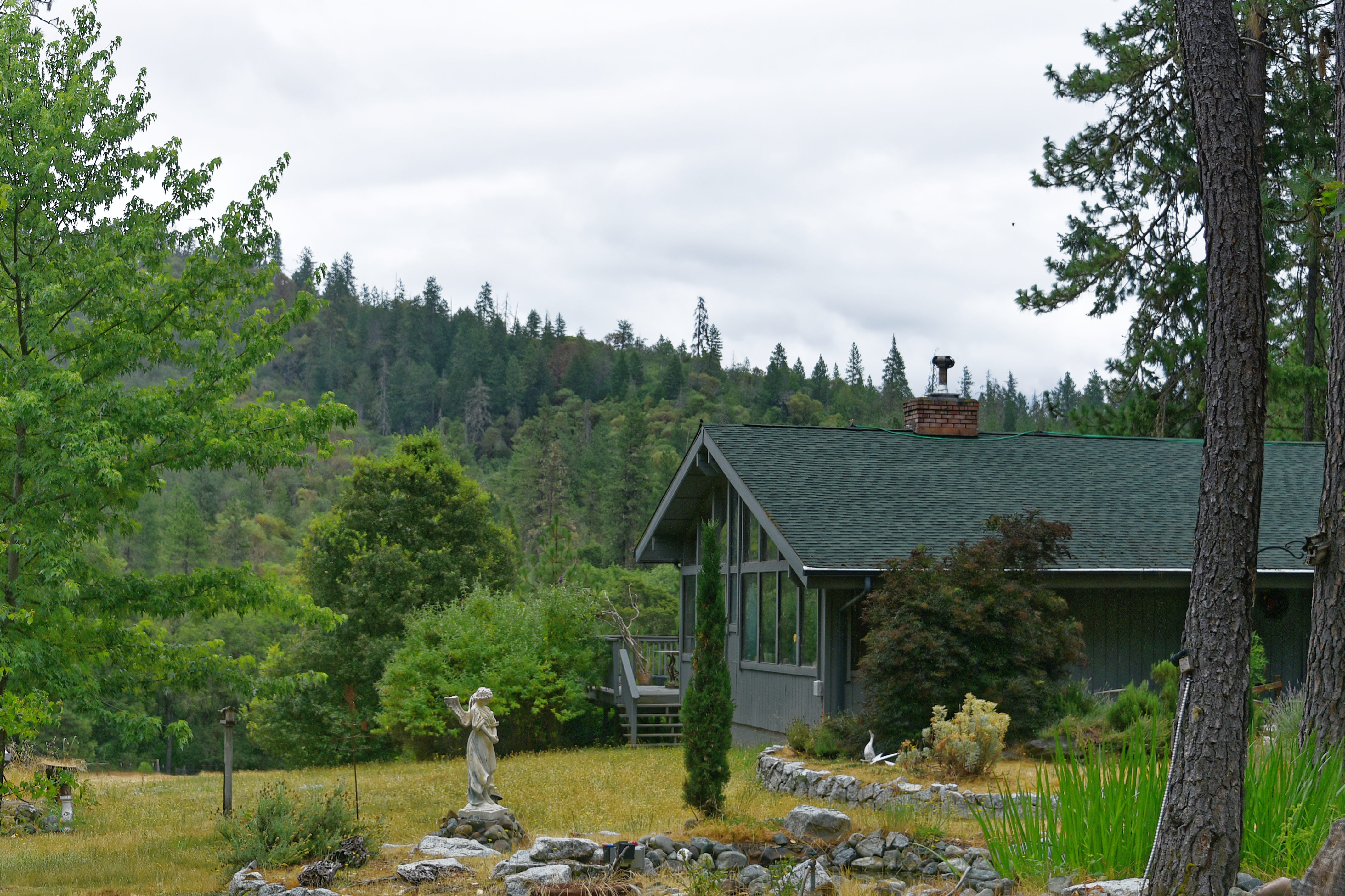
We live (very happily) in a rural part of Southern Oregon. Much of the land close to us is covered in trees. Large parts of our property has trees and bushes. We try and keep the area directly around the home clear, but what with me being over 80 and Jeannie with Parkinson’s, it is a challenging task.
We have had far less snow over the Winter than normal. There is no guarantee the coming Winter will provide the (historically) past levels of snow. We will have to wait and see.
State boundaries can be iconic. Many were drawn by human hands, but some of the most recognizable contours were shaped by nature: the boot of southeastern Louisiana, carved by the Mississippi River, or the ocean waves sculpting the hook of Cape Cod in Massachusetts.
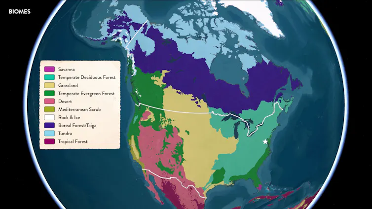
For a moment, imagine that there are no state lines. View the United States through its natural contours. As curators at the Smithsonian’s National Museum of Natural History, we often look at our nation this way, drawing different kinds of maps that trace mountains, watersheds, animal migrations, biomes, ancient seas and so much more.
These kinds of maps show us how connected we all are by nature, since it transcends state boundaries. That idea is central to our new exhibition, “From These Lands: Sharing Our Natural and Cultural Heritage,” now open at our museum to mark the 250th anniversary of the United States. We areco-curators of the show, part of a team of exhibit designers and developers who created the exhibition.
“From These Lands” uses items from the museum’s collections to explore these patterns and ideas, offering a way to see the country’s natural and cultural heritage beyond state lines.
Climate, vegetation and animal life vary across the landscapes of the United States, forming distinct biomes. Smithsonian/Esri/RESOLVE, CC BY-NC
One country, many pine cones
Pine cones can be easy to overlook.
When you’re out for a walk in the woods, you see the forest, maybe even the trees, but not always the cones at your feet. For many people, a pine cone is just a pine cone. But when you look closely, subtle differences in the styles of cones carry clues about the trees that produced them and the places where those trees live.
Pine trees grow across many of these regions, and their cones reflect some of the different environments where pines live. James Di Loreto, Smithsonian, CC BY-NC
There are 43 pine species native to the United States, making up nearly a third of the world’s pine tree diversity. Together, they stretch across surprisingly different combinations of climate, terrain, plants and animals, the regions scientists call biomes. Something as simple as the pine cone can let you hold that concept in your hand: soils, fire, rain, birds and rodents all helped shape the tree that made it.
For example, cones from the sand pine can shield seeds for years, only to release them as the heat from low-intensity fires melts their resin and opens their scales. These scrubby and fire-shaped landscapes are one part of the larger temperate evergreen forests that spread through the southeastern U.S.
On the other side of the country, the Coulter pine produces cones that can be more than a foot-and-half long (50 centimeters) and weigh up to 8 pounds (3.5 kilograms). This large cone size helps its seeds to survive fires, allowing small birds and mammals to then disperse them into new areas in the Mediterranean Scrub of Southern California.
A pine cone comes from one tree in one place, but its form reflects a wide set of environmental conditions. Pine cones provide an interesting way to view the different biomes found in the United States and its territories.
Geologic age maps can reveal ancient landscapes hidden beneath modern ones. Smithsonian/Esri/USGS/GSA, CC BY-NC
An ancient ocean in the middle of the country
The land under your feet can be millions of years old, and it has not always been dry ground.
During the late Mesozoic Era – the time interval made famous by the dinosaurs – a warm, shallow inland sea covered states from North Dakota to Texas. This Western Interior Seaway laid down many of the rocks and sediments that you can see today throughout the Great Plains and Badlands. The sea was also full of life, and the rocks it left behind are full of fossils.
These ammonite fossils from South Dakota come from an ancient, shallow sea that once covered much of the middle of North America. Phillip R. Lee, Smithsonian, CC BY-NC
There were familiar characters living on this ancient seafloor: clams, snails and sea stars. But swimming in the waters above were the now-extinct animals called ammonites.
These coiled, shelled relatives of squid and octopuses were abundant predators, hunting in the same waters as fish, turtles, sharks and extinct marine reptiles called plesiosaurs. Ammonites used the chambers in their shells to control buoyancy, much like the modern nautilus.
Ammonite fossils demonstrate that much of the central U.S. was an ancient ocean. They also remind us that the landscapes we know today are just the latest version of those reshaped over and over by the slow work of geologic time.
Thousands of animals trace migration routes across the United States. Smithsonian/Esri/Movebank Data Repository, CC BY-NC
Unlikely pairing: Shorebirds and horseshoe crabs
Animals move. Some travel only short distances with the seasons, but others travel thousands of miles, crossing not only state lines, but countries, oceans and hemispheres. Animal migration routes might look chaotic on a map, but birds, whales, turtles and more forge these paths for specific reasons.
Timing is a key component of migration. Thanks to a critical refueling stop in Delaware Bay, the ruddy turnstone shorebird manages to migrate thousands of miles each year to its breeding grounds in the high Arctic. These East Coast migrants time their layover with the migration of horseshoe crabs, which come ashore to lay millions of nutrient-packed eggs on beaches. The turnstones gorge themselves on those eggs before continuing their journey north.
It is a strange and wonderful handoff between an ancient marine animal hauling itself out of the ocean and a weary shorebird bound for the Arctic. A single bay brings them together, illustrating how the many migration routes through these lands can hinge on key moments and places.
The topography of North America ranges from broad coastal plains to rugged mountain systems. The ridges, valleys, streams and caves of the Appalachian Mountains create small pockets of habitat for many different plants and animals. Smithsonian/Esri/CEC/USGS, CC BY-NC
Salamander country
Topography is more than scenic landscapes. Everything from the flat coastal plains to the ridges, valleys and stream-cut mountainsides helps shape where animals can live and how biodiversity accumulates.
The rugged terrain of the Appalachian Mountains creates cool, wet forests, shaded hollows, caves, ponds and streams. These habitats can differ from each other in elevation, temperature, moisture and water flow – and salamanders take note. More salamander species live in the Appalachian Mountains than anywhere else in the world. It can feel as though every other rock you turn over hides yet another species.
A cave salamander from the Appalachian Mountains in Georgia. James Di Loreto, Smithsonian, CC BY-NC
The trio of Plethodon salamanders, the southern gray-cheeked, red-cheeked and red-legged salamanders, were once thought to be regional variations of the same species. But these salamanders live at varying elevations in different mountain ranges, and genetic sequencing confirmed that each was, in fact, its own species. Topography and shifting climates had broken up these populations into different habitats, allowing each to evolve into distinct species.
North America’s watersheds cross state and national boundaries, linking distant rivers and landscapes through the flow of water. Smithsonian/Esri/CEC, CC BY-NC
Following the American shad
Chesapeake Bay is the largest estuary in the U.S., fed by a watershed connecting rivers and drainage basins that reach into six states and the District of Columbia. It’s home to more than 3,600 species, including oysters and blue crabs. But one fish in particular has become strongly intertwined with the lives and cultures of many people around the bay.
American shad move between the Atlantic Ocean and the freshwater rivers of the Chesapeake Bay watershed, a migration long tied to the Pamunkey Indian Tribe’s diet, culture and stewardship of nature. James Di Loreto & Tonda Phalen, Smithsonian, CC BY-NC
The American shad spends much of its adult life in the Atlantic Ocean but returns to the freshwater rivers in the upper reaches of the Chesapeake Bay to spawn. For more than 12,000 years, this herring’s spring migration has been part of Pamunkey Indian Tribe diet and culture.
From 1918 to 2019, to mitigate declining populations of herring, the tribe ran a hatchery to “give back to the river.” The Pamunkey Tribe’s fishing rights date back to their 1677 treaty with the British Crown. Today, only the Pamunkey and citizens of other tribes in Virginia can legally fish for shad in this region.
A single type of fish moving between salt and freshwater, tracing the paths of the watershed, has helped to shape centuries of diet, law, culture and stewardship, highlighting the many connections between nature and culture.
Different ways to map the country
Pine cones, ammonites, shorebirds, salamanders and shad tell more than individual stories about particular places. Together, they point to older and larger patterns: varied forests, vanished seas, seasonal migrations, mountain habitats and rivers that harbor a fantastic diversity of life.
State lines are one way to picture the U.S., but natural history provides another – one that shows the ancient and living connections running across the landscape.
The Emperor’s New Mind: Concerning Computers, Minds and The Laws of Physics
Book by Roger Penrose
Here is a summary of the book that is first, a very deep read, and, second, full of detailed mathematics that were beyond me. I just skipped those parts. However, it is an incredible book and one that has extended my knowledge in so many ways. I think that it isn’t going too far to say that it has amended my knowledge tremendously and I am so glad to have read it, even at the age of 81.
The Emperor’s New Mind (1989) by Roger Penrose argues that human consciousness involves non-computable processes, meaning a computer can never fully replicate the human mind, even if it can simulate its functions. Penrose uses Gödel’s incompleteness theorems and quantum mechanics to support his view, suggesting that consciousness arises from physical processes in the brain that are not algorithmic, and that a deeper understanding of physics, possibly involving quantum gravity, is needed to explain the mind. The book explores the “mind-body problem” and challenges the idea that all thinking is computation, proposing that human understanding can grasp truths that formal systems cannot.
Key arguments and concepts
Gödel’s Incompleteness Theorems: Penrose argues that human mathematicians can see the truth of certain mathematical statements that a formal system (like a computer program) cannot prove, demonstrating a non-computable aspect of human thought.
Non-computability: He posits that certain mental activities, like mathematical insight, are inherently non-algorithmic and cannot be simulated by a computer, even a powerful one.
Quantum mechanics and consciousness: Penrose suggests that consciousness is linked to quantum mechanical processes in the brain, specifically involving microtubules, a theory he later developed further in Shadows of the Mind.
Critique of Strong AI: The book challenges the “strong AI” hypothesis that a sufficiently complex computer can achieve genuine consciousness, arguing that it misunderstands the nature of human understanding.
Reception and legacy
The book won the 1990 Science Book Prize.
It sparked debate and collaboration, notably with Stuart Hameroff, leading to the “orchestrated objective reduction” (Orch OR) theory of consciousness.
It remains a significant work in the philosophy of mind, artificial intelligence, and the physics of consciousness, influencing discussions on the limits of computation and the nature of the mind.