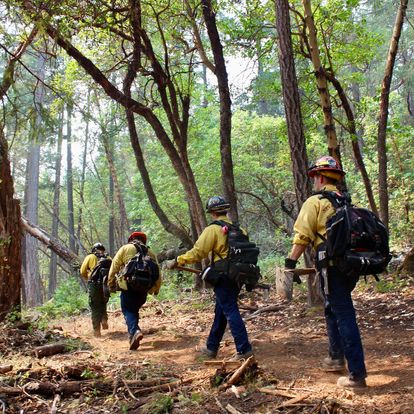
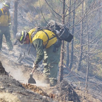
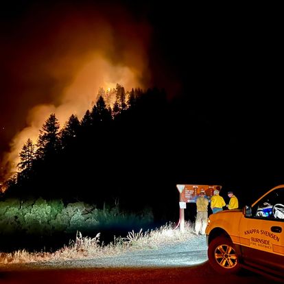
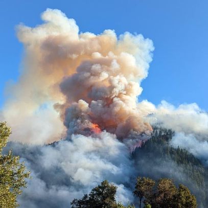
Photos of Rum Creek Fire!
Not all that are available by any means! These were copied from the Facebook page.
oooo
oooo

oooo

oooo

oooo
oooo
oooo

oooo
Well done all those actively involved. We will see what the next week brings.
Dogs are animals of integrity. We have much to learn from them.
Tag: Rum Creek Fire
Photos of Rum Creek Fire!
Not all that are available by any means! These were copied from the Facebook page.
oooo
oooo
oooo
oooo
oooo
oooo
oooo
oooo
Well done all those actively involved. We will see what the next week brings.
Just a brief update!

We have had gentle winds for Tuesday and Wednesday and there is good progress on the curtailment. So long as we don’t get more winds in the next 24 hours (writing this yesterday morning) then the firefighters will be able to keep up the good work.
The smoke has been bad and the whole area of Merlin and Grants Pass is affected.
But hopefully conditions will improve later on Thursday and more so on Friday.
The fire update, released around 10am yesterday, says:
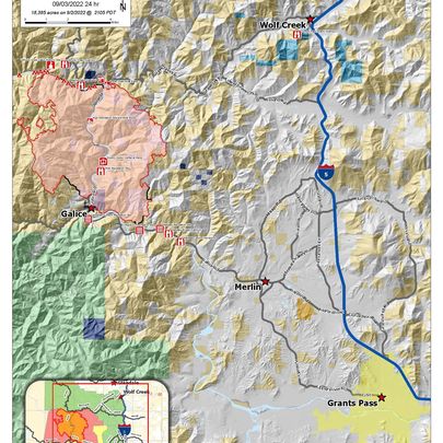
MERLIN, Ore. – Overnight, the Rum Creek Fire pushed across the line on the east side of the fire near McKnabe Creek, burning several hundred acres. Resources are being shifted to this area to corral the slop-over and establish new control lines. An increase in fire activity is expected through Friday as the weather shifts to a hotter, drier pattern. Inversions are expected to lift earlier in the day, increasing temperatures and winds while reducing relative humidity.
As of early this morning, the fire was already burning actively on the ridges. Firefighters are expecting potential spot fires, and have shifted resources to continue alternate contingency fire lines to the east.
Last night firefighters successfully conducted burnouts on the south edge of the fire near Taylor Creek, eliminating remaining fuels between the control lines and the fire’s edge. Today, they will work to secure the southeast corner of the fire working toward the north. Hose lays and pumps have been set up along many control lines, including those constructed near Stratton Creek.
On the west edge of the fire, burnout operations near Mount Peavine and the 34 road have secured more of the western edge, and crews built line from Taylor Gulch toward Chrome Ridge. Today, fire personnel will tie the line from Chrome Ridge north to Bear Gulch, and are working near Ridge Gulch. North of the Rogue River, the line tying to the Dad Creek Fire scar is expected to be completed today.
Firefighters working with the OSFM are assisting with active fire suppression as needed. They are also extinguishing all remanent heat spots found within 100 feet of buildings, and continuing to assess structures. Also they are making preparations to include clearing brush and installing sprinklers, to further develop structure protection.
It is starting to look as though an evacuation for us at Hugo Road is more and more unlikely.
There is no post for today!
Although I admit that having this come out at the usual time for a Tuesday rather flies in the face of that sub-heading!
But on Sunday evening Merlin was placed in the first zone of the evacuation instructions. This follows the rapidly expanding Rum Creek Fire that is just West of us. Depending on what defines as the actual location of the fire we are anything from 5 to 9 miles away. Our home is on Hugo Road, Merlin.
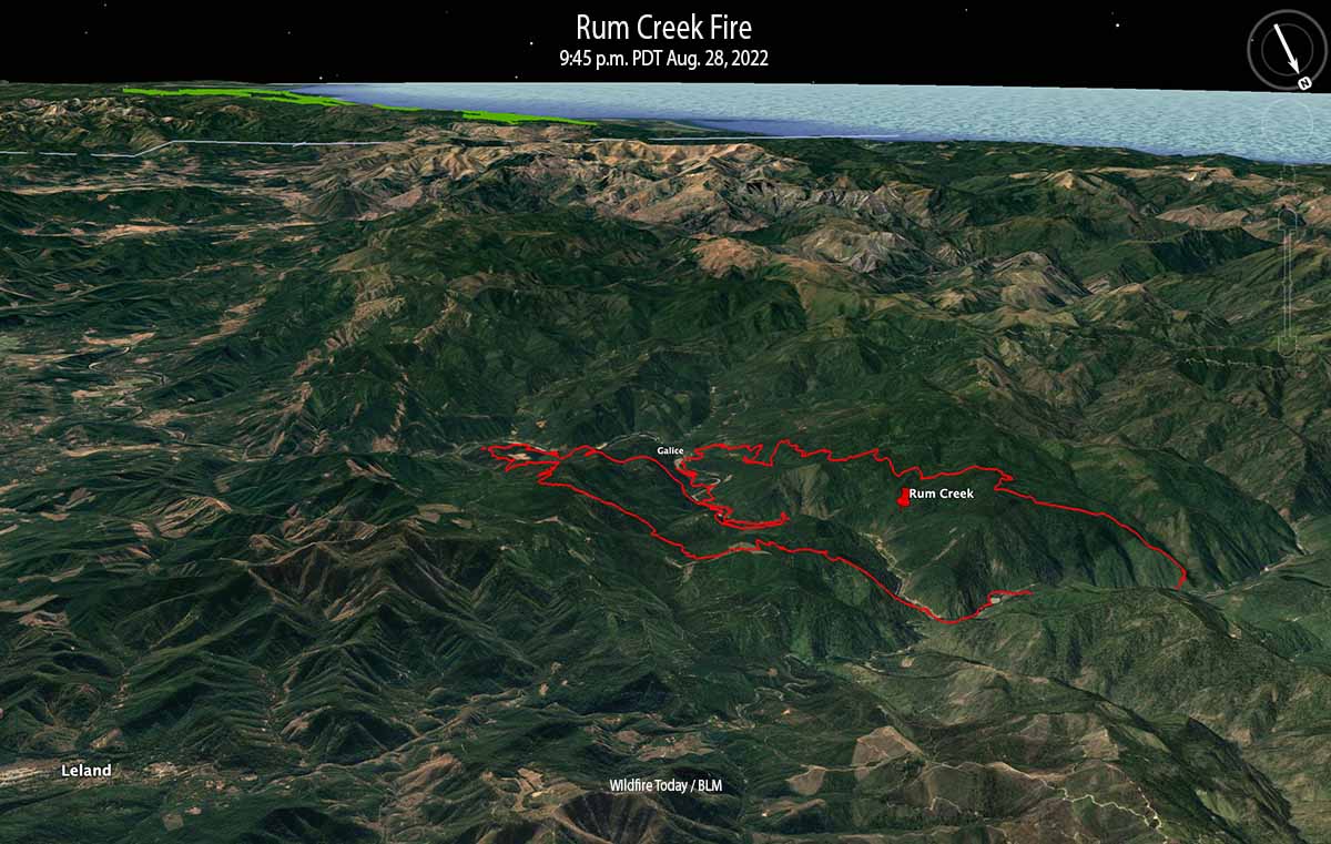
The Rum Creek Fire 14 miles northwest of Grants Pass, Oregon has grown to 10,709 acres since it started from lightning on August 17. The fire is burning in very steep, remote, rugged terrain on both sides of the Rogue River. It has spread upriver to Galice and east to Stratton Creek. Spot fires have occurred two miles down range.
(Copied from Wildfire Today.)
So there you are!
