A few days ago there was a conversation on the photography forum Ugly Hedgehog about the camera opening one’s eyes. It struck a note in me and Jeannie and I went out in the early morning, taking the camera, to shoot photographs of the Hellgate Canyon.
It is not the first time we have been there but it is the first time I have gone with my eyes wide open!
But first some history of the Rogue River. And thanks to WikiPedia for the following.
The Rogue River in southwestern Oregon in the United States flows about 215 miles (346 km) in a generally westward direction from the Cascade Range to the Pacific Ocean. Known for its salmon runs, whitewaterrafting, and rugged scenery, it was one of the original eight rivers named in the Wild and Scenic Rivers Act of 1968. Beginning near Crater Lake, which occupies the caldera left by the explosive volcanic eruption and collapse of Mount Mazama, the river flows through the geologically young High Cascades and the older Western Cascades, another volcanic province. Further west, the river passes through multiple exotic terranes of the more ancient Klamath Mountains. In the Kalmiopsis Wilderness section of the Rogue basin are some of the world’s best examples of rocks that form the Earth’s mantle.
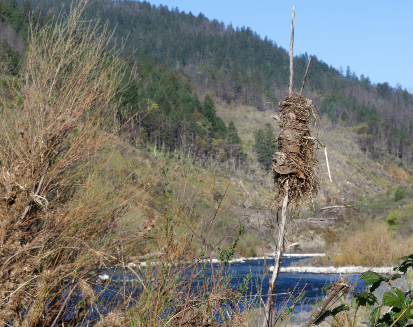
Hellgate Canyon is just 8 miles from where we live on Hugo Road. But just before Hellgate is the Hog Creek parking area. We stopped there and then went down to the landing stage on the edge of the Rogue River. I took some photographs.
Looking downstream.
Sign of a previous high water.Just a close-up of a rock.The level of the river seems pretty low.
Then we motored the short distance further on to the view point above the canyon. Took more photographs.
A faint reflection of the rocks and trees on the bank behind the river.
Then onto the viewing spot just before the bridge.
I am going to pause this now and continue it on Sunday.
Last Friday, the 26th, the area where we live in Oregon, that is Merlin just to the North-West of Grants Pass, Oregon, experienced a significant thunder and lightning storm. The challenge was that the storm had very little associated rain and, as a consequence, a number of fires were started in the tinder-dry forest.
We were not really aware of these fires over the week-end.
Then on Monday morning, our microwave internet linked failed. I went next door to our neighbours (thanks Dordie and Bill) and borrowed their PC to post a Loss of Service notice around 2pm on that Monday. That’s also when I heard that one of the fires, named the Brimstone Fire, had started less than a couple of miles away from where we live – h’m-mm!
The edge of the smoke cover.
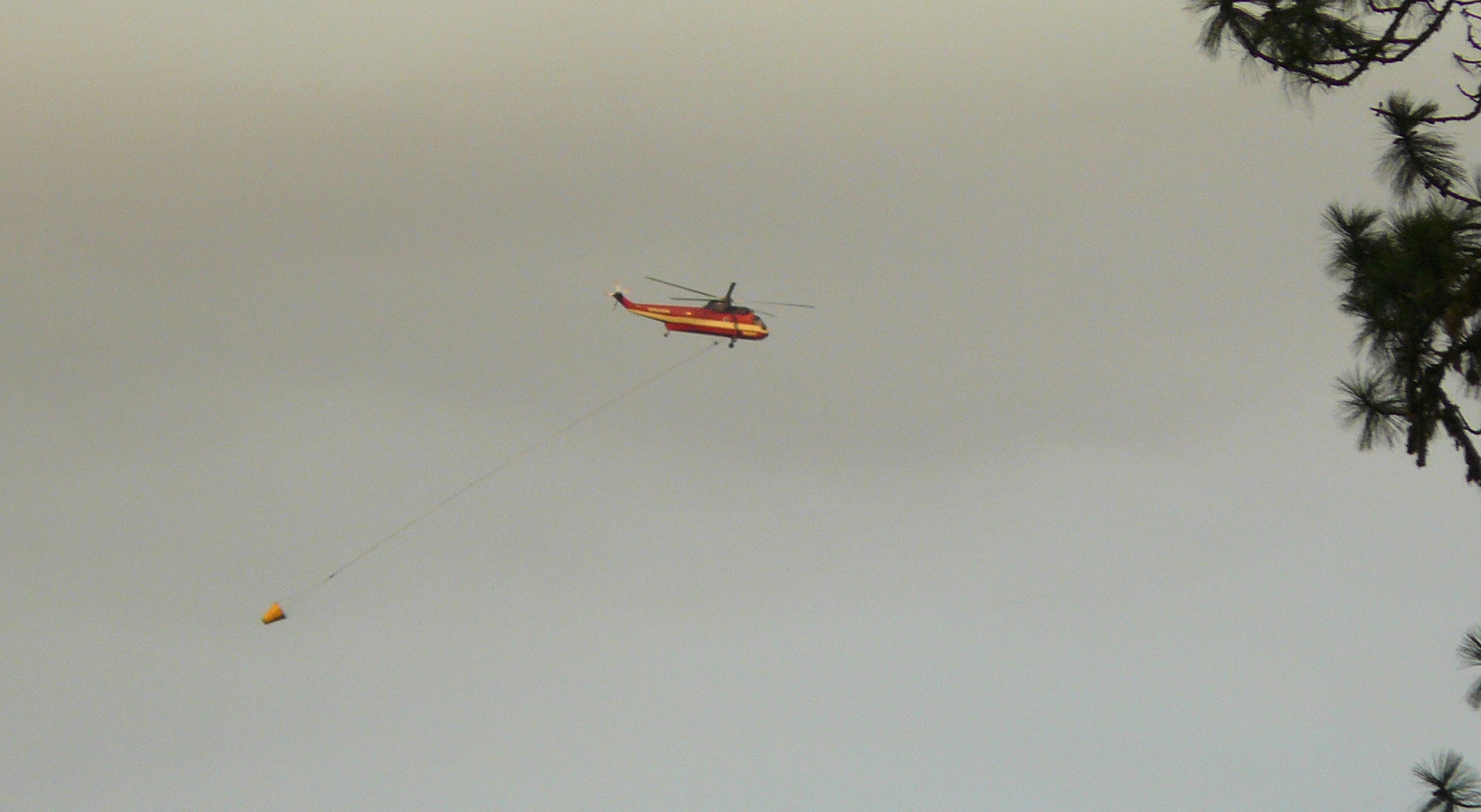
Later on that evening, the first of a great number of helicopter fire dousing flights flew by overhead.
Returning to refill at Grants Pass Airport.
The wind was creating some interesting cloud waves in the smoke cover.
Wave cloud – in the smoke cover.
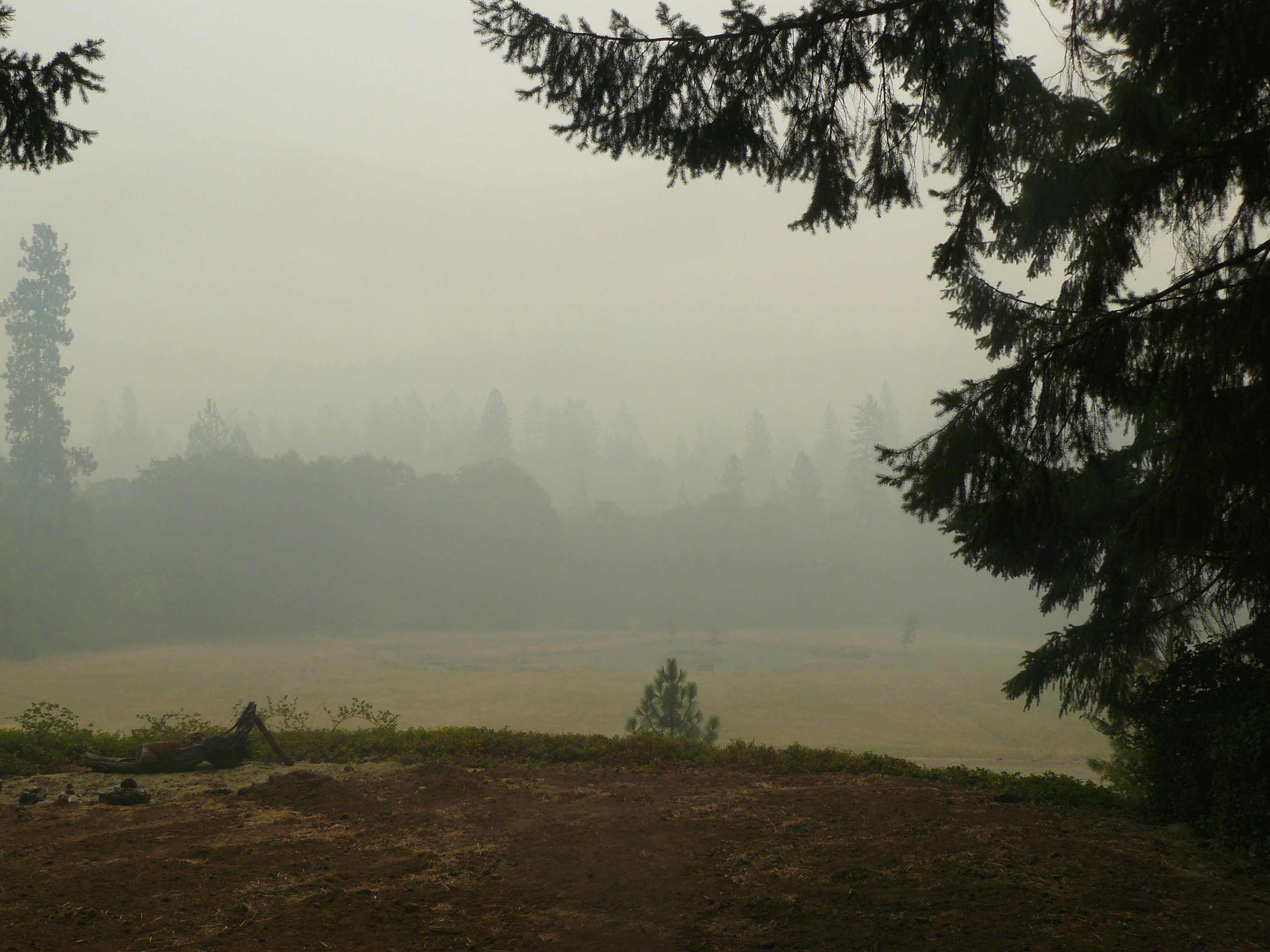
Then as each day passed the air became more and more smoke filled. Reliable reports had said that the smoke cover had expanded to Northern California.
Here’s a picture taken yesterday morning of the ground that drops away from the house!
About a quarter-mile visibility, frequently worse!
But at least our internet service has been restored enabling me for the first time to access the Fire Incident website, from which I read at 4:40 pm yesterday, the following.
Incident Overview
The 1,600-acre Brimstone Fire, located 5 miles west of Sunny Valley, made no significant movement late Tuesday or overnight. Crews coming in from night shift said planned fireline improvement on the north and southeast corners was completed, and burnouts in those same areas were successful. Nearly 800 people are assigned to the Brimstone Fire’s suppression effort. Specifically, 29 crews, 26 wildland fire engines, seven bulldozers and nine water tenders are divided between the day and night shifts. The weather has been calm and this has helped reduce fire activity. However, the heavy smoke layer has made it impossible to use helicopters on the fire.No evacuations have been announced for residential areas around the fire area, but structural fire protection personnel have assessed homes should an evacuation become necessary. To find out more about evacuation planning, call the Josephine County Emergency Operations Center (EOC) at (541) 474-5305.Firefighters ask that the public not use roads in the Upper Quartz Creek Rd and Hogs Creek Rd areas because these roads are narrow and are being heavily used by fire engines, trucks hauling water, and bulldozers.
Basic Information Incident Type: Wildfire Cause: Lightning Date of Origin: Monday July 29th, 2013 approx. 02:00 AM Location: 10 miles northwest of Merlin, OR Incident Commander: Chris Cline Current Situation Total Personnel: 773 Size: 1,600 acres Percent Contained: 10% Fuels Involved: Mixed conifer and hardwood trees of widely varied ages, snags (dead, standing trees), brush and logging slash. Fire Behavior: Torching and short-range spotting. The fire is difficult to see due to smoky conditions. Significant Events: Three roads are closed because fire engines and other equipment are using the roads. The closed roads are Hog Creek, Quartz Creek and Angora Creek. Outlook Planned Actions: Improve the fire line and strategically burn out unburned areas inside the fire line. Growth Potential: High Terrain Difficulty: High Current Weather Wind Conditions 10 mph NW Temperature 85 degrees Humidity 31%
Well at least I can settle down and work my way through 130+ emails!!