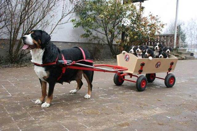
More wonderful pictures courtesy of Su.
Last week’s set of pictures from Su are here.
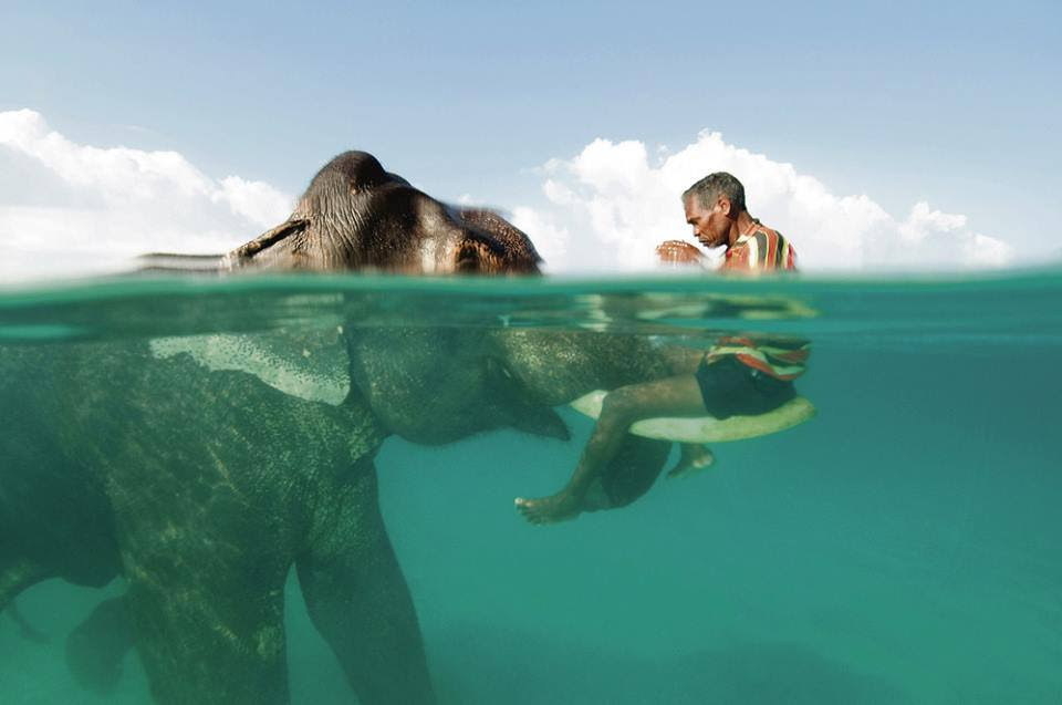
oooo
oooo

oooo

oooo

oooo
oooo
oooo

oooo
Final set of eight photographs from Su next Sunday.
All of you have a safe and happy week out there!
Dogs are animals of integrity. We have much to learn from them.
Category: Photography
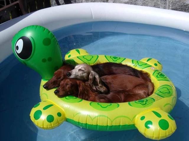
More wonderful pictures courtesy of Su.
Last week’s set of pictures from Su are here.
oooo
oooo
oooo
oooo
oooo
oooo
oooo
oooo
Final set of eight photographs from Su next Sunday.
All of you have a safe and happy week out there!
Now this is what I call making sand-castles!
Apologies to the person that sent me the link to: PHOTOS OF WORLD-CLASS SAND SCULPTORS AT WORK! Their name has slipped my mind.
The event was the 2014 US Sand Sculpting Challenge and 3D Art Exposition held recently in San Diego, California.
In any case, I wasn’t going to reblog the whole article because it’s much, much better if you go and read about the talented artists directly. Artists who produced this:

and this:

not overlooking this:
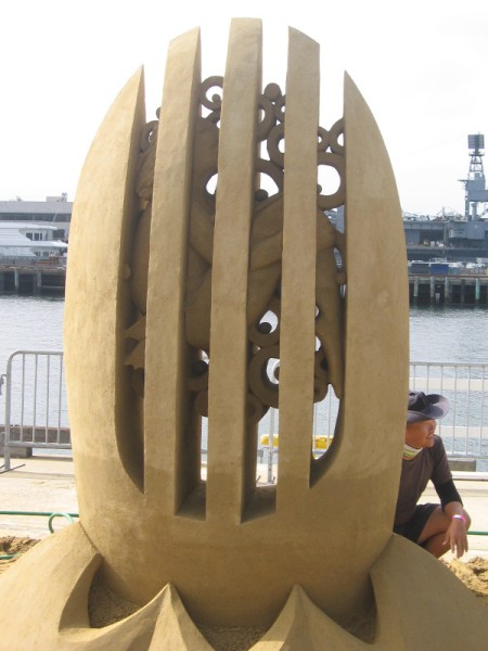
or this:
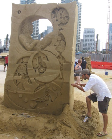
No, you absolutely have to drop into this place and read about these most talented artists.
Now how far is it to the nearest beach? …..
Must start practising …. wonder how long it would take me to build this:

Who would have believed it!
Way back in July 2012, I posted the following item.
oooo
Dear Readers of Learning from Dogs.
Today, Jeannie and I are off on a trip to Oregon.

We expect to be away for about the next 10 or 11 days.
While there are a number of new posts that will come out during this period, rather than have quiet days with nothing being posted, some days I will be republishing posts from the last three years; hopefully most of them new to your eyes.
Inevitably, responding promptly to comments will be tough.
Which is why I am so grateful to Martin Lack of Lack of Environment who graciously agreed to keep an eye on things while we are away.

oooo
That was twenty-six months ago.
Yesterday morning, Jean and I took Reggie and Chris down to our creek area to feed some wild deer that have been congregating in recent days.

After Jean had sprinkled some cracked corn on the ground, one of the seven deer around us started feeding and when it looked up at me, I took the following picture.

Can’t ever imagine living anywhere else now.
Funny how life runs!
Huge thanks to Suzann for sending these on.
You all have a great day!
oooo

oooo

oooo

oooo

oooo
oooo

Aren’t they wonderful!
More from Su next Sunday.
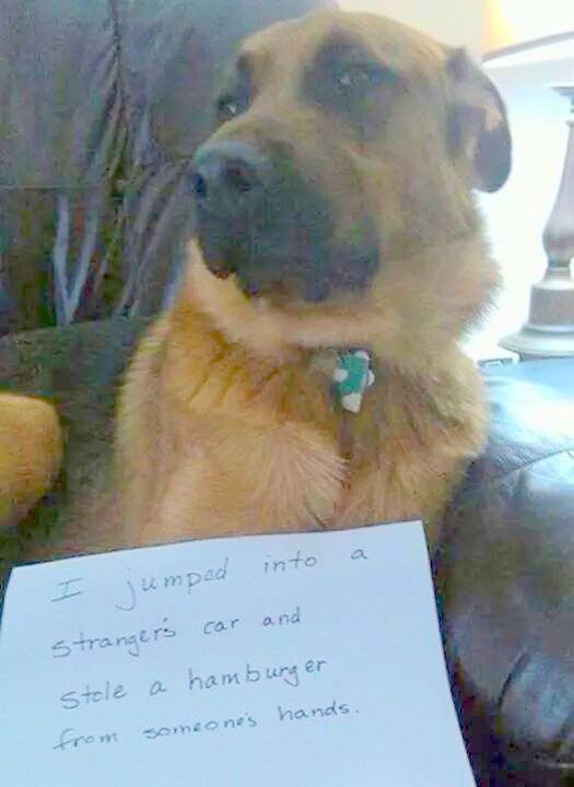
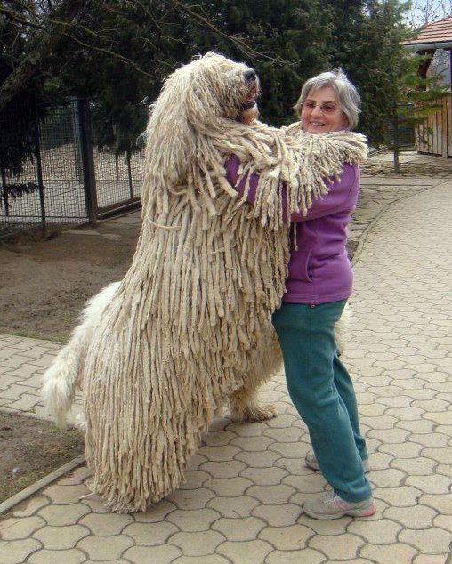
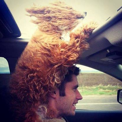
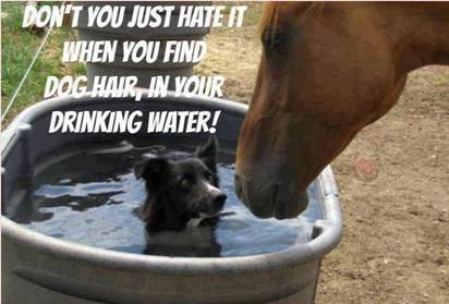
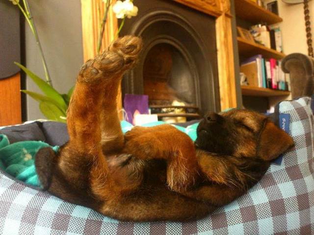
More naughtiness courtesy of Chris Snuggs.

oooo

oooo

oooo

oooo

oooo

oooo
oooo
Difficult to pick out a favourite but the dog that poops rainbows is a close front-runner for me.
How about you?
Sorry, couldn’t resist this.
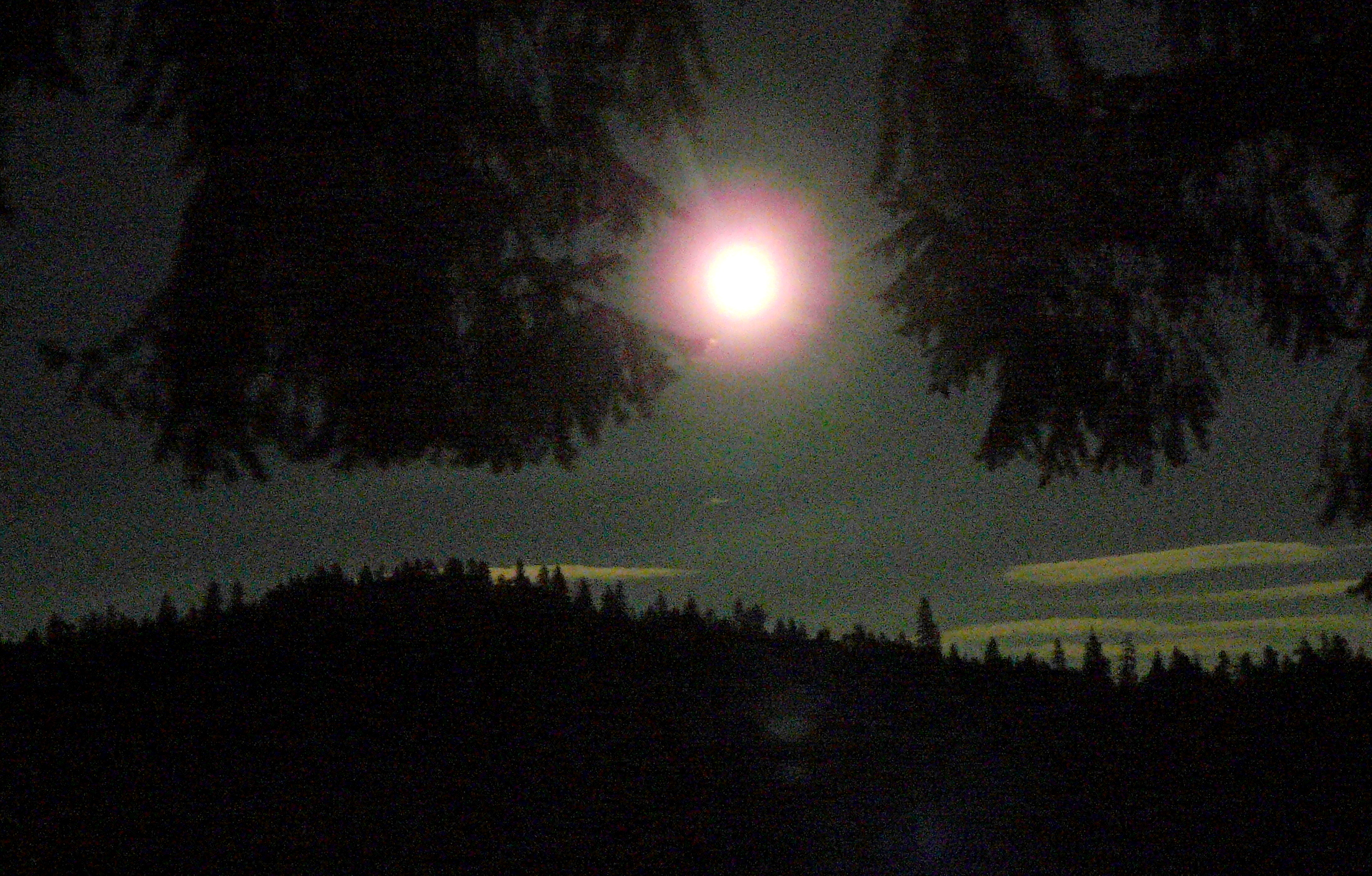
The following photograph was taken around 9pm (PDT) on the evening of the 8th September; i.e. Monday evening.
The image has been tweaked to display the picture more clearly but, nonetheless, shows the most beautiful Harvest Moon. The camera was pointing to the East; I was standing on the deck at the back of our house.
Anything to do with dogs?
You bet! There’s this ….

oooo
and this:
Uploaded on Nov 9, 2010
During Bob and Jan Shaw’s Annual fall training session outside of Newberry, MI in the beautiful Upper Peninsula, I had the opportunity to record over 100 huskies howling at a full moon.
“We all shine on…like the moon and the stars and the sun…we all shine on…come on and on and on…” John Lennon.
As topic changes go, this takes some beating!
I am referring, of course, to the contrast to yesterday’s post title: Wisdom, nature and philosophy.
The drought that this part of Oregon has been experiencing has had one obvious effect: the availability of good hay is rapidly diminishing. With four horses to feed and our own pasture just about eaten out, we need a few more tons before the rains arrive around the end of the year: fingers crossed! We have been frantically trying to find some.
What, you may ask, has this to do with Learning from Dogs? Only that by the time I sat down yesterday to write today’s post, I was squeezed in terms of writing a longer post, and had less than an hour to spare before driving up to Glendale to look at some second-cutting hay for sale.
Then a recent email from a long-term friend in Australia saved the day. It was from Amanda Smith and is reproduced just as she sent it to me; that in turn had been sent to Amanda from a friend of hers. It’s a delightful tale.
ooOOoo
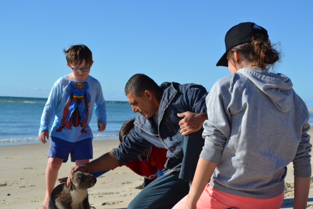
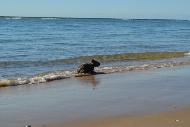
This occurred on a walk along Flinders Beach on North Stradbroke Island in Queensland a couple of days ago.
The Koalas seem fairly tame over here. We passed two sitting in she-oak trees each about two metres off the ground. They were not spooked at all by the attention we gave them.
Then, about half way along the beach, we saw this young fellow actually running up and down the beach and playing around the kids like a puppy.

oooo

oooo
oooo
After the koala allowed itself to be stroked and petted by us humans, it decided to go for a swim!

oooo
oooo
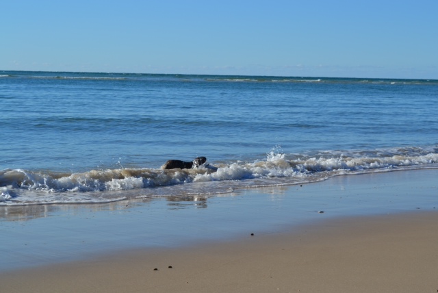
Then the little chap went about twenty metres into the sea, swam around for a good half-hour fascinating onlookers, before coming back to the beach.
oooo

oooo
The little chap then took a while to recover from his swim.
We have never heard of or seen this behaviour before: a koala who likes to “play” with humans, and swim in the ocean.
Unbelievable stuff, something we will always remember.
(Credit Allan Duncan)
ooOOoo
Makes finding hay for horses seem mundane! 🙂
It’s good to be naughty from time to time!
(Thanks to Chris Snuggs for the following.)

oooo

oooo

oooo

oooo

oooo

oooo
Wonderful. More from Chris in a week’s time.
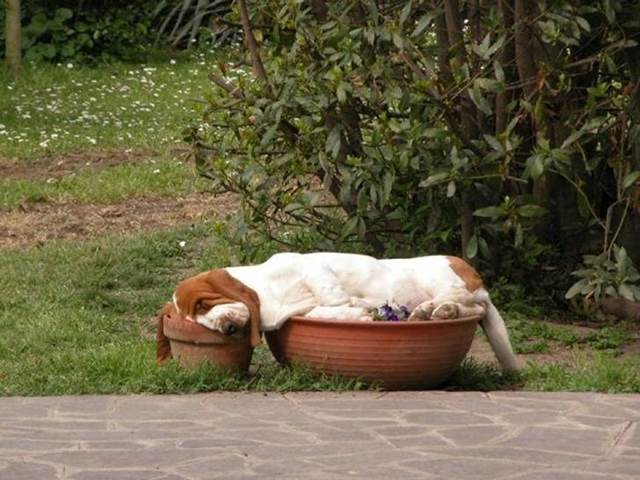
More of those glorious pictures from Sue via John Hurlburt.
If you missed the first set, then they may be found here.
oooo

oooo

oooo

oooo
oooo

oooo

oooo
oooo
Yet more next Sunday. You good people out there have a happy and stress-free week.
Keeping up a smiling weekend.
John Hurlburt sent me some wonderful pictures that had, in turn, been sent to him by Sue S.
Pictures to make you smile!
oooo
 oooo
oooo
 oooo
oooo
oooo

oooo
oooo

oooo

oooo
Gorgeous pictures. More great ones next week.
