Tag: Medford NWS

Picture Parade One Hundred and Seventy-Eight

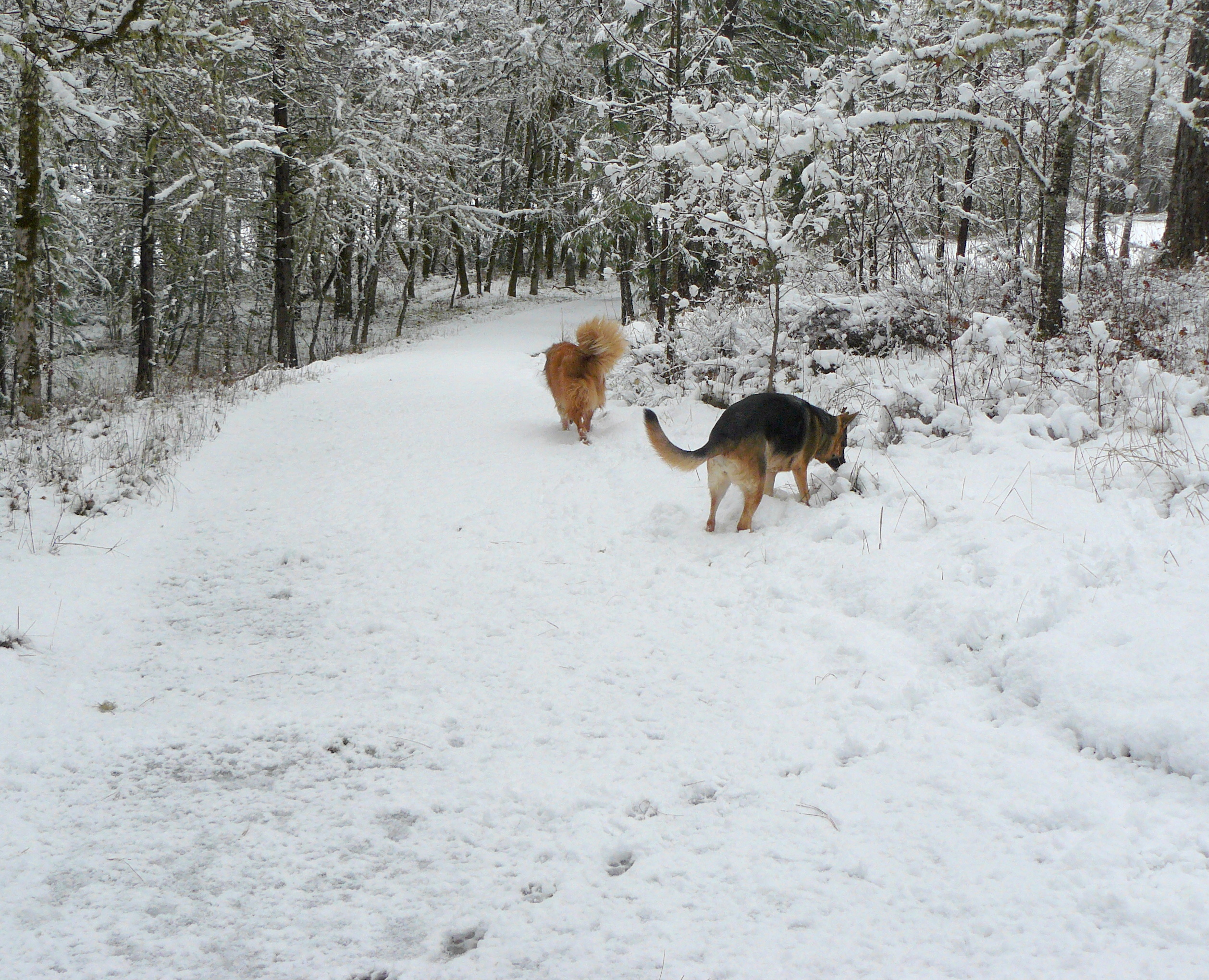
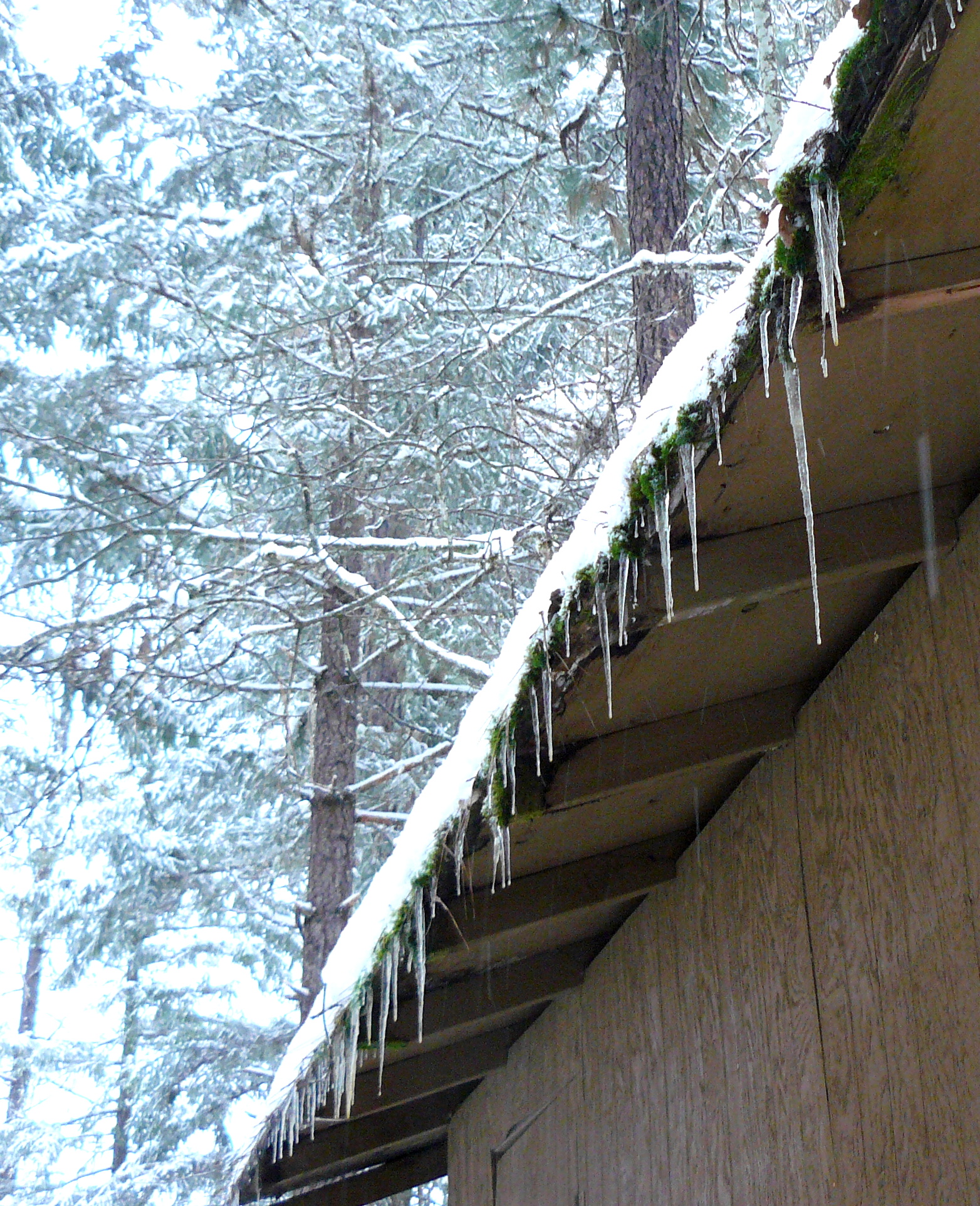
Scenes of the last week!

p1160824oooo

p1160825
Brandy and Cleo enjoying things!

oooo

p1160835oooo

Sexton Mountain is somewhere back there.

oooo

Ah! There it is!
Ah! There it is!

oooo

p1160850oooo

Smaller creatures taking a break!
Larger creatures taking a break!

See what the coming week has in store! (Oh, we live in Josephine County!)

FLOOD WATCH
NATIONAL WEATHER SERVICE MEDFORD OR
151 PM PST SAT JAN 7 2017

...HEAVY RAIN WILL COMBINE WITH MELTING SNOW TO CAUSE POSSIBLE
LOCAL FLOODING LATE TONIGHT THROUGH SUNDAY...

.ANOTHER FRONT MOVES INTO THE REGION LATE TONIGHT WITH MODERATE
TO HEAVY RAINFALL RATES. SNOW LEVELS WILL RISE WELL ABOVE THE
VALLEY FLOORS AND WILL COMBINE WITH SNOW MELT TO INCREASE RUN-OFF
THROUGH THE DAY SUNDAY AND INTO SUNDAY NIGHT.
...FLOOD WATCH NOW IN EFFECT FROM LATE TONIGHT THROUGH SUNDAY
EVENING...

THE FLOOD WATCH IS NOW IN EFFECT FOR

* PORTIONS OF THE COOS AND CURRY COUNTY COASTS...EASTERN CURRY
  AND JOSEPHINE COUNTY IN OREGON...AND WESTERN SISKIYOU COUNTY IN
  NORTHERN CALIFORNIA.

* FROM LATE TONIGHT THROUGH SUNDAY EVENING.

* 1 TO 3 INCHES OF RAIN...WITH HIGHEST AMOUNTS NEAR THE COAST AND
  LOWEST NEAR GRANTS PASS...ARE EXPECTED ON SUNDAY. THIS MODERATE
  TO HEAVY RAIN COMBINED WITH SNOW MELT MAY CAUSE URBAN AND SMALL
  STREAM FLOODING. CURRY AND JOSEPHINE COUNTIES ARE THE PRIMARY
  AREAS OF CONCERN...HOWEVER...PORTIONS OF WESTERN SISKIYOU COUNTY
  MAY SEE LOCALIZED FLOODING AS WELL.

* RECENT BROKEN BRANCHES AND OTHER DEBRIS FROM THE HEAVY SNOW
  COMBINED WITH ICE MAY CLOG STORM DRAINS AND CULVERTS IN THE
  WATCH AREA. HEAVY RAIN MAY ALSO CAUSE SLIDES OR DEBRIS FLOWS ON
  THE GAP WILDFIRE BURN SCAR NEAR HORSE CREEK...POSSIBLY REACHING
  HIGHWAY 96 BELOW THE BURN SCAR.

PRECAUTIONARY/PREPAREDNESS ACTIONS...

LANDSLIDES AND DEBRIS FLOWS ARE POSSIBLE DURING THIS FLOOD EVENT.
PEOPLE...STRUCTURES AND ROADS LOCATED BELOW STEEP SLOPES...IN
CANYONS AND NEAR THE MOUTHS OF CANYONS MAY BE A SERIOUS RISK FROM
RAPIDLY MOVING LANDSLIDES. A FLOOD WATCH MEANS THERE IS A
POTENTIAL FOR FLOODING BASED ON CURRENT FORECASTS.

Well at least it isn’t boring!

Service restored! :-)

Dear people,

A little over an hour-and-a-half ago, at 1pm PST, the power was restored.

The first task was to see if the water pipes coming from the well had been frozen last night because the outside temperature went down to -8 C./18 deg F. Luckily they had not. However tonight they are forecast to drop to -10 C./14 F. So before coming in to see if the internet was restored the number one task was to run a power cord to the well house and leave a 25 watt old-fashioned lamp down near the water pipes.

Ten minutes ago I turned on my AppleMac and, hey presto, we are connected to that big, virtual world.

Then a quick download of my Gmail to discover that I have 17,262 unread emails awaiting me! (Sorry, I was just showing off. There’s no way that I am that popular!!)

However, the last three digits are correct: there are 262 unread emails.

So I trust you will understand why there will not be a ‘proper’ post at midnight PST, as per normal, but hopefully if everything holds up (including yours truly) then blogging should be back to the regular daily pattern come next Saturday.

Oh, by the way, the forecast for this weekend includes a risk of flooding. Medford National Weather Service have published a hydrological warning.

HYDROLOGIC OUTLOOK
NATIONAL WEATHER SERVICE MEDFORD, OR
333 AM PST THU JAN 5 2017

...Flood Potential Outlook for quick rises and possible flooding
due to heavy rain and snow melt on creeks, streams, and rivers in
the following counties in California...Modoc...Siskiyou and in
Oregon...Coos...Curry...Douglas...Jackson...Josephine...

.A series of frontal systems will move through the area this weekend
through next week. The combination of recent heavy snowfall, rising
snow levels, and periods of heavy rainfall will lead to run-off
concerns beginning Sunday and continuing through early next week.

An initial round of heavy rainfall this weekend will saturate low
elevation snow pack leading to increased run-off. A second round of
heavy rain Tuesday through Thursday will lead to another period of
substantial run-off next week.

Lost for words!