As many of you know I flew during my years when I was based in England. I flew as a hobby. Very quickly I realised that looking at the ground from a few thousand feet up gave one a unique view of the landscape.
ooOOoo
50 Years of Flying for Heritage
Damian Grady
Damian Grady is the Historic England Aerial Reconnaissance Manager. He joined the Royal Commission on the Historical Monuments of England in 1990 to map archaeology from aerial photographs and from 1998 became responsible for managing the aerial reconnaissance programme.
Published 8 February 2017
On Wednesday 8 February 2017 Historic England celebrated 50 years of our flying programme. Since those early days in 1967 much has changed, but reconnaissance, the act of flying to record and monitor sites and landscapes of archaeological interest, is still at the heart of the work carried out by our research teams.
This article was originally written in 2017 to mark the 50th anniversary but we have kept it live as it continues to be read and enjoyed.
On a cold February afternoon in 1967 an Auster, four-seater, light aircraft took off from Fairoaks airfield on the outskirts of south west London. This was the first test flight of the Royal Commission on the Historical Monuments of England (RCHME), one of the predecessors of Historic England. On-board was the pilot, a photographer, Ron Parsons and John Hampton. John was responsible for setting up the RCHME Air Photo Library in 1965 to implement the commission’s resolution (1964) to “use air photography to build up rapidly a record of field monuments throughout England.”
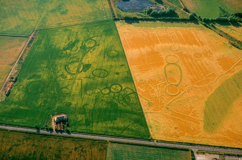
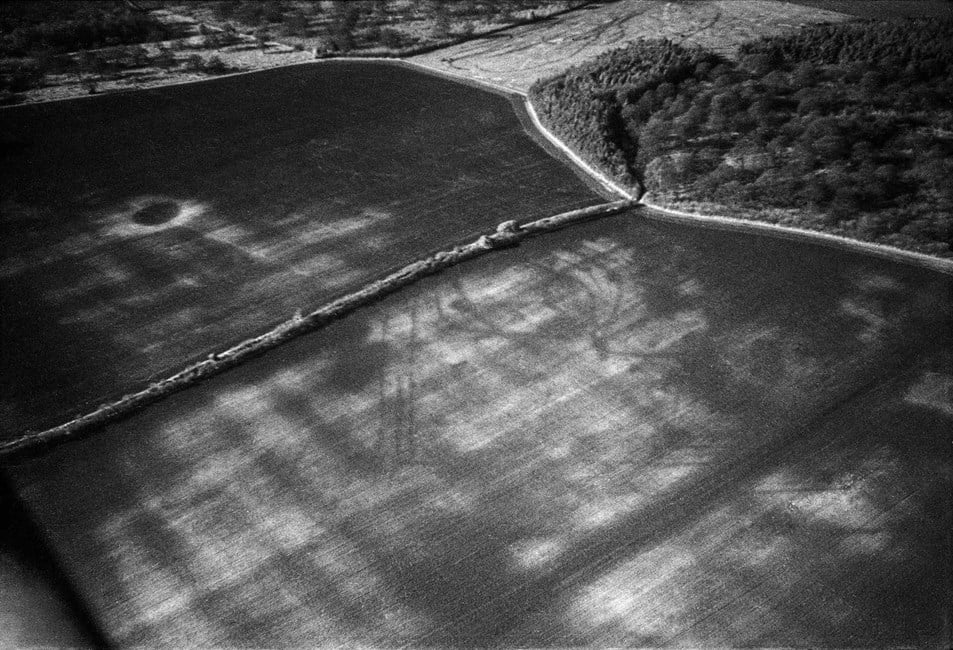
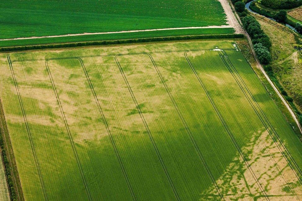
In the beginning this involved acquiring aerial photographs to build up a library of images of archaeological sites. By 1967 it was felt that RCHME should take its own oblique aerial photographs in support of its field survey work. Oblique photographs are taken at an “oblique” angle to the ground, as opposed to directly from above. They are usually taken with a hand held camera through the open window of a plane. The main target at this time was cropmarks; the walls and ditches of buried archaeology can affect the rate at which plants grow over them, causing differences in colour and height. These cropmarks are not always visible on the ground, so the best way to look for them is from the air.
This first flight was very much an experiment. Flying from Fairoaks to Basingstoke, Tidbury Ring and back they photographed prehistoric sites on the chalk soils of Hampshire. Many of the sites had been ploughed recently and were seen as colour differences in the soil and germinating crops. During the 1.5 hour flight John Hampton learned a number of valuable lessons, such as the best height to fly, the best angle to use and to make sure there was plenty of film! The lessons learned from this and subsequent flights formed the foundation of 50 years of flying by the aerial reconnaissance team in RCHME, English Heritage and now Historic England.
Growth of the archive
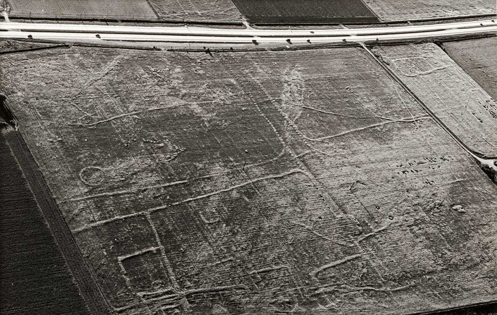
At about the same time as this first flight the collection of aerial photographs grew with the arrival of the Crawford Collection from the Ordnance Survey. Later, in the 1970s, the Air Photo library acquired many more aerial photographs from archaeologists and private fliers keen to discover archaeological sites. One such flier was Derrick Riley who took this photograph of an Iron Age/Roman field system in Nottinghamshire.
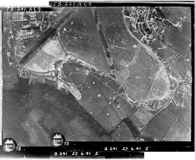
The oblique photographs acquired and taken by RCHME were ordered by kilometre square and stored in distinctive red boxes. Then in the 1980s there was a rapid growth with the acquisition of the Department of the Environment collection of vertical aerial photos. This collection included all prints taken of England by the RAF since the start of WWII such as the image below. This shows the airfield at Biggin Hill, near London with evidence of the many bomb craters sustained during German air raids. Further expansion came in the 1990s with the acquisition of the Ordnance Survey archive and in 2007 with the Aerofilms collection.
Photo mosaic of RAF images of Biggin Hill airfield taken on 27 June 1941, showing a camouflaged runway and filled in bomb craters (RAF_241_72 and 73). Source: Historic England Archive (RAF collection).
Mapping from aerial photographs
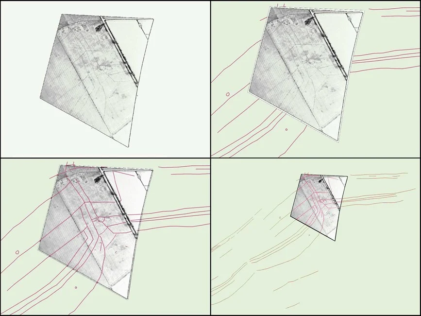
In the 1970s John Hampton and his team looked at various ways of interpreting and mapping from the aerial photographs taken by RCHME and acquired from local fliers. Along with others, they experimented with a variety of mapping techniques from sketch plotting to photogrammetry. An important step in the development of this process was the project to map the archaeology around the Iron Age hillfort of Danebury. This approach was scaled up by RCHME to map the prehistoric archaeology visible as cropmarks on the Yorkshire Wolds. This project used computer aided rectification of oblique aerial photographs, a process that was being developed.
In the late 1980s, as the archive acquired more aerial photographs, RCHME developed a systematic methodology to interpret, map and record all archaeological features, not just cropmarks, visible on aerial photographs. Pilot projects in Kent, Hertfordshire and the Thames Valley were set up to develop the methodology further.
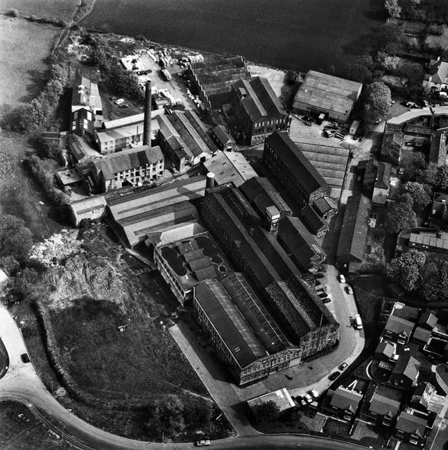
In the 1990s the range of subjects photographed increased as RCHME used aerial photographs to record the large building complexes they were surveying that were undergoing major changes at the time. These included textile mills, hospitals, prisons and Cold War military sites. For some of these sites such as the textile mill below in Leeds, these photographs are the last record we have as development pressures have since led to their demolition.
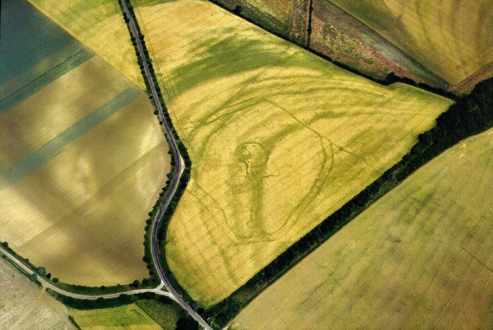
The 1990s also saw new discoveries across the country especially in the hot summers of 1995 and 1996. Below is just one such site, a “banjo” enclosure, so called because of the shape; a circular enclosure with a long funnel neck leading into it. See other examples of new sites discovered in the 1990s and at other times in the gallery below.
In the 1990s the political changes and opening up of eastern Europe led to archaeologists visiting the survey and archive teams to learn from our experience of flying, mapping and archiving aerial photographs. This led to us joining forces with other aerial archaeologists from western Europe to set up training courses in Hungary and Poland. This in turn led to further work exchanges and training courses across Europe.
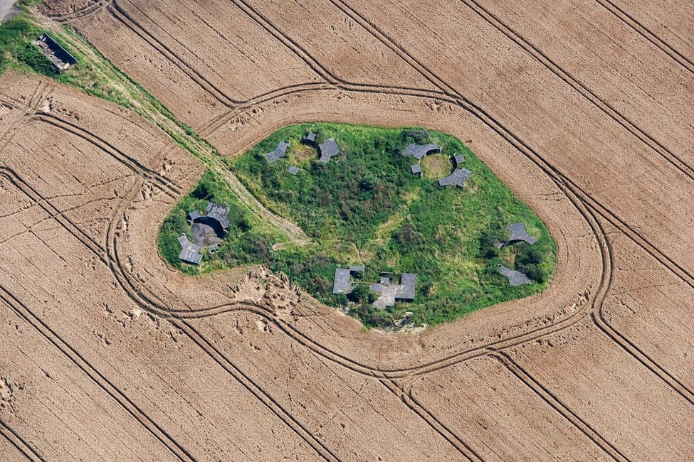
The late 1990s saw RCHME and EH working together to supply aerial photographs to help Field Monument Wardens monitor the condition of scheduled monuments. Following the merger of the two organisations in 1999 this became an important aspect of the flying programme. In the image below the World War Two anti-aircraft battery might appear to be safe since it has been removed from the cultivation that surrounds it. However, it is still at risk from being overgrown by scrub.
The new century saw important technological developments taken up by the flying and mapping teams. The reconnaissance teams began experimenting with digital cameras in 2003 and the archive developed standards for the long term preservation of digital data. The last negative film shot in the air was 2006. The archive now holds over 200,000 digital aerial photographs taken by the reconnaissance teams.
In 2001 English Heritage used lidar, a system of airborne laser scanning, for a review of mapping of the Stonehenge World Heritage site. Since then HE have developed our use of the data and now use it as a regular source for any mapping and interpretation projects.
The discovery of new archaeological sites is still the most exciting part of the flying programme, but since the first flight in 1967 the scale, range and scope has changed. New sensors and camera technology are allowing us to look at new ways of taking aerial photographs. New software and access to other aerial data such as lidar allows us to see, map and understand the historic landscape in ways that could only have been dreamed about in 1967.
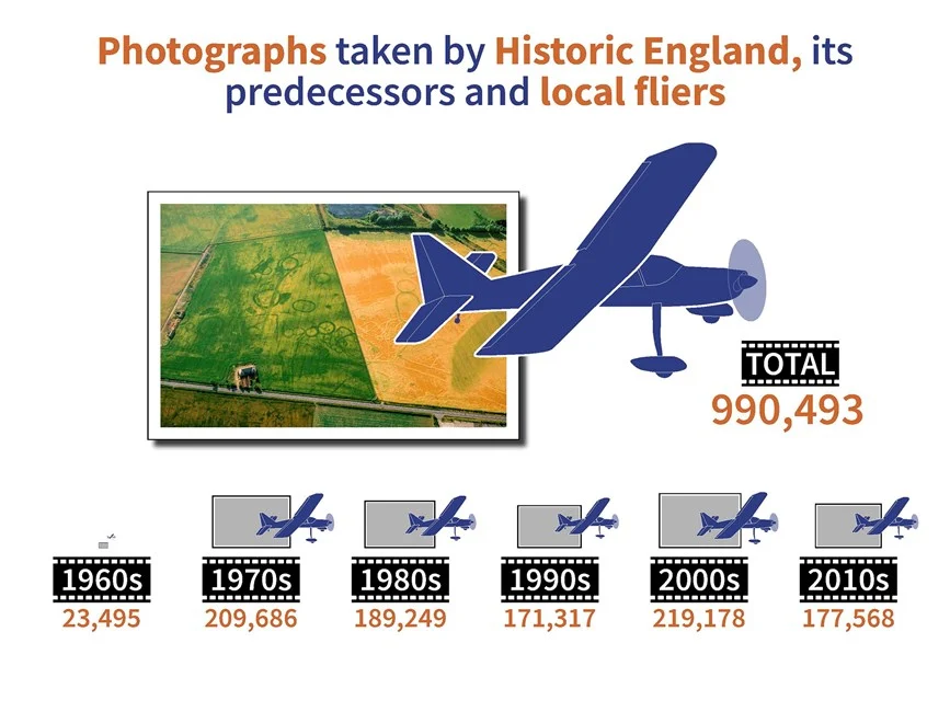
Since our systematic analysis of new and archive aerial photographs began in the late 1990s we have discovered over 122,000 new archaeological sites like the one above.
ooOOoo
I very much hope that republishing this article is in order. An email to the Press Office of Historic England requesting permission has been sent last Sunday afternoon.
This morning, 30th July, I received the following email:
To use the aerial images you have seen on our webpage ’50 Years Flying’ athttps://historicengland.org.uk/whats-new/research/50-years-flying/ , please make a note of the image reference numbers and then visit our Aerial Photography Explorer website at https://historicengland.org.uk/images-books/archive/collections/aerial-photos/ . If you then navigate to the oblique image search screen and fill in the reference number under the ‘file contains’ tab you will be taken to that image. By then hovering over that image a share/embed option will appear that will allow you to use the images free of charge on non-commercial websites and some social media sites such as X and Facebook. Our reference is 150356.
As many of you know I was born exactly six months before VE Day on May 8th, 1945.
We soon moved from Acton to 16 Toley Avenue, in Preston Road, Wembley. A short distance down Toley Ave was Ledway Drive that led up to Barn Hill Pond.
A review of Barn Hill Pond by a dog walker, Tara Furlong, in 2020.
It’s a pond on top of a hill, which gets smaller depending on how hot and dry the summer is. It has been known to have sightings of its own grey heron, mallards on occasion, etc. Fish may lurk in its depths, and frogspawn in the spring. There are views of Wembley, and across to central London from the trig point nearby, and aspirations to open up the view to Harrow-on-the-Hill. Take a little wander and you may spy St Paul’s Cathedral. A small number of benches are available, and the bins overflow in fine weather. There’s nothing but green space and houses nearby. It’s accessible via a fairly short, steep uphill walk on uneven ground from the unserviced car park, which can get very busy; or from Wembley Park. Photos on a typical British day – i.e. a bit cloudy and soggy.
As a young boy I well remember looking out from Barn Hill and seeing the devastation of the property from the Nazi bombers.
There are twenty programmes on Radio 4 that are about this postwar period in Britain. I have listened to the first three and have found them deeply interesting. Anyone interested in British history is recommended to listen to them. That is the link.
To my mind, nothing beats the sights of the World’s oceans.
In the past, I spent four years living on a yacht, a Tradewind 33, out in Cyprus. During that time I cruised to Turkey, to Greece, to Algiers, and loved it.
Here’s an extract from World Oceans day website.
Why Earth’s oceans are so important
Earth’s oceans are critical to human survival. Indeed, more than half the oxygen in our atmosphere is generated via photosynthesis by phytoplankton and seaweed in oceans. In addition, millions of people depend on fish and other marine animals for food. Research on some marine organisms has led to the development of new medications. Moreover, ocean currents, known as global conveyor belts, help regulate Earth’s climate.
Sir David Attenborough has produced a film Ocean and the trailer follows:
There is so much more to view on the World Oceans Day website. Please go to it.
When my son, Alex, and Lisa, were with us in the second half of last month, they spoke of the tremendous joy they experienced in visiting Yellowstone before they came to us.
A shard of smooth bone etched with irregular marks dating back 20,000 years puzzled archaeologists until they noticed something unique – the etchings, lines like tally marks, may have represented prime numbers. Similarly, a clay tablet from 1800 B.C.E. inscribed with Babylonian numbers describes a number system built on prime numbers.
As the Ishango bone, the Plimpton 322 tablet and other artifacts throughout history display, prime numbers have fascinated and captivated people throughout history. Today, prime numbers and their properties are studied in number theory, a branch of mathematics and active area of research today.
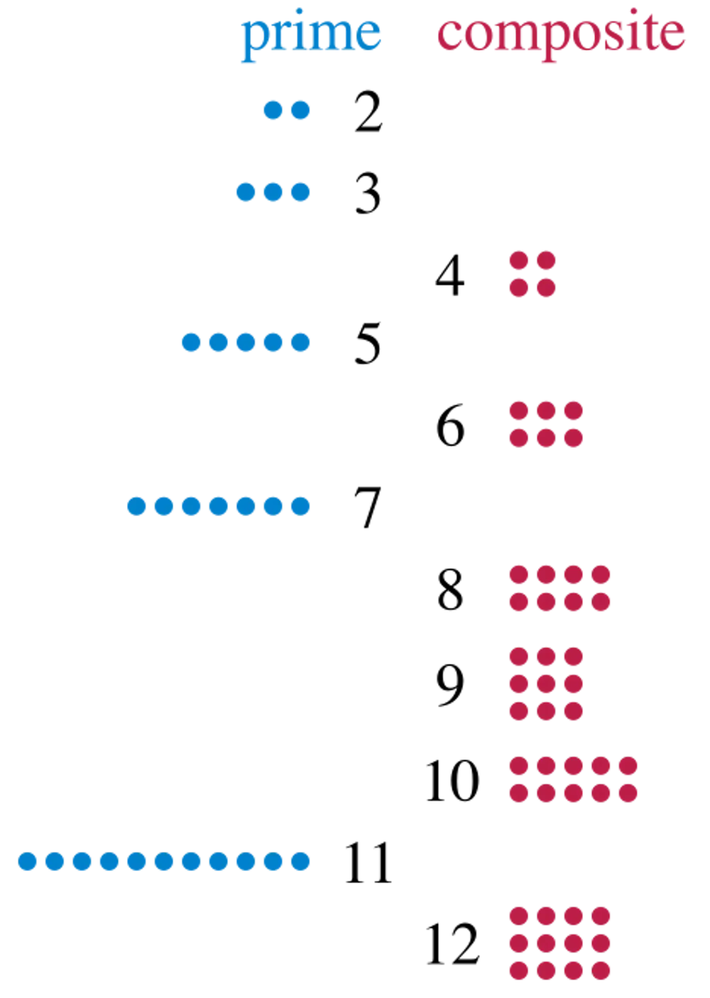
Informally, a positive counting number larger than one is prime if that number of dots can be arranged only into a rectangular array with one column or one row. For example, 11 is a prime number since 11 dots form only rectangular arrays of sizes 1 by 11 and 11 by 1. Conversely, 12 is not prime since you can use 12 dots to make an array of 3 by 4 dots, with multiple rows and multiple columns. Math textbooks define a prime number as a whole number greater than one whose only positive divisors are only 1 and itself.
Math historian Peter S. Rudman suggests that Greek mathematicians were likely the first to understand the concept of prime numbers, around 500 B.C.E.
Around 300 B.C.E., the Greek mathematician and logician Euler proved that there are infinitely many prime numbers. Euler began by assuming that there is a finite number of primes. Then he came up with a prime that was not on the original list to create a contradiction. Since a fundamental principle of mathematics is being logically consistent with no contradictions, Euler then concluded that his original assumption must be false. So, there are infinitely many primes.
The argument established the existence of infinitely many primes, however it was not particularly constructive. Euler had no efficient method to list all the primes in an ascending list.
Prime numbers, when expressed as that number of dots, can be arranged only in a single row or column, rather than a square or rectangle. David Eppstein/Wikimedia Commons
In the middle ages, Arab mathematicians advanced the Greeks’ theory of prime numbers, referred to as hasam numbers during this time. The Persian mathematician Kamal al-Din al-Farisi formulated the fundamental theorem of arithmetic, which states that any positive integer larger than one can be expressed uniquely as a product of primes.
From this view, prime numbers are the basic building blocks for constructing any positive whole number using multiplication – akin to atoms combining to make molecules in chemistry.
Today, primes in this form are called Mersenne primes after the French monk Marin Mersenne. Many of the largest known primes follow this format.
Several early mathematicians believed that a number of the form (2p – 1) is prime whenever p is prime. But in 1536, mathematician Hudalricus Regius noticed that 11 is prime but not (211 – 1), which equals 2047. The number 2047 can be expressed as 11 times 89, disproving the conjecture.
While not always true, number theorists realized that the (2p – 1) shortcut often produces primes and gives a systematic way to search for large primes.
The search for large primes
The number (2p – 1) is much larger relative to the value of p and provides opportunities to identify large primes.
When the number (2p – 1) becomes sufficiently large, it is much harder to check whether (2p – 1) is prime – that is, if (2p – 1) dots can be arranged only into a rectangular array with one column or one row.
Fortunately, Édouard Lucas developed a prime number test in 1878, later proved by Derrick Henry Lehmer in 1930. Their work resulted in an efficient algorithm for evaluating potential Mersenne primes. Using this algorithm with hand computations on paper, Lucas showed in 1876 that the 39-digit number (2127 – 1) equals 170,141,183,460,469,231,731,687,303,715,884,105,727, and that value is prime.
Also known as M127, this number remains the largest prime verified by hand computations. It held the record for largest known prime for 75 years.
Researchers began using computers in the 1950s, and the pace of discovering new large primes increased. In 1952, Raphael M. Robinson identified five new Mersenne primes using a Standard Western Automatic Computer to carry out the Lucas-Lehmer prime number tests.
As computers improved, the list of Mersenne primes grew, especially with the Cray supercomputer’s arrival in 1964. Although there are infinitely many primes, researchers are unsure how many fit the type (2p – 1) and are Mersenne primes.
By the early 1980s, researchers had accumulated enough data to confidently believe that infinitely many Mersenne primes exist. They could even guess how often these prime numbers appear, on average. Mathematicians have not found proof so far, but new data continues to support these guesses.
George Woltman, a computer scientist, founded the Great Internet Mersenne Prime Search, or GIMPS, in 1996. Through this collaborative program, anyone can download freely available software from the GIMPS website to search for Mersenne prime numbers on their personal computers. The website contains specific instructions on how to participate.
GIMPS has now identified 18 Mersenne primes, primarily on personal computers using Intel chips. The program averages a new discovery about every one to two years.
The largest known prime
Luke Durant, a retired programmer, discovered the current record for the largest known prime, (2136,279,841 – 1), in October 2024.
Referred to as M136279841, this 41,024,320-digit number was the 52nd Mersenne prime identified and was found by running GIMPS on a publicly available cloud-based computing network.
This network used Nvidia chips and ran across 17 countries and 24 data centers. These advanced chips provide faster computing by handling thousands of calculations simultaneously. The result is shorter run times for algorithms such as prime number testing.
New and increasingly powerful computer chips have allowed prime-number hunters to find increasingly larger primes. Fritzchens Fritz/Flickr
The Electronic Frontier Foundation is a civil liberty group that offers cash prizes for identifying large primes. It awarded prizes in 2000 and 2009 for the first verified 1 million-digit and 10 million-digit prime numbers.
Large prime number enthusiasts’ next two challenges are to identify the first 100 million-digit and 1 billion-digit primes. EFF prizes of US$150,000 and $250,000, respectively, await the first successful individual or group.
Eight of the 10 largest known prime numbers are Mersenne primes, so GIMPS and cloud computing are poised to play a prominent role in the search for record-breaking large prime numbers.
Large prime numbers have a vital role in many encryption methods in cybersecurity, so every internet user stands to benefit from the search for large prime numbers. These searches help keep digital communications and sensitive information safe.
I find it unbelievable that there are prizes for the first 100 million-digit prime number and also the first 1 billion-digit prime number. It is so far away from my understanding of these numbers that all I can say is: I find it unbelievable!
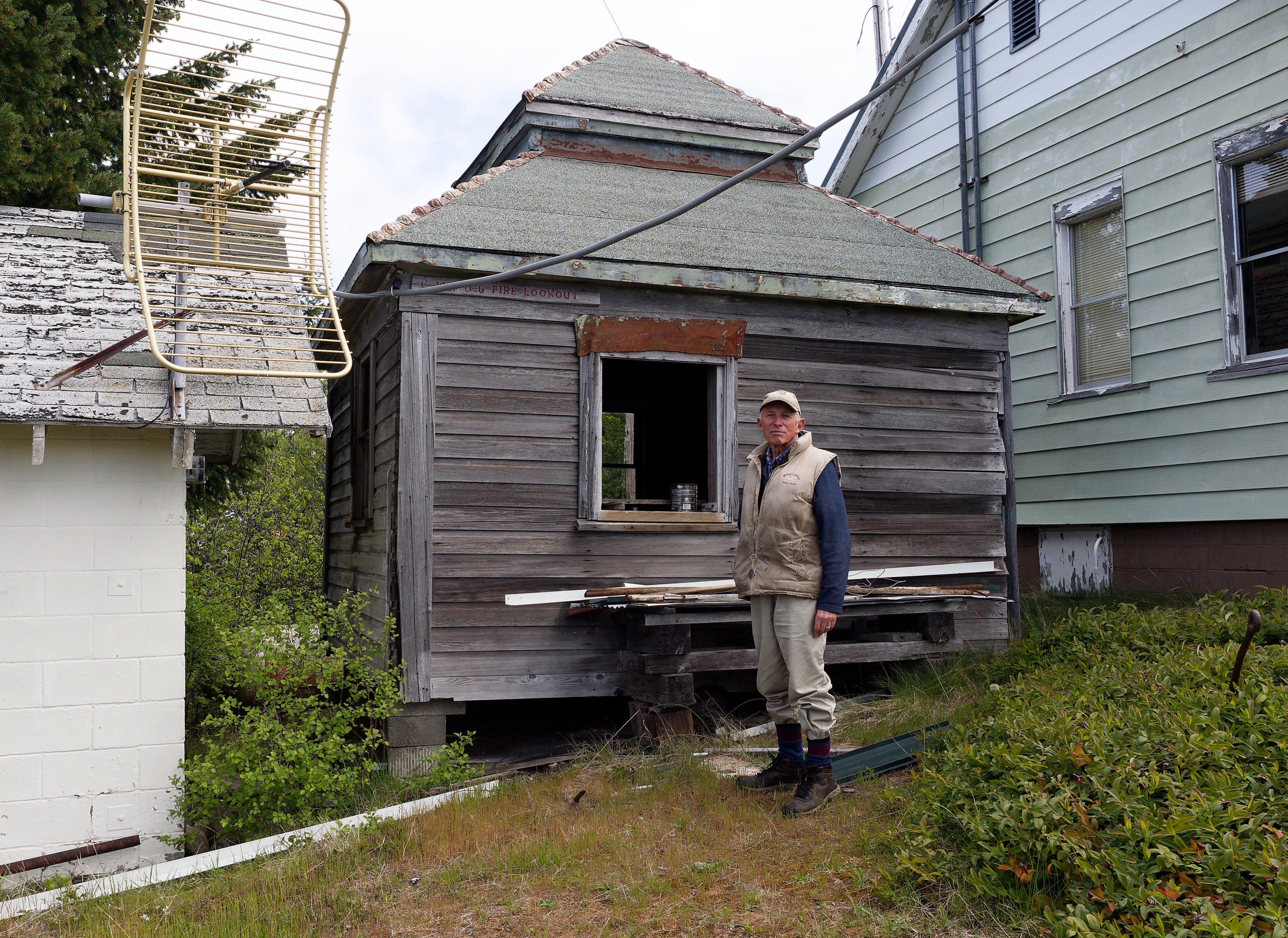
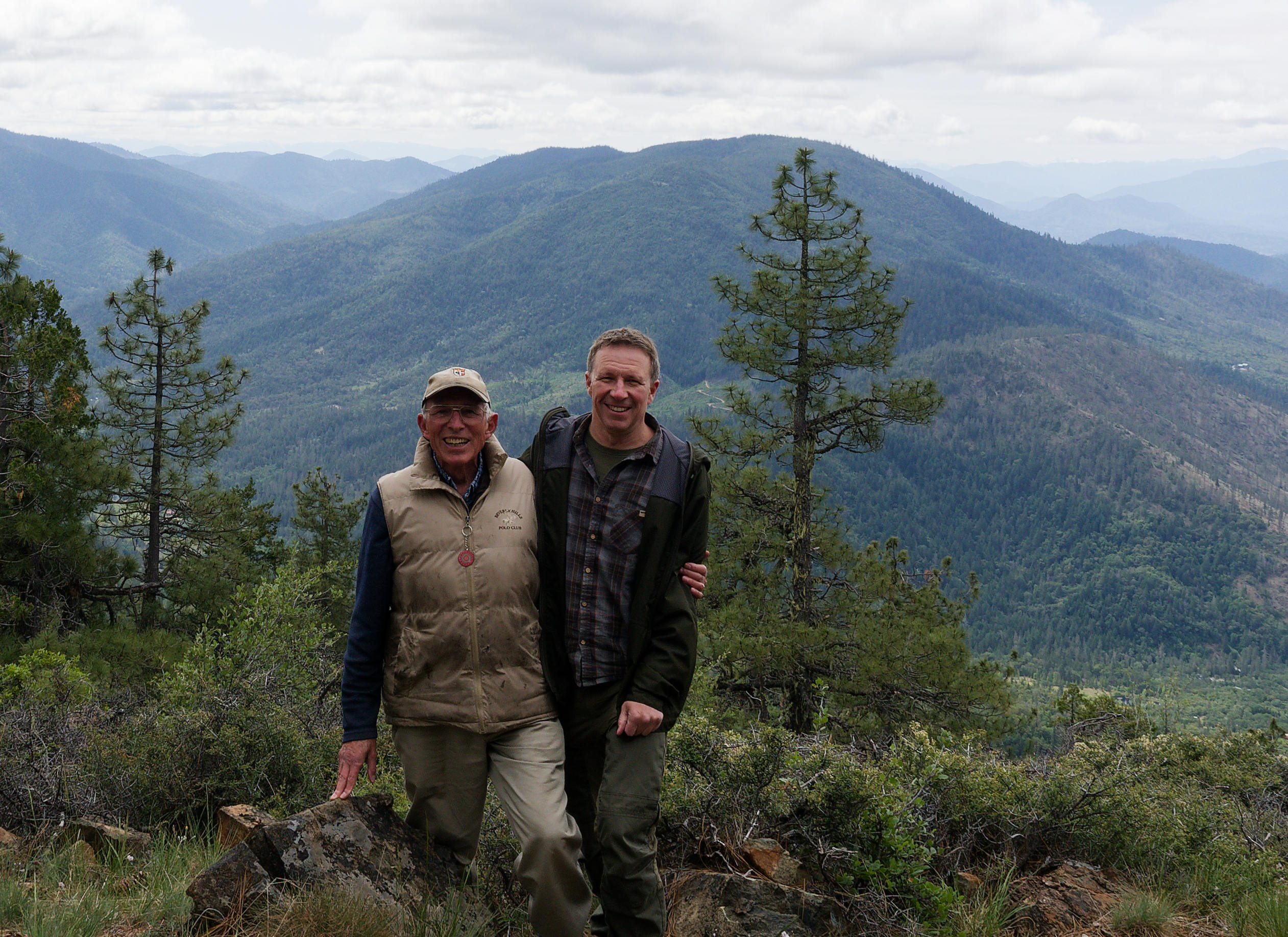
When my son and his partner, Lisa, were with us, just over a week ago, Alex suggested that he and I explored Sexton Mountain; some three miles to the North-East, as the crow flies. Normally the final stretch has to be walked because of a locked gate across the trail. However, that day the last 8/10ths of a mile were driven. It was a beautiful place with that summit 3,833 feet above sea-level (U.S. Geological Survey).
The Summit.
oooo
The original fire lookout.
oooo
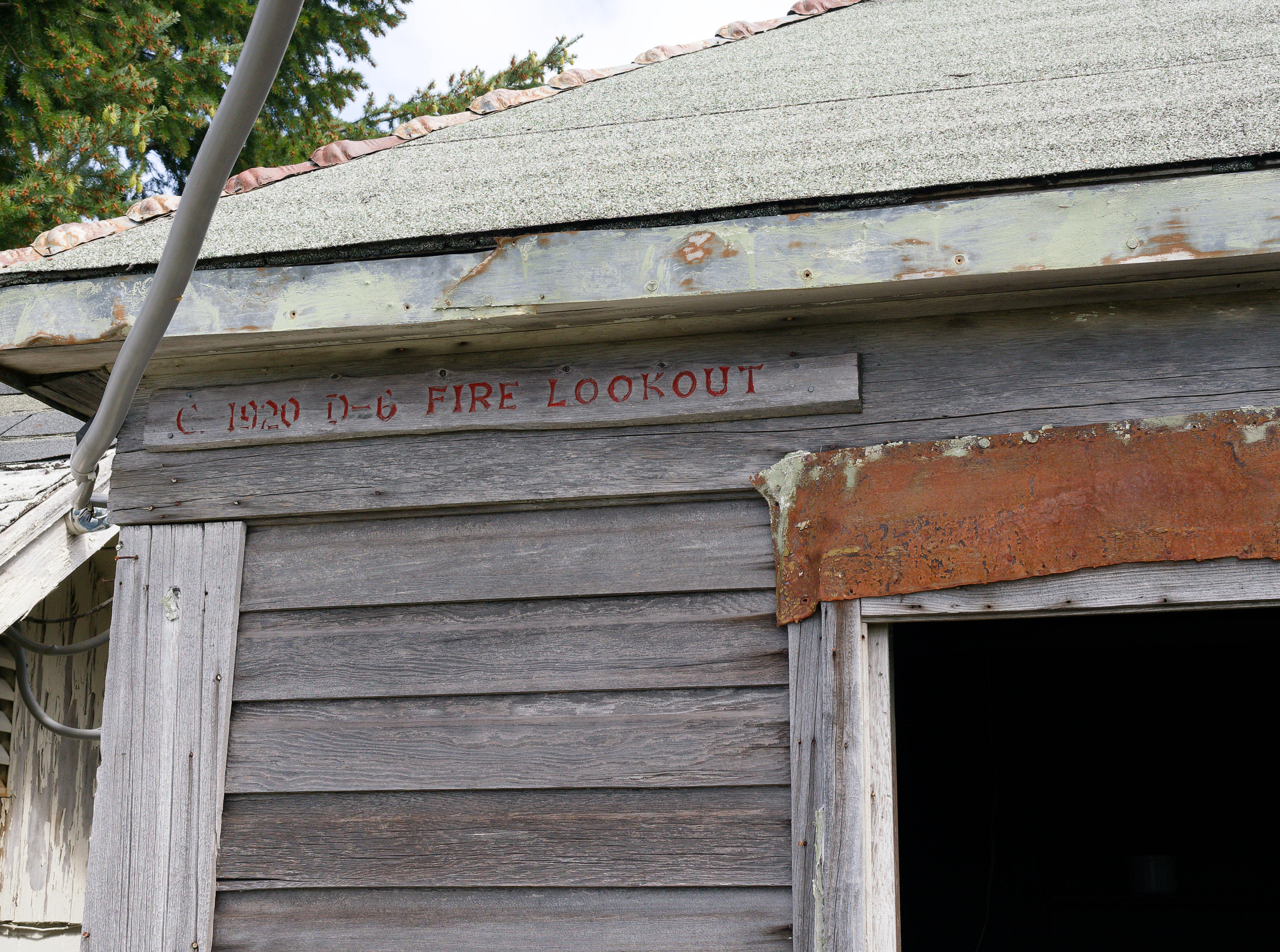
Confirmation of the year – 1920.
oooo
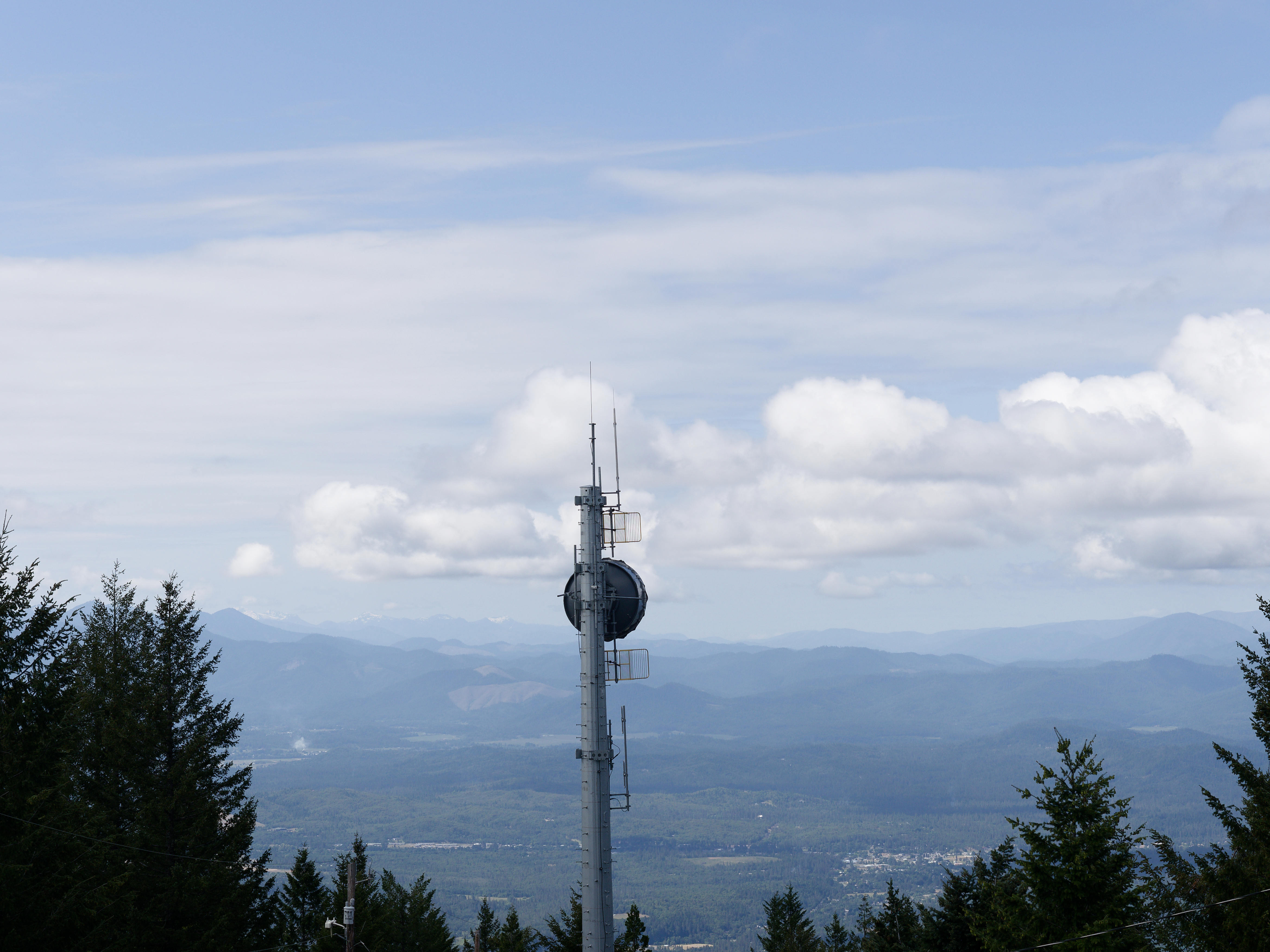
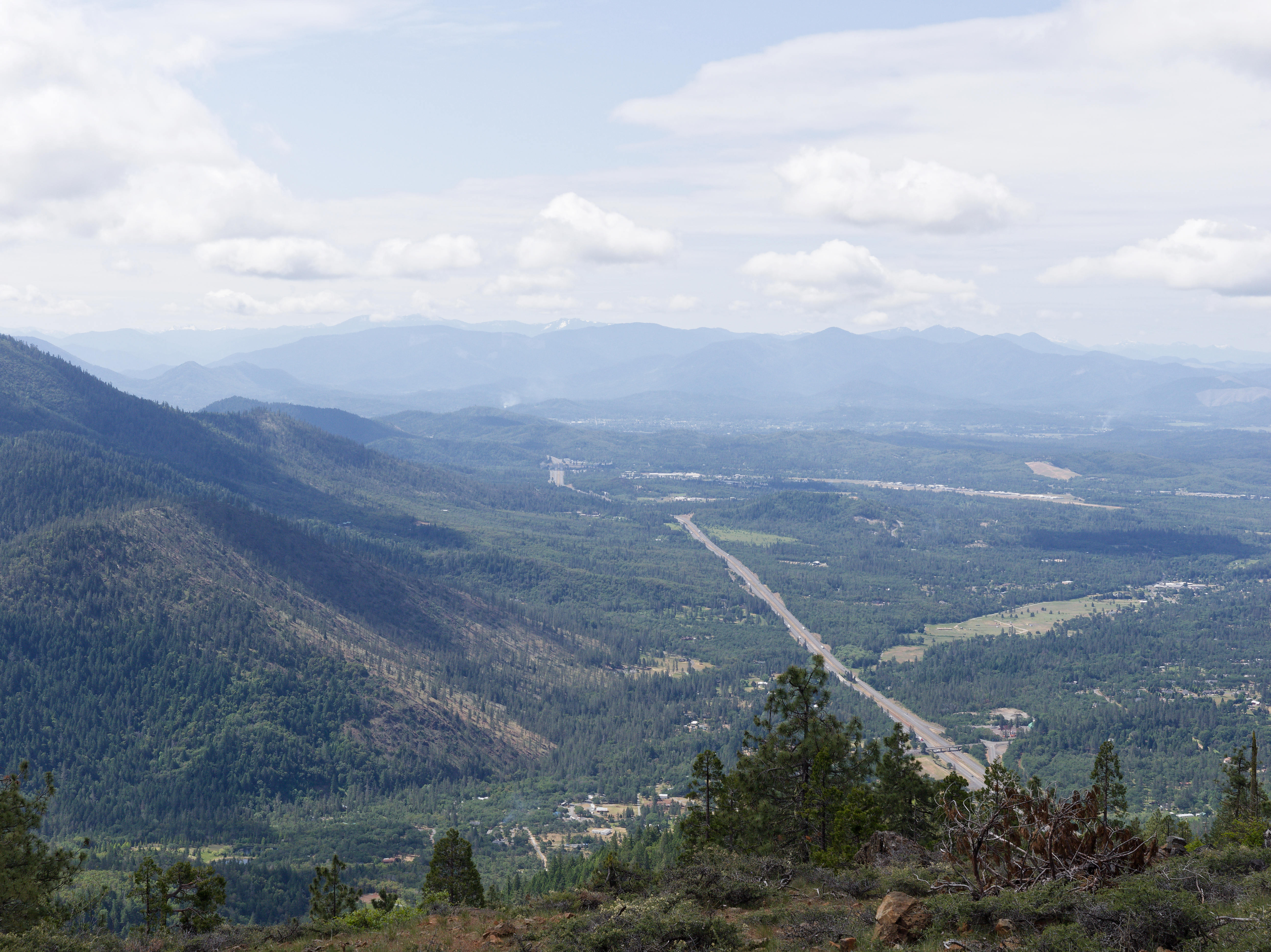
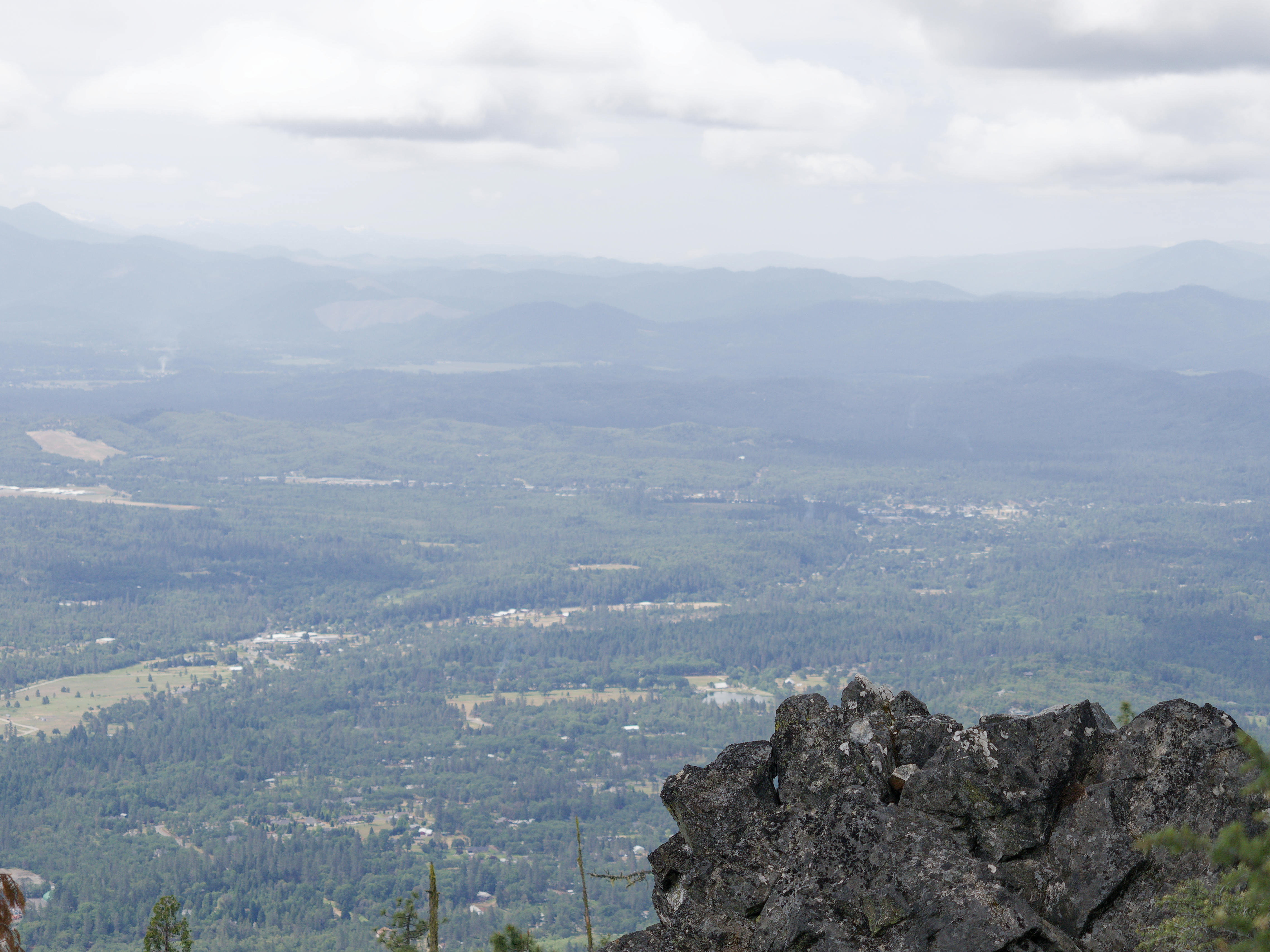
We descended 200 feet to be clear of the overhead cables. This is the view looking towards the South; the road being the I-5.
NASA hasn’t landed humans on Mars yet. But thanks to robotic missions, scientists now know more about the planet’s surface than they did when the movie, The Martian, was released.
Our human knowledge is constantly growing. In many, many directions. Here is a fascinating (well it is to me!) article from The Conversation.
ooOOoo
A decade after the release of ‘The Martian’ and a decade out from the world it envisions, a planetary scientist checks in on real-life Mars exploration
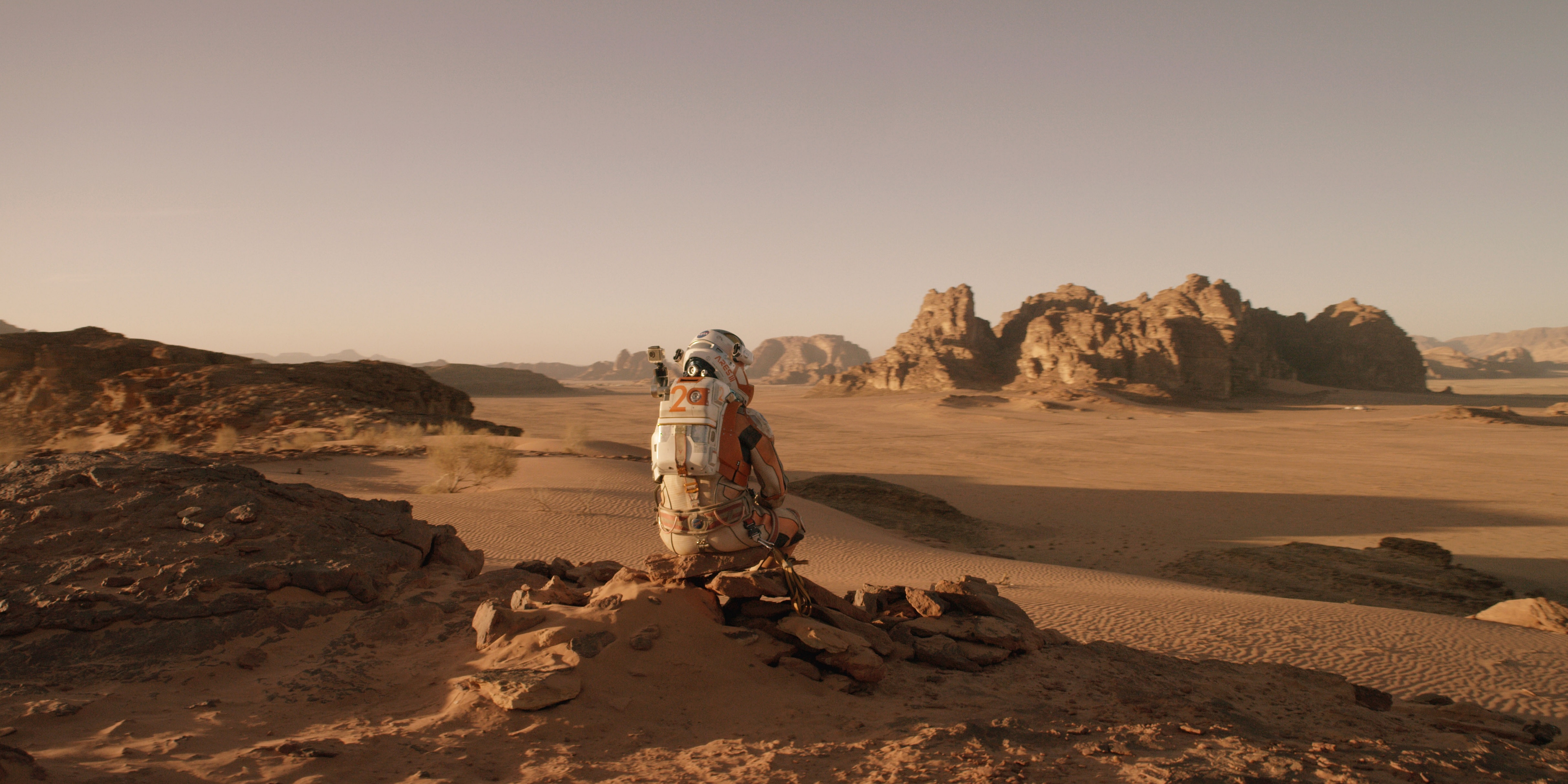
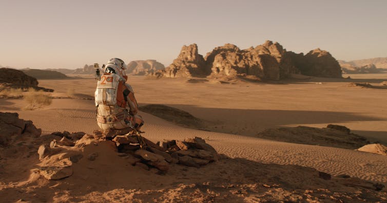
‘The Martian’ protagonist Mark Watney contemplates his ordeal. 20th Century Fox
Andy Weir’s bestselling story “The Martian” predicts that by 2035 NASA will have landed humans on Mars three times, perfected return-to-Earth flight systems and collaborated with the China National Space Administration. We are now 10 years past the Hollywood adaptation’s 2015 release and 10 years shy of its fictional timeline. At this midpoint, Mars exploration looks a bit different than how it was portrayed in “The Martian,” with both more discoveries and more controversy.
Although concepts for crewed missions to Mars have gained popularity, NASA’s actual plans for landing humans on Mars remain fragile. Notably, over the last 10 years, it has been robotic, rather than crewed, missions that have propelled discovery and the human imagination forward.
NASA’s 2023 Moon to Mars Strategy and Objectives Development document lays out the steps the agency was shooting for at the time, to go first to the Moon, and from there to Mars. NASA
Robotic discoveries
Since 2015, satellites and rovers have reshaped scientists’ understanding of Mars. They have revealed countless insights into how its climate has changed over time.
As Earth’s neighbor, climate shifts on Mars also reflect solar system processes affecting Earth at a time when life was first taking hold. Thus, Mars has become a focal point for investigating the age old questions of “where do we come from?” and “are we alone?”
The Opportunity, Curiosity and Perseverance rovers have driven dozens of miles studying layered rock formations that serve as a record of Mars’ past. By studying sedimentary layers – rock formations stacked like layers of a cake – planetary geologists have pieced together a vivid tale of environmental change that dwarfs what Earth is currently experiencing.
Mars was once a world of erupting volcanoes, glaciers, lakes and flowing rivers – an environment not unlike early Earth. Then its core cooled, its magnetic field faltered and its atmosphere drifted away. The planet’s exposed surface has retained signs of those processes ever since in the form of landscape patterns, sequences of layered sediment and mineral mixtures.
Layered sedimentary rocks exposed within the craters of Arabia Terra, Mars, recording ancient surface processes. Photo from the Mars Reconnaissance Orbiter High Resolution Imaging Science Experiment. NASA/JPL/University of Arizona
Arabia Terra
One focus of scientific investigation over the last 10 years is particularly relevant to the setting of “The Martian” but fails to receive mention in the story. To reach his best chance of survival, protagonist Mark Watney, played by Matt Damon, must cross a vast, dusty and crater-pocked region of Mars known as Arabia Terra.
In 2022 and 2023, I, along with colleagues at Northern Arizona University and Johns Hopkins University, published detailed analyses of the layered materials there using imagery from the Mars Reconnaissance Orbiter and Mars Odyssey satellites.
By using infrared imagery and measuring the dimensions of surface features, we linked multiple layered deposits to the same episodes of formation and learned more about the widespread crumbling nature of the terrain seen there today. Because water tends to cement rock tightly together, that loose material indicates that around 3.5 billion years ago, that area had a drying climate.
To make the discussions about this area easier, we even worked with the International Astronomical Union to name a few previously unnamed craters that were mentioned in the story. For example, one that Watney would have driven right by is now named Kozova Crater, after a town in Ukraine.
More to explore
Despite rapid advances in Mars science, many unknowns remain. Scientists still aren’t sure of the precise ages, atmospheric conditions and possible signatures of life associated with each of the different rock types observed on the surface.
For instance, the Perseverance rover recently drilled into and analyzed a unique set of rocks hosting organic – that is, carbon-based – compounds. Organic compounds serve as the building blocks of life, but more detailed analysis is required to determine whether these specific rocks once hosted microbial life.
The in-development Mars Sample Return mission aims to address these basic outstanding questions by delivering the first-ever unaltered fragments of another world to Earth. The Perseverance rover is already caching rock and soil samples, including ones hosting organic compounds, in sealed tubes. A future lander will then need to pick up and launch the caches back to Earth.
Sampling Mars rocks could tell scientists more about the red planet’s past, and whether it could have hosted life.
Once home, researchers can examine these materials with instruments orders of magnitude more sensitive than anything that could be flown on a spacecraft. Scientists stand to learn far more about the habitability, geologic history and presence of any signs of life on Mars through the sample return campaign than by sending humans to the surface.
This perspective is why NASA, the European Space Agency and others have invested some US$30 billion in robotic Mars exploration since the 1960s. The payoff has been staggering: That work has triggered rapid technological advances in robotics, telecommunications and materials science. For example, Mars mission technology has led to better sutures for heart surgery and cars that can drive themselves.
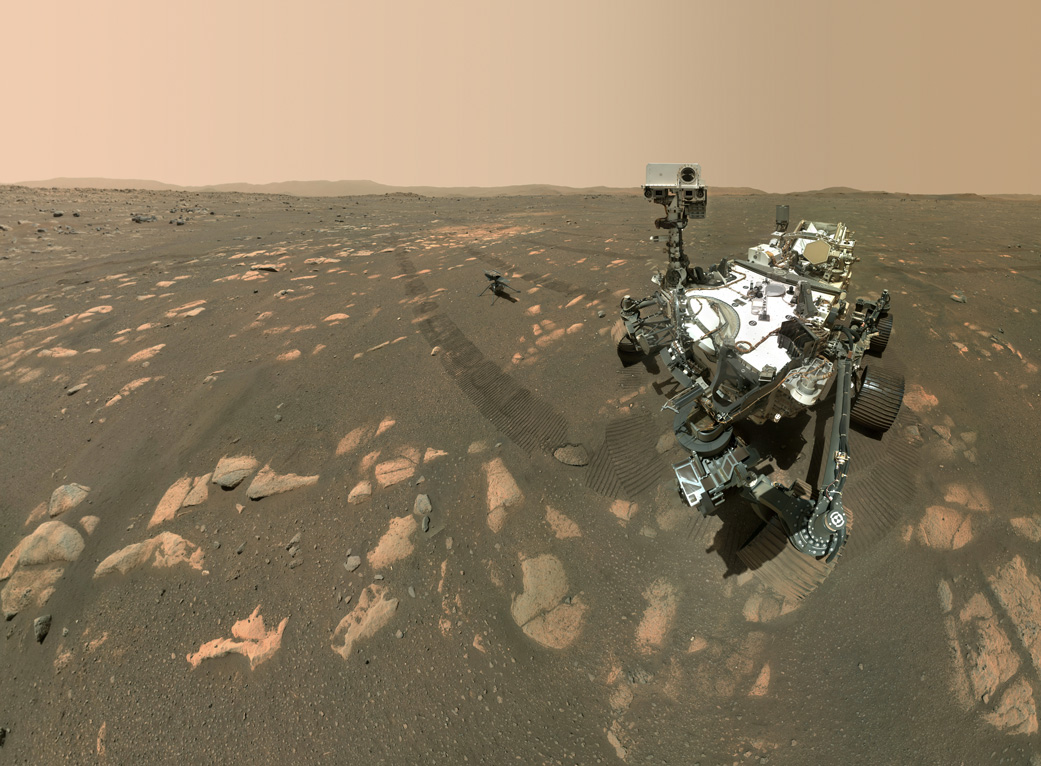
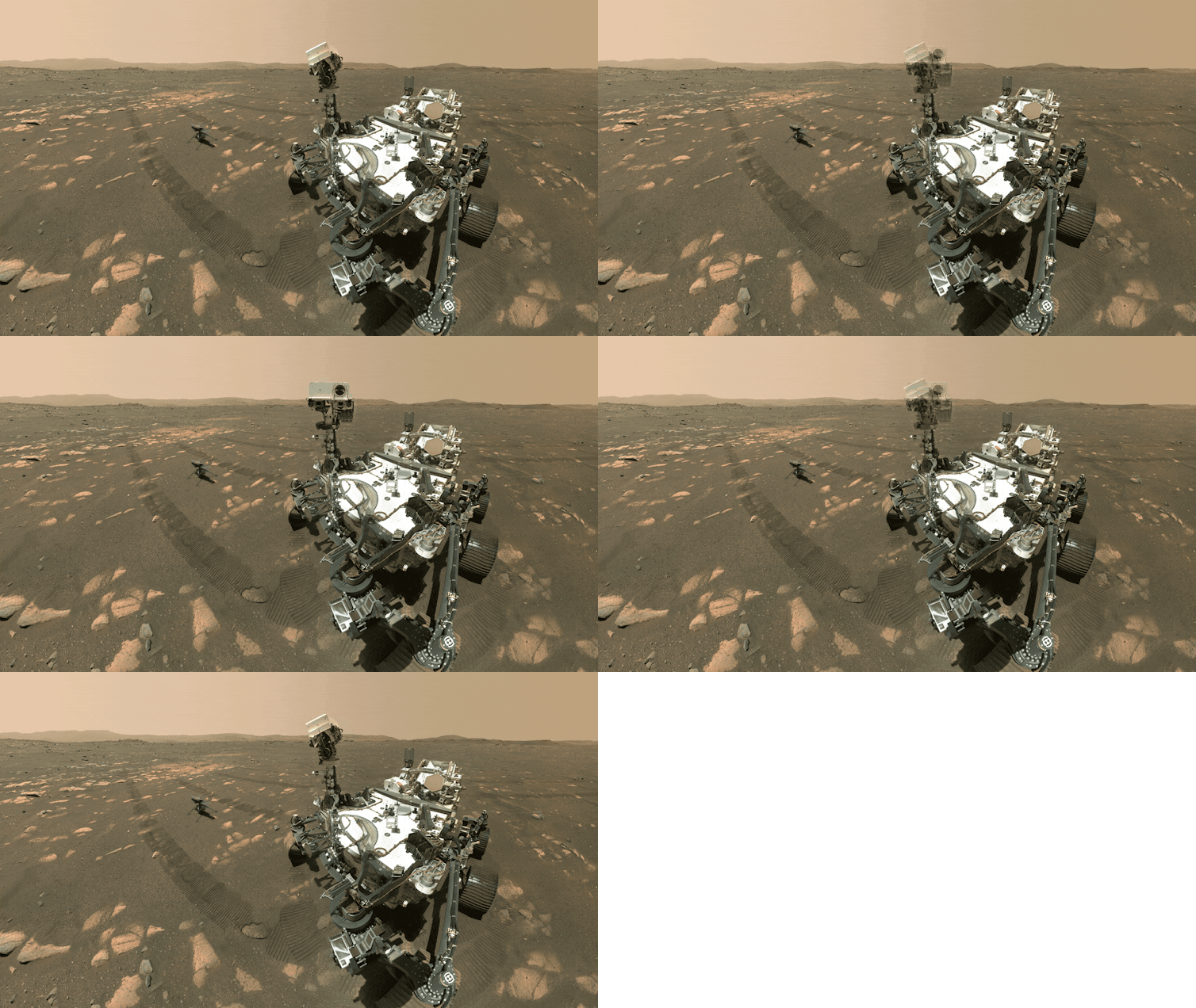
A selfie from NASA’s Perseverance Mars rover with the Ingenuity helicopter, taken with the rover’s extendable arm on April 6, 2021. NASA/JPL-Caltech/MSSS
Calling the red planet home?
Colonizing Mars has a seductive appeal. It’s hard not to cheer for the indomitable human spirit while watching Watney battle dust storms, oxygen shortages and food scarcity over 140 million miles from rescue.
Much of the momentum toward colonizing Mars is now tied to SpaceX and its CEO Elon Musk, whose stated mission to make humanity a “multi-planetary species” has become a sort of rallying cry. But while Mars colonization is romantic on paper, it is extremely difficult to actually carry out, and many critics have questioned the viability of a Mars habitation as a refuge far from Earth.
Now, with NASA potentially facing a nearly 50% reduction to its science budget, the U.S. risks dissolving its planetary science and robotic operations portfolio altogether, including sample return.
Nonetheless, President Donald Trump and Musk have pushed for human space exploration to somehow continue to progress, despite those proposed cuts – effectively sidelining the robotic, science-driven programs that have underpinned all of Mars exploration to date.
Yet, it is these programs that have yielded humanity’s richest insights into the red planet and given both scientists and storytellers like Andy Weir the foundation to imagine what it must be like to stand on Mars’ surface at all.
Nothing to add from yours truly except to say that this quote is highly relevant: “Challenges are what make life interesting and overcoming them is what makes life meaningful.” – Joshua J. Marine
(And this was the result of me looking online for quotes and coming across 50 quotes from USA Today.)
Alex, my son, and his partner, Lisa, are coming to see us later today. They arrived in Portland on Sunday, 11th but first of all wanted to see Yellowstone.










.jpg)